Property Record
637 N Us Highway 27/441, Lady Lake, FL 32159


NEARBY LISTINGS FOR SALE OR LEASE
Property Detail
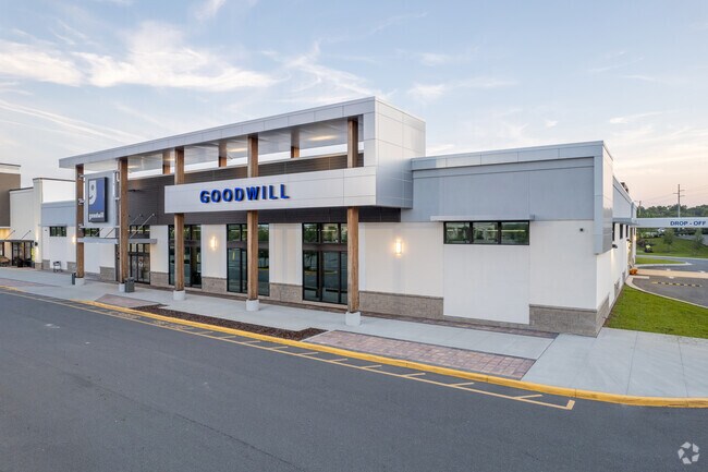
637 N Us Highway 27/441
Orlando
Lady Lake Commons
Orlando-Kissimmee-Sanford, FL
LADY LAKE COMMONS PB 76 PG 7-8 LOT 1
08-18-24-1100-000-00100
Lake
Regionalshoppingcenterormallwithanchorstore
Florida
0
1
2026
9.97 AC
030409
Lake County
72,245 SF
DEMOGRAPHICS near 637 N Us Highway 27/441
1 Mile
3 Mile
5 Mile
2024 Total Population
5,459
33,669
80,881
2029 Population
6,335
40,387
98,393
Pop Growth 2024-2029
+ 16.05%
+ 19.95%
+ 21.65%
Average Age
62
63
64
2024 Total Households
3,117
18,357
43,504
HH Growth 2024-2029
+ 15.98%
+ 20.36%
+ 22.26%
Median Household Inc
$45,992
$54,201
$60,557
Avg Household Size
1.70
1.80
1.80
2024 Avg HH Vehicles
1.00
1.00
1.00
Median Home Value
$131,390
$245,021
$269,571
Median Year Built
1992
1995
2000
Nearby Places
Map Layers
Map Styles
 Street
 Aerial
- Restaurants
- Banks
- Shops
- Fitness
- Groceries
SALE & LEASE HISTORY
LISTING DATE
SALE/LEASE

Sep 25, 2016
For Lease
Oct 18, 2018
For Lease
Nearby Properties
Address
Land Use
TOTAL SIZE
Lot Size
Zoning
Address
Land Use
TOTAL SIZE
Lot Size
Zoning
404,584 SF
29.32 AC
MF12
Address
Land Use
TOTAL SIZE
Lot Size
Zoning
344,318 SF
25.73 AC
MF18
Address
Land Use
TOTAL SIZE
Lot Size
Zoning
344,823 SF
17.53 AC
Address
Land Use
TOTAL SIZE
Lot Size
Zoning
58,955 SF
6.85 AC
Address
Land Use
TOTAL SIZE
Lot Size
Zoning
171,544 SF
15.78 AC
CP
Address
Land Use
TOTAL SIZE
Lot Size
Zoning
71,467 SF
9.31 AC
Address
Land Use
TOTAL SIZE
Lot Size
Zoning
182,128 SF
13.25 AC
MF12
Address
Land Use
TOTAL SIZE
Lot Size
Zoning
30,641 SF
103.82 AC
CT
Address
Land Use
TOTAL SIZE
Lot Size
Zoning
165,197 SF
16.74 AC
HC
Address
Land Use
TOTAL SIZE
Lot Size
Zoning
28,844 SF
12.90 AC
Address
Land Use
TOTAL SIZE
Lot Size
Zoning
60,998 SF
5 AC
Address
Land Use
TOTAL SIZE
Lot Size
Zoning
115,531 SF
6.21 AC
MH9
Address
Land Use
TOTAL SIZE
Lot Size
Zoning
94,208 SF
12.72 AC
CP
Address
Land Use
TOTAL SIZE
Lot Size
Zoning
90,064 SF
8.12 AC
A
Address
Land Use
TOTAL SIZE
Lot Size
Zoning
101,064 SF
7.64 AC
CP
Address
Land Use
TOTAL SIZE
Lot Size
Zoning
78,586 SF
1.61 AC
CP
Address
Land Use
TOTAL SIZE
Lot Size
Zoning
29,018 SF
2.43 AC
HC
Address
Land Use
TOTAL SIZE
Lot Size
Zoning
57,545 SF
8.80 AC
Address
Land Use
TOTAL SIZE
Lot Size
Zoning
45,553 SF
12.86 AC
Address
Land Use
TOTAL SIZE
Lot Size
Zoning
201,953 SF
19.52 AC
HC
Address
Land Use
TOTAL SIZE
Lot Size
Zoning
91,762 SF
3.24 AC
Address
Land Use
TOTAL SIZE
Lot Size
Zoning
69,101 SF
9.69 AC
CP
Address
Land Use
TOTAL SIZE
Lot Size
Zoning
169,950 SF
18.74 AC
A
Address
Land Use
TOTAL SIZE
Lot Size
Zoning
101,154 SF
19.35 AC
PFD
Address
Land Use
TOTAL SIZE
Lot Size
Zoning
103,632 SF
9.59 AC
Address
Land Use
TOTAL SIZE
Lot Size
Zoning
106,910 SF
10.40 AC
CP
Address
Land Use
TOTAL SIZE
Lot Size
Zoning
43,686 SF
1.23 AC
CP
Address
Land Use
TOTAL SIZE
Lot Size
Zoning
67,350 SF
1.52 AC
CP
Address
Land Use
TOTAL SIZE
Lot Size
Zoning
12,456 SF
88.51 AC
C1
Address
Land Use
TOTAL SIZE
Lot Size
Zoning
73,894 SF
2.34 AC
CP
The World's #1 Commercial Real Estate Marketplace
Connect with us
© 2026 CoStar Group
The information above has been obtained from sources believed reliable. While we do not doubt its accuracy we have not verified it and make no guarantee, warranty or representation about it. It is your responsibility to independently confirm its accuracy and completeness. Any projections, opinions, assumptions, or estimates used are for example only and do not represent the current or future performance of the property. The value of this transaction to you depends on tax and other factors which should be evaluated by your tax, financial, and legal advisors. You and your advisors should conduct a careful, independent investigation of the property to determine to your satisfaction the suitability of the property for your needs.