Property Record
6375 Highway 305 N, Olive Branch, MS 38654


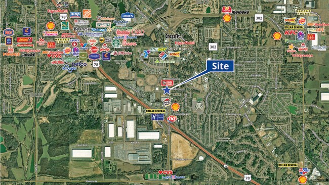
NEARBY LISTINGS FOR SALE OR LEASE
Property Detail
6375 Highway 305 N
Memphis, TN-MS-AR
Caroma Commercial & Industrial Park 1St
1068337640002200
CAROMA COMMERCIAL & INDUSTRIA 1ST REV OF LOT 21 & 22 LOT 22
Carwash
DeSoto
X
Mississippi
28033C0104H
22
2025
1.23 AC
2025
DeSoto County
070821
Memphis
3,624 SF
DEMOGRAPHICS near 6375 Highway 305 N
1 Mile
3 Mile
5 Mile
2024 Total Population
6,244
34,297
76,318
2029 Population
6,785
37,148
80,431
Pop Growth 2024-2029
+ 8.66%
+ 8.31%
+ 5.39%
Average Age
38
39
38
2024 Total Households
2,406
12,570
27,155
HH Growth 2024-2029
+ 8.69%
+ 8.33%
+ 5.38%
Median Household Inc
$80,282
$78,127
$80,525
Avg Household Size
2.60
2.70
2.80
2024 Avg HH Vehicles
2.00
2.00
2.00
Median Home Value
$190,249
$231,296
$237,215
Median Year Built
1995
1997
1997
Nearby Places
Map Layers
Map Styles
 Street
 Aerial
- Restaurants
- Banks
- Shops
- Fitness
- Groceries
PUBLIC TRANSPORTATION
AIRPORT
Memphis International
DRIVE
WALK
Distance
Memphis International
23 min
13.5 mi
SALE & LEASE HISTORY
LISTING DATE
SALE/LEASE

Sep 12, 2023
For Sale
Nearby Properties
Address
Land Use
TOTAL SIZE
Lot Size
Zoning
Address
Land Use
TOTAL SIZE
Lot Size
Zoning
1,059,729 SF
74.33 AC
M-2
Address
Land Use
TOTAL SIZE
Lot Size
Zoning
864,054 SF
72.19 AC
M-1
Address
Land Use
TOTAL SIZE
Lot Size
Zoning
860,464 SF
54.55 AC
M-1
Address
Land Use
TOTAL SIZE
Lot Size
Zoning
813,440 SF
38.72 AC
PB
Address
Land Use
TOTAL SIZE
Lot Size
Zoning
693,680 SF
47.15 AC
M-1
Address
Land Use
TOTAL SIZE
Lot Size
Zoning
814,054 SF
51.14 AC
M-1
Address
Land Use
TOTAL SIZE
Lot Size
Zoning
927,742 SF
42.73 AC
PB
Address
Land Use
TOTAL SIZE
Lot Size
Zoning
447,008 SF
28.41 AC
PB
Address
Land Use
TOTAL SIZE
Lot Size
Zoning
390,874 SF
122.03 AC
M-1
Address
Land Use
TOTAL SIZE
Lot Size
Zoning
599,752 SF
40.17 AC
M-1
Address
Land Use
TOTAL SIZE
Lot Size
Zoning
1,082,465 SF
57.74 AC
PB
Address
Land Use
TOTAL SIZE
Lot Size
Zoning
445,114 SF
32.34 AC
M-1
Address
Land Use
TOTAL SIZE
Lot Size
Zoning
399,672 SF
19.97 AC
M-1
Address
Land Use
TOTAL SIZE
Lot Size
Zoning
27,669 SF
34.27 AC
R-4
Address
Land Use
TOTAL SIZE
Lot Size
Zoning
480,000 SF
23.80 AC
M-2
Address
Land Use
TOTAL SIZE
Lot Size
Zoning
377,821 SF
22.08 AC
PB
Address
Land Use
TOTAL SIZE
Lot Size
Zoning
10,155 SF
26.43 AC
R-4
Address
Land Use
TOTAL SIZE
Lot Size
Zoning
404,888 SF
43.17 AC
M-2
Address
Land Use
TOTAL SIZE
Lot Size
Zoning
293,310 SF
15.40 AC
M-1
Address
Land Use
TOTAL SIZE
Lot Size
Zoning
301,365 SF
19.98 AC
M-2
Address
Land Use
TOTAL SIZE
Lot Size
Zoning
13,554 SF
15.32 AC
PUD
Address
Land Use
TOTAL SIZE
Lot Size
Zoning
287,500 SF
20 AC
M-2
Address
Land Use
TOTAL SIZE
Lot Size
Zoning
329,096 SF
21.64 AC
M-1
Address
Land Use
TOTAL SIZE
Lot Size
Zoning
250,364 SF
13.72 AC
M-1
Address
Land Use
TOTAL SIZE
Lot Size
Zoning
9,682 SF
14 AC
PUD
Address
Land Use
TOTAL SIZE
Lot Size
Zoning
320,000 SF
16.20 AC
M-2
Address
Land Use
TOTAL SIZE
Lot Size
Zoning
11,097 SF
13.39 AC
PUD
Address
Land Use
TOTAL SIZE
Lot Size
Zoning
259,264 SF
14.31 AC
PB
Address
Land Use
TOTAL SIZE
Lot Size
Zoning
160,000 SF
17 AC
M-2
Address
Land Use
TOTAL SIZE
Lot Size
Zoning
217,448 SF
19.07 AC
M-1
The World's #1 Commercial Real Estate Marketplace
Connect with us
© 2025 CoStar Group
The information above has been obtained from sources believed reliable. While we do not doubt its accuracy we have not verified it and make no guarantee, warranty or representation about it. It is your responsibility to independently confirm its accuracy and completeness. Any projections, opinions, assumptions, or estimates used are for example only and do not represent the current or future performance of the property. The value of this transaction to you depends on tax and other factors which should be evaluated by your tax, financial, and legal advisors. You and your advisors should conduct a careful, independent investigation of the property to determine to your satisfaction the suitability of the property for your needs.