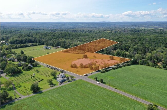
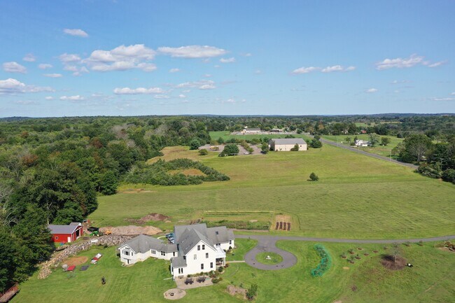
Property Record
638 Brunswick Pike, Lambertville, NJ 08530


NEARBY LISTINGS FOR SALE OR LEASE
Property Detail
638 Brunswick Pike
26-00016-0000-00017-02
FACILITY NAME: GREEN MEDICINE
Commercialnec
Hunterdon
X
New Jersey
34021C0082F
17.2
2024
22.12 AC
2025
Hunterdon
011800
Northern New Jersey
30,048 SF
Newark, NJ-PA
DEMOGRAPHICS near 638 Brunswick Pike
1 Mile
3 Mile
5 Mile
2024 Total Population
424
9,196
24,149
2029 Population
425
9,265
24,074
Pop Growth 2024-2029
+ 0.24%
+ 0.75%
(0.31%)
Average Age
47
47
47
2024 Total Households
171
4,239
10,014
HH Growth 2024-2029
+ 0.58%
+ 0.97%
(0.14%)
Median Household Inc
$146,428
$115,255
$140,223
Avg Household Size
2.50
2.10
2.40
2024 Avg HH Vehicles
3.00
2.00
2.00
Median Home Value
$596,491
$536,171
$647,176
Median Year Built
1965
1962
1971
Nearby Places
Map Layers
Map Styles
 Street
 Aerial
- Restaurants
- Banks
- Shops
- Fitness
- Groceries
PUBLIC TRANSPORTATION
AIRPORT
Trenton Mercer
DRIVE
WALK
Distance
Trenton Mercer
22 min
10.4 mi
Lehigh Valley International
DRIVE
WALK
Distance
Lehigh Valley International
80 min
43.8 mi
Freight Ports
Port of Philadelphia
DRIVE
WALK
Distance
Port of Philadelphia
59 min
37.9 mi
SALE & LEASE HISTORY
LISTING DATE
SALE/LEASE

Nov 03, 2021
For Sale
Feb 15, 2018
For Sale
Nearby Properties
Address
Land Use
TOTAL SIZE
Lot Size
Zoning
Address
Land Use
TOTAL SIZE
Lot Size
Zoning
11.51 AC
PRD
Address
Land Use
TOTAL SIZE
Lot Size
Zoning
605.14 AC
MRC
Address
Land Use
TOTAL SIZE
Lot Size
Zoning
4 AC
PRD
Address
Land Use
TOTAL SIZE
Lot Size
Zoning
53.62 AC
RR-5
Address
Land Use
TOTAL SIZE
Lot Size
Zoning
Address
Land Use
TOTAL SIZE
Lot Size
Zoning
24,768 SF
1.47 AC
FP
Address
Land Use
TOTAL SIZE
Lot Size
Zoning
30,136 SF
5 AC
RR-6
Address
Land Use
TOTAL SIZE
Lot Size
Zoning
8,456 SF
2.36 AC
R-2
Address
Land Use
TOTAL SIZE
Lot Size
Zoning
7,765 SF
0.13 AC
CBD
Address
Land Use
TOTAL SIZE
Lot Size
Zoning
0.36 AC
CBD
Address
Land Use
TOTAL SIZE
Lot Size
Zoning
1,620 SF
0.23 AC
Address
Land Use
TOTAL SIZE
Lot Size
Zoning
4,924 SF
0.57 AC
CBD
Address
Land Use
TOTAL SIZE
Lot Size
Zoning
1,756 SF
172.02 AC
MRC
Address
Land Use
TOTAL SIZE
Lot Size
Zoning
12,392 SF
5 AC
RR-6
Address
Land Use
TOTAL SIZE
Lot Size
Zoning
1,536 SF
29.11 AC
LI
Address
Land Use
TOTAL SIZE
Lot Size
Zoning
14,429 SF
2.20 AC
COM
Address
Land Use
TOTAL SIZE
Lot Size
Zoning
4,434 SF
1.47 AC
HC
Address
Land Use
TOTAL SIZE
Lot Size
Zoning
127.42 AC
MRC
Address
Land Use
TOTAL SIZE
Lot Size
Zoning
8,012 SF
4 AC
MRC
Address
Land Use
TOTAL SIZE
Lot Size
Zoning
21.21 AC
MRC
Address
Land Use
TOTAL SIZE
Lot Size
Zoning
10,114 SF
5 AC
RR-6
Address
Land Use
TOTAL SIZE
Lot Size
Zoning
146.41 AC
MRC
Address
Land Use
TOTAL SIZE
Lot Size
Zoning
39,390 SF
1.80 AC
R-2
Address
Land Use
TOTAL SIZE
Lot Size
Zoning
147.58 AC
Q
Address
Land Use
TOTAL SIZE
Lot Size
Zoning
540 SF
9.40 AC
LI
Address
Land Use
TOTAL SIZE
Lot Size
Zoning
4,200 SF
14.98 AC
HC
Address
Land Use
TOTAL SIZE
Lot Size
Zoning
4,423 SF
0.40 AC
R-2
Address
Land Use
TOTAL SIZE
Lot Size
Zoning
132.95 AC
MRC
Address
Land Use
TOTAL SIZE
Lot Size
Zoning
2,618 SF
83.19 AC
MRC
The World's #1 Commercial Real Estate Marketplace
Connect with us
© 2025 CoStar Group
The information above has been obtained from sources believed reliable. While we do not doubt its accuracy we have not verified it and make no guarantee, warranty or representation about it. It is your responsibility to independently confirm its accuracy and completeness. Any projections, opinions, assumptions, or estimates used are for example only and do not represent the current or future performance of the property. The value of this transaction to you depends on tax and other factors which should be evaluated by your tax, financial, and legal advisors. You and your advisors should conduct a careful, independent investigation of the property to determine to your satisfaction the suitability of the property for your needs.