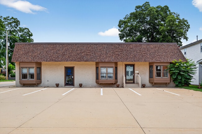
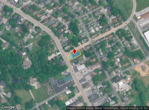
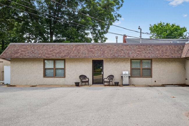
Property Record
638 N Main St, Columbia, IL 62236
NEARBY LISTINGS FOR SALE OR LEASE
Property Detail
638 N Main St
St. Louis, MO-IL
John Mckee Add
04-16-435-003-000
PART LOT 6 JOHN MCKEE ADDN
Commercialnec
Monroe
X
Illinois
17133C0079F
6
2024
0.24 AC
2024
Monroe County
600103
St. Louis
DEMOGRAPHICS near 638 N Main St
1 Mile
3 Mile
5 Mile
2024 Total Population
6,400
12,336
17,038
2029 Population
6,336
12,302
16,881
Pop Growth 2024-2029
(1.00%)
(0.28%)
(0.92%)
Average Age
42
41
42
2024 Total Households
2,605
4,859
6,704
HH Growth 2024-2029
(1.04%)
(0.31%)
(0.95%)
Median Household Inc
$93,646
$103,957
$101,257
Avg Household Size
2.40
2.50
2.50
2024 Avg HH Vehicles
2.00
2.00
2.00
Median Home Value
$260,017
$298,542
$284,477
Median Year Built
1979
1987
1984
Nearby Places
- Restaurants
- Banks
- Shops
- Fitness
- Groceries
PUBLIC TRANSPORTATION
AIRPORT
Scott AFB/Midamerica St Louis
DRIVE
WALK
Distance
Scott AFB/Midamerica St Louis
49 min
25.9 mi
St Louis Lambert International
DRIVE
WALK
Distance
St Louis Lambert International
44 min
28.5 mi
Freight Ports
Tulsa Port of Inola
DRIVE
WALK
Distance
Tulsa Port of Inola
426 min
384.3 mi
Nearby Properties
Address
Land Use
TOTAL SIZE
Lot Size
Zoning
Address
Land Use
TOTAL SIZE
Lot Size
Zoning
11.55 AC
CC3
Address
Land Use
TOTAL SIZE
Lot Size
Zoning
11.08 AC
CC3
Address
Land Use
TOTAL SIZE
Lot Size
Zoning
32.24 AC
CBP2
Address
Land Use
TOTAL SIZE
Lot Size
Zoning
8.43 AC
CR7
Address
Land Use
TOTAL SIZE
Lot Size
Zoning
18.88 AC
CI1
Address
Land Use
TOTAL SIZE
Lot Size
Zoning
8.83 AC
CBP2
Address
Land Use
TOTAL SIZE
Lot Size
Zoning
3.93 AC
CC3
Address
Land Use
TOTAL SIZE
Lot Size
Zoning
13 AC
CC3
Address
Land Use
TOTAL SIZE
Lot Size
Zoning
2.82 AC
CC3
Address
Land Use
TOTAL SIZE
Lot Size
Zoning
5.60 AC
CC3
Address
Land Use
TOTAL SIZE
Lot Size
Zoning
1,363 SF
4.61 AC
CC3
Address
Land Use
TOTAL SIZE
Lot Size
Zoning
3 AC
CC2
Address
Land Use
TOTAL SIZE
Lot Size
Zoning
3.32 AC
CC2
Address
Land Use
TOTAL SIZE
Lot Size
Zoning
2.19 AC
CC3
Address
Land Use
TOTAL SIZE
Lot Size
Zoning
Address
Land Use
TOTAL SIZE
Lot Size
Zoning
4.01 AC
CI1
Address
Land Use
TOTAL SIZE
Lot Size
Zoning
3.78 AC
CC3
Address
Land Use
TOTAL SIZE
Lot Size
Zoning
0.76 AC
CC2
Address
Land Use
TOTAL SIZE
Lot Size
Zoning
2.38 AC
CC2
Address
Land Use
TOTAL SIZE
Lot Size
Zoning
3.56 AC
CC3
Address
Land Use
TOTAL SIZE
Lot Size
Zoning
1.35 AC
CC3
Address
Land Use
TOTAL SIZE
Lot Size
Zoning
3.21 AC
CC2
Address
Land Use
TOTAL SIZE
Lot Size
Zoning
1.45 AC
CC3
Address
Land Use
TOTAL SIZE
Lot Size
Zoning
2.11 AC
CC3
Address
Land Use
TOTAL SIZE
Lot Size
Zoning
5.97 AC
MB2
Address
Land Use
TOTAL SIZE
Lot Size
Zoning
1.91 AC
CC2
Address
Land Use
TOTAL SIZE
Lot Size
Zoning
0.76 AC
CC1
Address
Land Use
TOTAL SIZE
Lot Size
Zoning
1.56 AC
CC2
Address
Land Use
TOTAL SIZE
Lot Size
Zoning
1.86 AC
CC3
Address
Land Use
TOTAL SIZE
Lot Size
Zoning
0.45 AC
CC2
The World's #1 Commercial Real Estate Marketplace
Connect with us
© 2025 CoStar Group
The information above has been obtained from sources believed reliable. While we do not doubt its accuracy we have not verified it and make no guarantee, warranty or representation about it. It is your responsibility to independently confirm its accuracy and completeness. Any projections, opinions, assumptions, or estimates used are for example only and do not represent the current or future performance of the property. The value of this transaction to you depends on tax and other factors which should be evaluated by your tax, financial, and legal advisors. You and your advisors should conduct a careful, independent investigation of the property to determine to your satisfaction the suitability of the property for your needs.