Property Record
638 River Bend Ct, Newport News, VA 23602


NEARBY LISTINGS FOR SALE OR LEASE
-
-
View all Newport News listings for sale on LoopNet.com
Property Detail
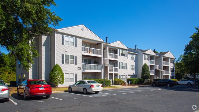
638 River Bend Ct
Virginia Beach-Chesapeake-Norfolk, VA-NC
Acreage Parcel
152.00-07-01
19.1982 ACRES
Apartmenthouse5plusunits
Newport News
X
Virginia
51199C0151D
19.86 AC
2026
Palmer
2025
Hampton Roads
032114
DEMOGRAPHICS near 638 River Bend Ct
1 Mile
3 Mile
5 Mile
2024 Total Population
10,894
82,269
174,577
2029 Population
10,694
81,721
174,657
Pop Growth 2024-2029
(1.84%)
(0.67%)
+ 0.05%
Average Age
36
38
38
2024 Total Households
4,724
34,686
69,725
HH Growth 2024-2029
(1.91%)
(0.83%)
(0.15%)
Median Household Inc
$65,601
$68,087
$72,954
Avg Household Size
2.30
2.30
2.40
2024 Avg HH Vehicles
2.00
2.00
2.00
Median Home Value
$250,906
$271,178
$271,324
Median Year Built
1992
1986
1984
Nearby Places
Map Layers
Map Styles
 Street
 Aerial
- Restaurants
- Banks
- Shops
- Fitness
- Groceries
PUBLIC TRANSPORTATION
COMMUTER RAIL
Newport News (Northeast Regional - Amtrak)
DRIVE
WALK
Distance
Newport News (Northeast Regional - Amtrak)
15 min
7.0 mi
AIRPORT
Newport News/Williamsburg International
DRIVE
WALK
Distance
Newport News/Williamsburg International
8 min
2.8 mi
Norfolk International
DRIVE
WALK
Distance
Norfolk International
38 min
26.1 mi
Freight Ports
Virginia Port Authority - Newport News
DRIVE
WALK
Distance
Virginia Port Authority - Newport News
19 min
13.9 mi
Nearby Properties
Address
Land Use
TOTAL SIZE
Lot Size
Zoning
Address
Land Use
TOTAL SIZE
Lot Size
Zoning
717,621 SF
141.28 AC
M1
Address
Land Use
TOTAL SIZE
Lot Size
Zoning
464,936 SF
33.26 AC
R7
Address
Land Use
TOTAL SIZE
Lot Size
Zoning
565,343 SF
46.70 AC
C1
Address
Land Use
TOTAL SIZE
Lot Size
Zoning
75,168 SF
824.63 AC
M1
Address
Land Use
TOTAL SIZE
Lot Size
Zoning
393,640 SF
14.12 AC
PLANNED DE
Address
Land Use
TOTAL SIZE
Lot Size
Zoning
35,125 SF
5.81 AC
R9
Address
Land Use
TOTAL SIZE
Lot Size
Zoning
25 AC
R8
Address
Land Use
TOTAL SIZE
Lot Size
Zoning
210,585 SF
32.06 AC
R9
Address
Land Use
TOTAL SIZE
Lot Size
Zoning
100 SF
7.27 AC
R9
Address
Land Use
TOTAL SIZE
Lot Size
Zoning
264,447 SF
2.30 AC
C4
Address
Land Use
TOTAL SIZE
Lot Size
Zoning
139,155 SF
15.01 AC
O2
Address
Land Use
TOTAL SIZE
Lot Size
Zoning
3,278 SF
7.44 AC
R9
Address
Land Use
TOTAL SIZE
Lot Size
Zoning
28.29 AC
R7
Address
Land Use
TOTAL SIZE
Lot Size
Zoning
39,492 SF
798.51 AC
RESOURCE C
Address
Land Use
TOTAL SIZE
Lot Size
Zoning
71,551 SF
110 AC
O3
Address
Land Use
TOTAL SIZE
Lot Size
Zoning
290,280 SF
41.97 AC
C1
Address
Land Use
TOTAL SIZE
Lot Size
Zoning
4.62 AC
C4
Address
Land Use
TOTAL SIZE
Lot Size
Zoning
100 SF
7.68 AC
R9
Address
Land Use
TOTAL SIZE
Lot Size
Zoning
22,652 SF
74.72 AC
P1
Address
Land Use
TOTAL SIZE
Lot Size
Zoning
4.10 AC
R9
Address
Land Use
TOTAL SIZE
Lot Size
Zoning
617 SF
73.49 AC
M1
Address
Land Use
TOTAL SIZE
Lot Size
Zoning
100 SF
10.46 AC
R8
Address
Land Use
TOTAL SIZE
Lot Size
Zoning
100 SF
14 AC
R7
Address
Land Use
TOTAL SIZE
Lot Size
Zoning
197,355 SF
10.89 AC
R8
Address
Land Use
TOTAL SIZE
Lot Size
Zoning
11.95 AC
R8
Address
Land Use
TOTAL SIZE
Lot Size
Zoning
517,920 SF
1.56 AC
C4
Address
Land Use
TOTAL SIZE
Lot Size
Zoning
13.10 AC
R5
Address
Land Use
TOTAL SIZE
Lot Size
Zoning
8.09 AC
R8
Address
Land Use
TOTAL SIZE
Lot Size
Zoning
20.73 AC
R7
The World's #1 Commercial Real Estate Marketplace
Connect with us
© 2026 CoStar Group
The information above has been obtained from sources believed reliable. While we do not doubt its accuracy we have not verified it and make no guarantee, warranty or representation about it. It is your responsibility to independently confirm its accuracy and completeness. Any projections, opinions, assumptions, or estimates used are for example only and do not represent the current or future performance of the property. The value of this transaction to you depends on tax and other factors which should be evaluated by your tax, financial, and legal advisors. You and your advisors should conduct a careful, independent investigation of the property to determine to your satisfaction the suitability of the property for your needs.