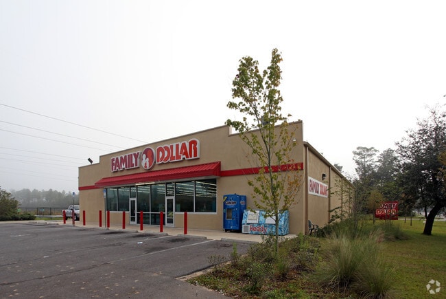
Property Record
6380 Highway 87 N, Milton, FL 32570


NEARBY LISTINGS FOR SALE OR LEASE
Property Detail
6380 Highway 87 N
21-2N-28-0000-06400-0000
*CORRECTED DEED DESCRIPTION* 12/13/2010 DES AS FOLLOWS: COM AT NE CORN OF LOT 22 OF ARLINGWOOD SUB THN N88*5119W ON N SUB LN 2129.50 FT TO NW CORN OF LOT 44 OF SUB & POB THN S21*2251E 227.27 FT TO N R/W OF ARLINGWOOD DR THN ON RD N89*1910W 277.97 FT
Storebuilding
Santa Rosa
X
Florida
12113C0320H
22
2024
2.67 AC
2025
Avalon Beach/Milton
010505
Pensacola
9,900 SF
Pensacola-Ferry Pass-Brent, FL
DEMOGRAPHICS near 6380 Highway 87 N
1 Mile
3 Mile
5 Mile
2024 Total Population
3,521
22,303
39,117
2029 Population
4,028
25,503
44,786
Pop Growth 2024-2029
+ 14.40%
+ 14.35%
+ 14.49%
Average Age
39
40
40
2024 Total Households
1,377
8,715
14,954
HH Growth 2024-2029
+ 14.67%
+ 14.68%
+ 14.91%
Median Household Inc
$58,945
$69,297
$69,625
Avg Household Size
2.50
2.50
2.50
2024 Avg HH Vehicles
2.00
2.00
2.00
Median Home Value
$206,618
$235,532
$232,612
Median Year Built
1980
1989
1990
Nearby Places
Map Layers
Map Styles
 Street
 Aerial
- Restaurants
- Banks
- Shops
- Fitness
- Groceries
PUBLIC TRANSPORTATION
AIRPORT
Pensacola International
DRIVE
WALK
Distance
Pensacola International
39 min
22.3 mi
Nearby Properties
Address
Land Use
TOTAL SIZE
Lot Size
Zoning
Address
Land Use
TOTAL SIZE
Lot Size
Zoning
173,250 SF
28.91 AC
C1
Address
Land Use
TOTAL SIZE
Lot Size
Zoning
80,314 SF
9.76 AC
C1
Address
Land Use
TOTAL SIZE
Lot Size
Zoning
8,223 SF
40 AC
Address
Land Use
TOTAL SIZE
Lot Size
Zoning
102,921 SF
5 AC
R3
Address
Land Use
TOTAL SIZE
Lot Size
Zoning
147,443 SF
11.44 AC
I1
Address
Land Use
TOTAL SIZE
Lot Size
Zoning
39,570 SF
0.36 AC
C1
Address
Land Use
TOTAL SIZE
Lot Size
Zoning
91,887 SF
10.83 AC
C1
Address
Land Use
TOTAL SIZE
Lot Size
Zoning
10 AC
R1A
Address
Land Use
TOTAL SIZE
Lot Size
Zoning
82,994 SF
6 AC
RR1
Address
Land Use
TOTAL SIZE
Lot Size
Zoning
49,540 SF
2.30 AC
HCD
Address
Land Use
TOTAL SIZE
Lot Size
Zoning
40,142 SF
5.28 AC
R3
Address
Land Use
TOTAL SIZE
Lot Size
Zoning
46,613 SF
5.72 AC
C1
Address
Land Use
TOTAL SIZE
Lot Size
Zoning
72,208 SF
66.85 AC
C2
Address
Land Use
TOTAL SIZE
Lot Size
Zoning
15 AC
R1A
Address
Land Use
TOTAL SIZE
Lot Size
Zoning
22.09 AC
PE
Address
Land Use
TOTAL SIZE
Lot Size
Zoning
35,405 SF
2.55 AC
R3
Address
Land Use
TOTAL SIZE
Lot Size
Zoning
48,463 SF
10.64 AC
R3
Address
Land Use
TOTAL SIZE
Lot Size
Zoning
43,399 SF
9.24 AC
R1A
Address
Land Use
TOTAL SIZE
Lot Size
Zoning
37,845 SF
2.24 AC
R3
Address
Land Use
TOTAL SIZE
Lot Size
Zoning
48,242 SF
4.94 AC
HCD
Address
Land Use
TOTAL SIZE
Lot Size
Zoning
48,990 SF
3.68 AC
C1
Address
Land Use
TOTAL SIZE
Lot Size
Zoning
55,538 SF
3.72 AC
C2
Address
Land Use
TOTAL SIZE
Lot Size
Zoning
34,226 SF
2.85 AC
R3
Address
Land Use
TOTAL SIZE
Lot Size
Zoning
10,455 SF
1.27 AC
C1
Address
Land Use
TOTAL SIZE
Lot Size
Zoning
23,418 SF
1.67 AC
C1
Address
Land Use
TOTAL SIZE
Lot Size
Zoning
29,048 SF
6.58 AC
C1
Address
Land Use
TOTAL SIZE
Lot Size
Zoning
20,230 SF
2 AC
R3
Address
Land Use
TOTAL SIZE
Lot Size
Zoning
18,531 SF
4.01 AC
C2
Address
Land Use
TOTAL SIZE
Lot Size
Zoning
20,625 SF
4.28 AC
C1
Address
Land Use
TOTAL SIZE
Lot Size
Zoning
19,052 SF
2.22 AC
SSC-RC
The World's #1 Commercial Real Estate Marketplace
Connect with us
© 2025 CoStar Group
The information above has been obtained from sources believed reliable. While we do not doubt its accuracy we have not verified it and make no guarantee, warranty or representation about it. It is your responsibility to independently confirm its accuracy and completeness. Any projections, opinions, assumptions, or estimates used are for example only and do not represent the current or future performance of the property. The value of this transaction to you depends on tax and other factors which should be evaluated by your tax, financial, and legal advisors. You and your advisors should conduct a careful, independent investigation of the property to determine to your satisfaction the suitability of the property for your needs.