Property Record
6380 Ramsey St, Fayetteville, NC 28311


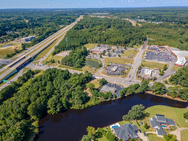
This Property Is For Sale
NEARBY LISTINGS FOR SALE OR LEASE
Property Detail
6380 Ramsey St
Fayetteville, NC
Ramsey St/Heather Rg To Cc Ln
0531-91-1892
BROADWELL-WEBER INVESTMENTS LO:2 SE:01 PL:0112-0134
Commercialacreage
Cumberland
AE
North Carolina
3720053100J
2
2025
0.94 AC
2025
East Fayetteville
002506
Fayetteville
DEMOGRAPHICS near 6380 Ramsey St
1 Mile
3 Mile
5 Mile
2024 Total Population
4,879
22,197
43,026
2029 Population
4,799
21,973
42,777
Pop Growth 2024-2029
(1.64%)
(1.01%)
(0.58%)
Average Age
35
36
37
2024 Total Households
2,143
9,010
17,828
HH Growth 2024-2029
(1.73%)
(1.05%)
(0.61%)
Median Household Inc
$60,460
$62,315
$53,122
Avg Household Size
2.30
2.40
2.30
2024 Avg HH Vehicles
2.00
2.00
2.00
Median Home Value
$235,687
$190,537
$173,892
Median Year Built
1992
1987
1984
Nearby Places
Map Layers
Map Styles
 Street
 Aerial
- Restaurants
- Banks
- Shops
- Fitness
- Groceries
PUBLIC TRANSPORTATION
COMMUTER RAIL
Fayetteville Amtrak Station (Palmetto - Amtrak, Silver Meteor - Amtrak)
DRIVE
WALK
Distance
Fayetteville Amtrak Station (Palmetto - Amtrak, Silver Meteor - Amtrak)
13 min
8.1 mi
AIRPORT
Fayetteville Regional/Grannis Field
DRIVE
WALK
Distance
Fayetteville Regional/Grannis Field
21 min
13.0 mi
Freight Ports
Port of Wilmington
DRIVE
WALK
Distance
Port of Wilmington
138 min
98.7 mi
Nearby Properties
Address
Land Use
TOTAL SIZE
Lot Size
Zoning
Address
Land Use
TOTAL SIZE
Lot Size
Zoning
7,981 SF
599.07 AC
OI
Address
Land Use
TOTAL SIZE
Lot Size
Zoning
224 SF
331 AC
MP
Address
Land Use
TOTAL SIZE
Lot Size
Zoning
1,920 SF
14.88 AC
MR5
Address
Land Use
TOTAL SIZE
Lot Size
Zoning
4,380 SF
33.27 AC
SF10
Address
Land Use
TOTAL SIZE
Lot Size
Zoning
2,466 SF
19.67 AC
MUCZ
Address
Land Use
TOTAL SIZE
Lot Size
Zoning
212,754 SF
29.98 AC
CC
Address
Land Use
TOTAL SIZE
Lot Size
Zoning
1,289 SF
18.12 AC
MR5
Address
Land Use
TOTAL SIZE
Lot Size
Zoning
5,436 SF
14.01 AC
MR5
Address
Land Use
TOTAL SIZE
Lot Size
Zoning
40,647 SF
13.89 AC
CC
Address
Land Use
TOTAL SIZE
Lot Size
Zoning
2,080 SF
14.47 AC
MR5
Address
Land Use
TOTAL SIZE
Lot Size
Zoning
103,225 SF
69.36 AC
PND
Address
Land Use
TOTAL SIZE
Lot Size
Zoning
4,210 SF
22.02 AC
MR5
Address
Land Use
TOTAL SIZE
Lot Size
Zoning
3,842 SF
13.56 AC
PND
Address
Land Use
TOTAL SIZE
Lot Size
Zoning
2,802 SF
3.47 AC
CP-PLANNED
Address
Land Use
TOTAL SIZE
Lot Size
Zoning
8.28 AC
MR5-MIXED
Address
Land Use
TOTAL SIZE
Lot Size
Zoning
3,006 SF
4.96 AC
MR5
Address
Land Use
TOTAL SIZE
Lot Size
Zoning
2,246 SF
4.47 AC
MR5
Address
Land Use
TOTAL SIZE
Lot Size
Zoning
16,705 SF
3.37 AC
CC
Address
Land Use
TOTAL SIZE
Lot Size
Zoning
3,949 SF
8.95 AC
MR5
Address
Land Use
TOTAL SIZE
Lot Size
Zoning
135,386 SF
16.96 AC
CC
Address
Land Use
TOTAL SIZE
Lot Size
Zoning
3,054 SF
14.65 AC
MR5
Address
Land Use
TOTAL SIZE
Lot Size
Zoning
4,783 SF
12.50 AC
SF6
Address
Land Use
TOTAL SIZE
Lot Size
Zoning
15,345 SF
0.62 AC
MUC
Address
Land Use
TOTAL SIZE
Lot Size
Zoning
3,633 SF
12.20 AC
MR5
Address
Land Use
TOTAL SIZE
Lot Size
Zoning
2.04 AC
CC
Address
Land Use
TOTAL SIZE
Lot Size
Zoning
23,386 SF
6.83 AC
CC-COMMUNI
Address
Land Use
TOTAL SIZE
Lot Size
Zoning
9.07 AC
MR5
Address
Land Use
TOTAL SIZE
Lot Size
Zoning
24,967 SF
39.98 AC
PND
Address
Land Use
TOTAL SIZE
Lot Size
Zoning
23,386 SF
6.04 AC
CC
Address
Land Use
TOTAL SIZE
Lot Size
Zoning
3,467 SF
10.38 AC
MR5
The World's #1 Commercial Real Estate Marketplace
Connect with us
© 2026 CoStar Group
The information above has been obtained from sources believed reliable. While we do not doubt its accuracy we have not verified it and make no guarantee, warranty or representation about it. It is your responsibility to independently confirm its accuracy and completeness. Any projections, opinions, assumptions, or estimates used are for example only and do not represent the current or future performance of the property. The value of this transaction to you depends on tax and other factors which should be evaluated by your tax, financial, and legal advisors. You and your advisors should conduct a careful, independent investigation of the property to determine to your satisfaction the suitability of the property for your needs.