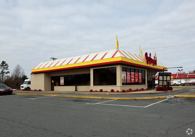
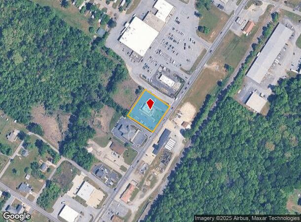
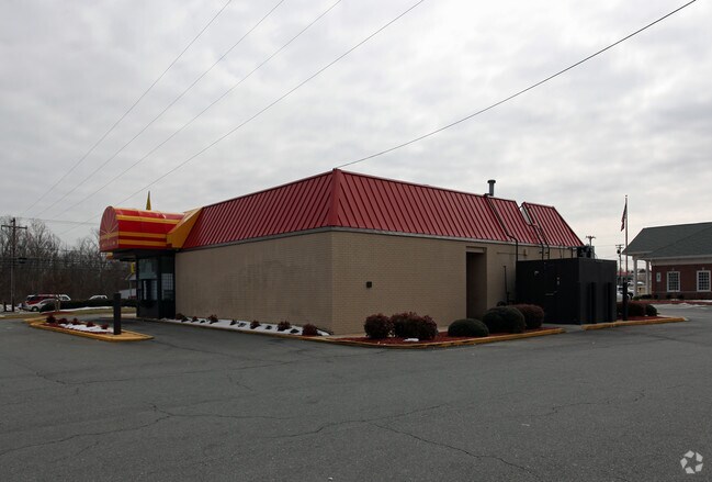
Property Record
6385 Old Us Highway 52, Lexington, NC 27295
NEARBY LISTINGS FOR SALE OR LEASE
Property Detail
6385 Old Us Highway 52
11-308-E-000-0005-0-0-0
P=9-56 L5 BK2493-620
Restaurantdrivein
Davidson
X
North Carolina
3710672800J
0.88 AC
2025
South Davidson County
2025
Greensboro/Winston-Salem
060400
Winston-Salem, NC
4,468 SF
DEMOGRAPHICS near 6385 Old Us Highway 52
1 Mile
3 Mile
5 Mile
2024 Total Population
1,444
8,291
28,300
2029 Population
1,472
8,635
29,770
Pop Growth 2024-2029
+ 1.94%
+ 4.15%
+ 5.19%
Average Age
42
42
43
2024 Total Households
572
3,311
11,317
HH Growth 2024-2029
+ 1.57%
+ 4.02%
+ 5.07%
Median Household Inc
$44,090
$59,911
$59,530
Avg Household Size
2.40
2.40
2.50
2024 Avg HH Vehicles
2.00
2.00
2.00
Median Home Value
$163,260
$172,921
$185,376
Median Year Built
1979
1982
1986
Nearby Places
Map Layers
Map Styles
 Street
 Aerial
- Restaurants
- Banks
- Shops
- Fitness
- Groceries
PUBLIC TRANSPORTATION
AIRPORT
Piedmont Triad International
DRIVE
WALK
Distance
Piedmont Triad International
44 min
30.9 mi
Freight Ports
Port of Wilmington
DRIVE
WALK
Distance
Port of Wilmington
266 min
219.0 mi
Nearby Properties
Address
Land Use
TOTAL SIZE
Lot Size
Zoning
Address
Land Use
TOTAL SIZE
Lot Size
Zoning
133,946 SF
22.50 AC
LI
Address
Land Use
TOTAL SIZE
Lot Size
Zoning
375,613 SF
22.57 AC
LI
Address
Land Use
TOTAL SIZE
Lot Size
Zoning
89,483 SF
60.95 AC
RA3
Address
Land Use
TOTAL SIZE
Lot Size
Zoning
181,176 SF
17.13 AC
LI
Address
Land Use
TOTAL SIZE
Lot Size
Zoning
92,492 SF
8.86 AC
LI
Address
Land Use
TOTAL SIZE
Lot Size
Zoning
33,761 SF
9.48 AC
HC
Address
Land Use
TOTAL SIZE
Lot Size
Zoning
110,455 SF
20.36 AC
RA3
Address
Land Use
TOTAL SIZE
Lot Size
Zoning
69,345 SF
9.29 AC
LI
Address
Land Use
TOTAL SIZE
Lot Size
Zoning
10,248 SF
9 AC
OI
Address
Land Use
TOTAL SIZE
Lot Size
Zoning
8,586 SF
5.15 AC
LI
Address
Land Use
TOTAL SIZE
Lot Size
Zoning
48,362 SF
5.26 AC
HC
Address
Land Use
TOTAL SIZE
Lot Size
Zoning
90,496 SF
10.99 AC
LI
Address
Land Use
TOTAL SIZE
Lot Size
Zoning
108,891 SF
11.36 AC
LI
Address
Land Use
TOTAL SIZE
Lot Size
Zoning
147,689 SF
29.23 AC
OI
Address
Land Use
TOTAL SIZE
Lot Size
Zoning
34,258 SF
3.58 AC
LI
Address
Land Use
TOTAL SIZE
Lot Size
Zoning
29,406 SF
5.70 AC
RS
Address
Land Use
TOTAL SIZE
Lot Size
Zoning
6,000 SF
1.17 AC
LI
Address
Land Use
TOTAL SIZE
Lot Size
Zoning
51,836 SF
3.96 AC
LI
Address
Land Use
TOTAL SIZE
Lot Size
Zoning
37,990 SF
5.27 AC
LI
Address
Land Use
TOTAL SIZE
Lot Size
Zoning
9,409 SF
1.88 AC
HC
Address
Land Use
TOTAL SIZE
Lot Size
Zoning
26,908 SF
11.79 AC
RA3
Address
Land Use
TOTAL SIZE
Lot Size
Zoning
64,333 SF
10 AC
LI
Address
Land Use
TOTAL SIZE
Lot Size
Zoning
23,093 SF
9.68 AC
RA3
Address
Land Use
TOTAL SIZE
Lot Size
Zoning
34,038 SF
7.81 AC
LI
Address
Land Use
TOTAL SIZE
Lot Size
Zoning
12,674 SF
4.72 AC
LI
Address
Land Use
TOTAL SIZE
Lot Size
Zoning
44,050 SF
3.53 AC
LI
Address
Land Use
TOTAL SIZE
Lot Size
Zoning
37,293 SF
8.91 AC
RS
Address
Land Use
TOTAL SIZE
Lot Size
Zoning
7,824 SF
1.29 AC
HC
Address
Land Use
TOTAL SIZE
Lot Size
Zoning
11,710 SF
1.38 AC
HC
Address
Land Use
TOTAL SIZE
Lot Size
Zoning
23,680 SF
1.62 AC
HC
The World's #1 Commercial Real Estate Marketplace
Connect with us
© 2025 CoStar Group
The information above has been obtained from sources believed reliable. While we do not doubt its accuracy we have not verified it and make no guarantee, warranty or representation about it. It is your responsibility to independently confirm its accuracy and completeness. Any projections, opinions, assumptions, or estimates used are for example only and do not represent the current or future performance of the property. The value of this transaction to you depends on tax and other factors which should be evaluated by your tax, financial, and legal advisors. You and your advisors should conduct a careful, independent investigation of the property to determine to your satisfaction the suitability of the property for your needs.