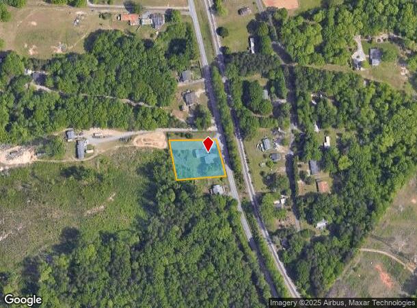
Property Record
6390 Walnut Cove Rd, Walkertown, NC 27051

NEARBY LISTINGS FOR SALE OR LEASE
Property Detail
6390 Walnut Cove Rd
Winston-Salem, NC
The Grey Wing Studio
6859-53-7755
THE GREY WING STUDIO LO:021F BL:5155 BU:1
Storebuilding
Forsyth
X
North Carolina
3710685900J
21f
2024
0.91 AC
2025
NE Forsyth County
002904
Greensboro/Winston-Salem
1,596 SF
DEMOGRAPHICS near 6390 Walnut Cove Rd
1 Mile
3 Mile
5 Mile
2024 Total Population
449
9,870
33,075
2029 Population
470
10,311
34,470
Pop Growth 2024-2029
+ 4.68%
+ 4.47%
+ 4.22%
Average Age
43
42
41
2024 Total Households
184
3,954
12,990
HH Growth 2024-2029
+ 4.35%
+ 4.48%
+ 4.21%
Median Household Inc
$48,124
$62,771
$60,784
Avg Household Size
2.30
2.40
2.50
2024 Avg HH Vehicles
2.00
2.00
2.00
Median Home Value
$188,371
$178,258
$179,276
Median Year Built
1981
1984
1981
Nearby Places
Map Layers
Map Styles
 Street
 Aerial
- Restaurants
- Banks
- Shops
- Fitness
- Groceries
PUBLIC TRANSPORTATION
AIRPORT
Piedmont Triad International
DRIVE
WALK
Distance
Piedmont Triad International
35 min
22.2 mi
SALE & LEASE HISTORY
LISTING DATE
SALE/LEASE

Sep 17, 2018
For Lease
Sep 11, 2019
For Sale
Aug 02, 2019
For Lease
Nearby Properties
Address
Land Use
TOTAL SIZE
Lot Size
Zoning
Address
Land Use
TOTAL SIZE
Lot Size
Zoning
73,908 SF
14.40 AC
GB-S
Address
Land Use
TOTAL SIZE
Lot Size
Zoning
77,879 SF
9.56 AC
GB-S
Address
Land Use
TOTAL SIZE
Lot Size
Zoning
113,016 SF
6.45 AC
IP
Address
Land Use
TOTAL SIZE
Lot Size
Zoning
11,500 SF
139.75 AC
GI,RS9
Address
Land Use
TOTAL SIZE
Lot Size
Zoning
107,609 SF
11.53 AC
HB-S
Address
Land Use
TOTAL SIZE
Lot Size
Zoning
66,636 SF
14.81 AC
IP
Address
Land Use
TOTAL SIZE
Lot Size
Zoning
48,400 SF
8.59 AC
HB-S
Address
Land Use
TOTAL SIZE
Lot Size
Zoning
31,290 SF
9.76 AC
IP,RS9
Address
Land Use
TOTAL SIZE
Lot Size
Zoning
13,101 SF
1.73 AC
HB-S
Address
Land Use
TOTAL SIZE
Lot Size
Zoning
14,424 SF
1.88 AC
HB,LB,RS20
Address
Land Use
TOTAL SIZE
Lot Size
Zoning
18,076 SF
3.60 AC
RS20
Address
Land Use
TOTAL SIZE
Lot Size
Zoning
15,702 SF
2.55 AC
LB-S
Address
Land Use
TOTAL SIZE
Lot Size
Zoning
30,435 SF
7.04 AC
HB
Address
Land Use
TOTAL SIZE
Lot Size
Zoning
15,435 SF
3.33 AC
LO-S,PB-S
Address
Land Use
TOTAL SIZE
Lot Size
Zoning
5,663 SF
1.40 AC
HB-S
Address
Land Use
TOTAL SIZE
Lot Size
Zoning
11,664 SF
2.43 AC
IP
Address
Land Use
TOTAL SIZE
Lot Size
Zoning
5,459 SF
1.29 AC
HB-S
Address
Land Use
TOTAL SIZE
Lot Size
Zoning
3,737 SF
1.13 AC
HB-S
Address
Land Use
TOTAL SIZE
Lot Size
Zoning
23,829 SF
3.56 AC
IP,RS20
Address
Land Use
TOTAL SIZE
Lot Size
Zoning
20,700 SF
5.50 AC
LI
Address
Land Use
TOTAL SIZE
Lot Size
Zoning
55.41 AC
HB,IP,RS9
Address
Land Use
TOTAL SIZE
Lot Size
Zoning
21,726 SF
3.57 AC
RS20
Address
Land Use
TOTAL SIZE
Lot Size
Zoning
2,524 SF
1.11 AC
HB-S
Address
Land Use
TOTAL SIZE
Lot Size
Zoning
21,125 SF
2.36 AC
HB
Address
Land Use
TOTAL SIZE
Lot Size
Zoning
21,625 SF
1.86 AC
HB
Address
Land Use
TOTAL SIZE
Lot Size
Zoning
10,428 SF
2.76 AC
RS40
Address
Land Use
TOTAL SIZE
Lot Size
Zoning
5,229 SF
2.95 AC
LO-S
Address
Land Use
TOTAL SIZE
Lot Size
Zoning
44.75 AC
RM12,RS9
Address
Land Use
TOTAL SIZE
Lot Size
Zoning
10,600 SF
4.84 AC
RS9
Address
Land Use
TOTAL SIZE
Lot Size
Zoning
7,110 SF
0.54 AC
HB-S
The World's #1 Commercial Real Estate Marketplace
Connect with us
© 2025 CoStar Group
The information above has been obtained from sources believed reliable. While we do not doubt its accuracy we have not verified it and make no guarantee, warranty or representation about it. It is your responsibility to independently confirm its accuracy and completeness. Any projections, opinions, assumptions, or estimates used are for example only and do not represent the current or future performance of the property. The value of this transaction to you depends on tax and other factors which should be evaluated by your tax, financial, and legal advisors. You and your advisors should conduct a careful, independent investigation of the property to determine to your satisfaction the suitability of the property for your needs.