Property Record
6399 County Road 19, Loretto, MN 55357


NEARBY LISTINGS FOR SALE OR LEASE
-
-
View all Loretto listings for sale on LoopNet.com
Property Detail
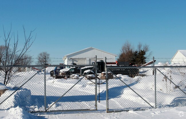
6399 County Road 19
Minneapolis-St. Paul-Bloomington, MN-WI
Unplatted 31 119 23
31-119-23-34-0008
UNPLATTED 31 119 23 THAT PART OF THE SOUTH 1371.17 FEET OF THE EAST HALF OF THE SOUTHWEST QUARTER OF SECTION 31 TOWNSHIP 119 RANGE 23 WHICH LIES NORTH OF THE T IRREGULAR
Industrialgeneral
Hennepin
X
Minnesota
27053C0134F
22.75 AC
2024
Northwest
2024
Minneapolis/St Paul
027102
DEMOGRAPHICS near 6399 County Road 19
1 Mile
3 Mile
5 Mile
2024 Total Population
627
4,247
13,501
2029 Population
612
4,155
13,365
Pop Growth 2024-2029
(2.39%)
(2.17%)
(1.01%)
Average Age
42
42
41
2024 Total Households
232
1,512
4,829
HH Growth 2024-2029
(2.16%)
(2.25%)
(0.95%)
Median Household Inc
$130,172
$137,579
$128,306
Avg Household Size
2.70
2.80
2.70
2024 Avg HH Vehicles
2.00
3.00
2.00
Median Home Value
$421,250
$484,431
$485,091
Median Year Built
1986
1981
1983
Nearby Places
Map Layers
Map Styles
 Street
 Aerial
- Restaurants
- Banks
- Shops
- Fitness
- Groceries
PUBLIC TRANSPORTATION
AIRPORT
Minneapolis-St Paul International/Wold-Chamberlain
DRIVE
WALK
Distance
Minneapolis-St Paul International/Wold-Chamberlain
47 min
32.4 mi
Nearby Properties
Address
Land Use
TOTAL SIZE
Lot Size
Zoning
Address
Land Use
TOTAL SIZE
Lot Size
Zoning
Address
Land Use
TOTAL SIZE
Lot Size
Zoning
25.53 AC
Address
Land Use
TOTAL SIZE
Lot Size
Zoning
42.54 AC
Address
Land Use
TOTAL SIZE
Lot Size
Zoning
26.54 AC
Address
Land Use
TOTAL SIZE
Lot Size
Zoning
11.52 AC
Address
Land Use
TOTAL SIZE
Lot Size
Zoning
Address
Land Use
TOTAL SIZE
Lot Size
Zoning
10.29 AC
Address
Land Use
TOTAL SIZE
Lot Size
Zoning
15.21 AC
Address
Land Use
TOTAL SIZE
Lot Size
Zoning
10.01 AC
Address
Land Use
TOTAL SIZE
Lot Size
Zoning
17.91 AC
Address
Land Use
TOTAL SIZE
Lot Size
Zoning
2.02 AC
Address
Land Use
TOTAL SIZE
Lot Size
Zoning
0.95 AC
Address
Land Use
TOTAL SIZE
Lot Size
Zoning
4.59 AC
Address
Land Use
TOTAL SIZE
Lot Size
Zoning
1,582 SF
74 AC
Address
Land Use
TOTAL SIZE
Lot Size
Zoning
17.04 AC
Address
Land Use
TOTAL SIZE
Lot Size
Zoning
60.18 AC
Address
Land Use
TOTAL SIZE
Lot Size
Zoning
1.89 AC
Address
Land Use
TOTAL SIZE
Lot Size
Zoning
Address
Land Use
TOTAL SIZE
Lot Size
Zoning
4.67 AC
Address
Land Use
TOTAL SIZE
Lot Size
Zoning
5.85 AC
Address
Land Use
TOTAL SIZE
Lot Size
Zoning
41.66 AC
Address
Land Use
TOTAL SIZE
Lot Size
Zoning
1.25 AC
Address
Land Use
TOTAL SIZE
Lot Size
Zoning
17.60 AC
Address
Land Use
TOTAL SIZE
Lot Size
Zoning
53.19 AC
Address
Land Use
TOTAL SIZE
Lot Size
Zoning
1.73 AC
Address
Land Use
TOTAL SIZE
Lot Size
Zoning
Address
Land Use
TOTAL SIZE
Lot Size
Zoning
Address
Land Use
TOTAL SIZE
Lot Size
Zoning
74.80 AC
Address
Land Use
TOTAL SIZE
Lot Size
Zoning
2,232 SF
113.85 AC
The World's #1 Commercial Real Estate Marketplace
Connect with us
© 2025 CoStar Group
The information above has been obtained from sources believed reliable. While we do not doubt its accuracy we have not verified it and make no guarantee, warranty or representation about it. It is your responsibility to independently confirm its accuracy and completeness. Any projections, opinions, assumptions, or estimates used are for example only and do not represent the current or future performance of the property. The value of this transaction to you depends on tax and other factors which should be evaluated by your tax, financial, and legal advisors. You and your advisors should conduct a careful, independent investigation of the property to determine to your satisfaction the suitability of the property for your needs.