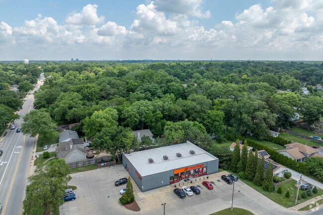
Property Record
63Rd St, Downers Grove, IL 60515

NEARBY LISTINGS FOR SALE OR LEASE
Property Detail
63Rd St
Chicago-Naperville-Elgin, IL-IN
Downers Grove Gardens
08-13-418-060
DOWNERS GROVE GARDENS /EX HWY DESC 691658 BK 712 PG 40/ & /EX HWY DESC 61-26264/ & /EX HWY DESC 96-ED-61/
Commercialnec
DuPage
X
Illinois
17043C0168J
27
2024
0.21 AC
2024
Eastern East/West Corr
844802
Chicago
DEMOGRAPHICS near 63Rd St
1 mile
3 mile
5 mile
2024 Total Population
14,088
107,402
251,276
2029 Population
14,117
106,439
248,114
Pop Growth 2024-2029
+ 0.21%
(0.90%)
(1.26%)
Average Age
41
42
42
2024 Total Households
5,803
44,811
99,641
HH Growth 2024-2029
+ 0.34%
(0.95%)
(1.31%)
Median Household Inc
$92,464
$93,465
$100,986
Avg Household Size
2.40
2.30
2.40
2024 Avg HH Vehicles
2.00
2.00
2.00
Median Home Value
$324,626
$354,235
$374,457
Median Year Built
1977
1976
1977
Nearby Places
Map Layers
Map Styles
 Street
 Aerial
Transit
 Traffic
 Biking
Places
Listings with unknown addresses are not visible on the map
- Restaurants
- Banks
- Shops
- Fitness
- Groceries
PUBLIC TRANSPORTATION
COMMUTER RAIL
Belmont Station (Burlington Northern-Santa Fe Railway Line - Northeast Illinois Regional Commuter Railroad (Metra))
Drive
Walk
Distance
Belmont Station (Burlington Northern-Santa Fe Railway Line - Northeast Illinois Regional Commuter Railroad (Metra))
4 min
1.7 mi
Downers Grove Main Street Station (Burlington Northern-Santa Fe Railway Line - Northeast Illinois Regional Commuter Railroad (Metra))
Drive
Walk
Distance
Downers Grove Main Street Station (Burlington Northern-Santa Fe Railway Line - Northeast Illinois Regional Commuter Railroad (Metra))
5 min
2.7 mi
AIRPORT
Chicago Midway International
Drive
Walk
Distance
Chicago Midway International
29 min
18.7 mi
Chicago O'Hare International
Drive
Walk
Distance
Chicago O'Hare International
37 min
24.4 mi
Freight Ports
Port Milwaukee
Drive
Walk
Distance
Port Milwaukee
118 min
96.1 mi
Nearby Properties
Address
Land Use
TOTAL SIZE
Lot Size
Zoning
Address
Land Use
TOTAL SIZE
Lot Size
Zoning
12.96 AC
M
Address
Land Use
TOTAL SIZE
Lot Size
Zoning
439,070 SF
38.77 AC
C
Address
Land Use
TOTAL SIZE
Lot Size
Zoning
8.08 AC
C
Address
Land Use
TOTAL SIZE
Lot Size
Zoning
5.13 AC
M
Address
Land Use
TOTAL SIZE
Lot Size
Zoning
22.17 AC
M
Address
Land Use
TOTAL SIZE
Lot Size
Zoning
1.34 AC
Address
Land Use
TOTAL SIZE
Lot Size
Zoning
19.58 AC
C
Address
Land Use
TOTAL SIZE
Lot Size
Zoning
13.53 AC
M
Address
Land Use
TOTAL SIZE
Lot Size
Zoning
470,838 SF
17.13 AC
M
Address
Land Use
TOTAL SIZE
Lot Size
Zoning
2.37 AC
Address
Land Use
TOTAL SIZE
Lot Size
Zoning
18.23 AC
M
Address
Land Use
TOTAL SIZE
Lot Size
Zoning
315,708 SF
21.95 AC
M
Address
Land Use
TOTAL SIZE
Lot Size
Zoning
19.02 AC
M
Address
Land Use
TOTAL SIZE
Lot Size
Zoning
8.53 AC
M
Address
Land Use
TOTAL SIZE
Lot Size
Zoning
13.44 AC
C
Address
Land Use
TOTAL SIZE
Lot Size
Zoning
14.98 AC
M
Address
Land Use
TOTAL SIZE
Lot Size
Zoning
308,196 SF
17.65 AC
M
Address
Land Use
TOTAL SIZE
Lot Size
Zoning
9.58 AC
M
Address
Land Use
TOTAL SIZE
Lot Size
Zoning
205,315 SF
0.87 AC
Address
Land Use
TOTAL SIZE
Lot Size
Zoning
173,098 SF
16.32 AC
R-6
Address
Land Use
TOTAL SIZE
Lot Size
Zoning
164,787 SF
8.20 AC
Address
Land Use
TOTAL SIZE
Lot Size
Zoning
173,459 SF
14.58 AC
C
Address
Land Use
TOTAL SIZE
Lot Size
Zoning
25.64 AC
Address
Land Use
TOTAL SIZE
Lot Size
Zoning
126,165 SF
20.34 AC
Address
Land Use
TOTAL SIZE
Lot Size
Zoning
9.97 AC
M
Address
Land Use
TOTAL SIZE
Lot Size
Zoning
8.34 AC
C
Address
Land Use
TOTAL SIZE
Lot Size
Zoning
12.94 AC
M
Address
Land Use
TOTAL SIZE
Lot Size
Zoning
61,553 SF
2.35 AC
M
Address
Land Use
TOTAL SIZE
Lot Size
Zoning
118,665 SF
1.11 AC
C
Address
Land Use
TOTAL SIZE
Lot Size
Zoning
13.46 AC
M
The World's #1 Commercial Real Estate Marketplace
Connect with us
© 2026 CoStar Group
The information above has been obtained from sources believed reliable. While we do not doubt its accuracy we have not verified it and make no guarantee, warranty or representation about it. It is your responsibility to independently confirm its accuracy and completeness. Any projections, opinions, assumptions, or estimates used are for example only and do not represent the current or future performance of the property. The value of this transaction to you depends on tax and other factors which should be evaluated by your tax, financial, and legal advisors. You and your advisors should conduct a careful, independent investigation of the property to determine to your satisfaction the suitability of the property for your needs.