Property Record
64 E 1St St, Corning, NY 14830

Property Detail
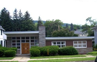
64 E 1St St
Corning, NY
CHURCH BLOCK 49 LOT 3 63X165
460300-318-045-0002-016-000
Steuben
Publicschool
New York
RT
16.000
2025
0.24 AC
2024
Ithaca/Elmira
962700
Other Market Areas
1,634 SF
NEARBY LISTINGS FOR SALE OR LEASE
-
-
View all Corning listings for sale on LoopNet.com
DEMOGRAPHICS near 64 E 1St St
1 mile
3 mile
5 mile
2024 Total Population
6,301
14,983
23,059
2029 Population
6,103
14,505
22,434
Pop Growth 2024-2029
(3.14%)
(3.19%)
(2.71%)
Average Age
41
41
42
2024 Total Households
3,006
6,840
10,150
HH Growth 2024-2029
(3.36%)
(3.30%)
(2.81%)
Median Household Inc
$58,695
$66,907
$75,199
Avg Household Size
2.00
2.10
2.20
2024 Avg HH Vehicles
1.00
2.00
2.00
Median Home Value
$184,963
$170,681
$187,065
Median Year Built
1947
1949
1958
Nearby Places
Map Layers
Map Styles
 Street
 Aerial
Transit
 Traffic
 Biking
Places
Listings with unknown addresses are not visible on the map
- Restaurants
- Banks
- Shops
- Fitness
- Groceries
PUBLIC TRANSPORTATION
AIRPORT
Elmira/Corning Regional
Drive
Walk
Distance
Elmira/Corning Regional
17 min
10.4 mi
Nearby Properties
Address
Land Use
TOTAL SIZE
Lot Size
Zoning
Address
Land Use
TOTAL SIZE
Lot Size
Zoning
52,288 SF
9.50 AC
BD
Address
Land Use
TOTAL SIZE
Lot Size
Zoning
302,250 SF
19.74 AC
BD
Address
Land Use
TOTAL SIZE
Lot Size
Zoning
Address
Land Use
TOTAL SIZE
Lot Size
Zoning
192,620 SF
31.50 AC
05 - COMME
Address
Land Use
TOTAL SIZE
Lot Size
Zoning
27,603 SF
90.91 AC
CONF
Address
Land Use
TOTAL SIZE
Lot Size
Zoning
Address
Land Use
TOTAL SIZE
Lot Size
Zoning
17,717 SF
205.78 AC
CONF
Address
Land Use
TOTAL SIZE
Lot Size
Zoning
279,299 SF
6.72 AC
PC
Address
Land Use
TOTAL SIZE
Lot Size
Zoning
78,653 SF
4.06 AC
BD
Address
Land Use
TOTAL SIZE
Lot Size
Zoning
150,000 SF
17.94 AC
05
Address
Land Use
TOTAL SIZE
Lot Size
Zoning
3.32 AC
C
Address
Land Use
TOTAL SIZE
Lot Size
Zoning
81,728 SF
4.03 AC
BD
Address
Land Use
TOTAL SIZE
Lot Size
Zoning
97,110 SF
13.31 AC
C
Address
Land Use
TOTAL SIZE
Lot Size
Zoning
82,123 SF
1.35 AC
C
Address
Land Use
TOTAL SIZE
Lot Size
Zoning
90,947 SF
2.79 AC
C
Address
Land Use
TOTAL SIZE
Lot Size
Zoning
43,869 SF
5.02 AC
BD
Address
Land Use
TOTAL SIZE
Lot Size
Zoning
Address
Land Use
TOTAL SIZE
Lot Size
Zoning
Address
Land Use
TOTAL SIZE
Lot Size
Zoning
48,040 SF
12.11 AC
BD
Address
Land Use
TOTAL SIZE
Lot Size
Zoning
20.37 AC
07 - MIXED
Address
Land Use
TOTAL SIZE
Lot Size
Zoning
82,146 SF
2.60 AC
R2
Address
Land Use
TOTAL SIZE
Lot Size
Zoning
18,524 SF
2.86 AC
C
Address
Land Use
TOTAL SIZE
Lot Size
Zoning
242,379 SF
4.30 AC
BD
Address
Land Use
TOTAL SIZE
Lot Size
Zoning
94,984 SF
11.62 AC
Address
Land Use
TOTAL SIZE
Lot Size
Zoning
49,384 SF
1.19 AC
C
Address
Land Use
TOTAL SIZE
Lot Size
Zoning
29,752 SF
0.33 AC
C
Address
Land Use
TOTAL SIZE
Lot Size
Zoning
55,981 SF
8 AC
05 - COMME
Address
Land Use
TOTAL SIZE
Lot Size
Zoning
84,356 SF
2.46 AC
MR
Address
Land Use
TOTAL SIZE
Lot Size
Zoning
40,000 SF
1.84 AC
CONF
Address
Land Use
TOTAL SIZE
Lot Size
Zoning
22.80 AC
05 - COMME
The World's #1 Commercial Real Estate Marketplace
Connect with us
© 2026 CoStar Group
The information above has been obtained from sources believed reliable. While we do not doubt its accuracy we have not verified it and make no guarantee, warranty or representation about it. It is your responsibility to independently confirm its accuracy and completeness. Any projections, opinions, assumptions, or estimates used are for example only and do not represent the current or future performance of the property. The value of this transaction to you depends on tax and other factors which should be evaluated by your tax, financial, and legal advisors. You and your advisors should conduct a careful, independent investigation of the property to determine to your satisfaction the suitability of the property for your needs.