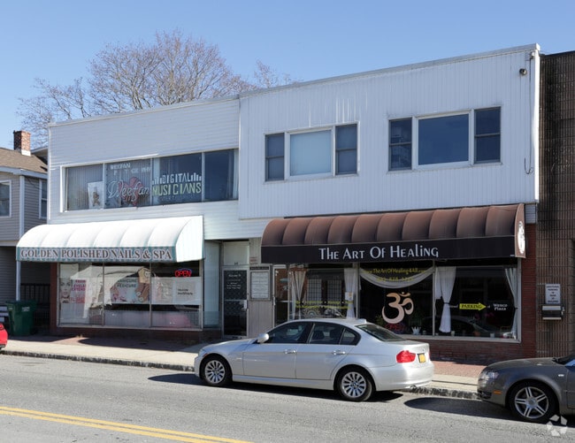
Property Record
64 Gleneida Ave, Carmel, NY 10512


Current Lease Availabilities
NEARBY LISTINGS FOR SALE OR LEASE
Property Detail
64 Gleneida Ave
Dutchess County-Putnam County, NY
Putnam
372000-044-014-0001-041-000-0000
New York
Townhouserowhouse
0.08 AC
X
Carmel
36079C0141E
Westchester/So Connecticut
6,740 SF
DEMOGRAPHICS near 64 Gleneida Ave
1 Mile
3 Mile
5 Mile
2024 Total Population
3,665
19,283
44,650
2029 Population
3,684
19,417
44,820
Pop Growth 2024-2029
+ 0.52%
+ 0.69%
+ 0.38%
Average Age
43
44
43
2024 Total Households
1,363
7,255
16,442
HH Growth 2024-2029
+ 0.51%
+ 0.70%
+ 0.39%
Median Household Inc
$102,045
$93,871
$101,449
Avg Household Size
2.60
2.60
2.60
2024 Avg HH Vehicles
2.00
2.00
2.00
Median Home Value
$428,125
$376,961
$387,482
Median Year Built
1984
1973
1969
Nearby Places
Map Layers
Map Styles
 Street
 Aerial
- Restaurants
- Banks
- Shops
- Fitness
- Groceries
PUBLIC TRANSPORTATION
COMMUTER RAIL
Southeast Station (Harlem Line - Metro-North Commuter Railroad Company (Metro-North))
DRIVE
WALK
Distance
Southeast Station (Harlem Line - Metro-North Commuter Railroad Company (Metro-North))
12 min
4.7 mi
Brewster Station (Harlem Line - Metro-North Commuter Railroad Company (Metro-North))
DRIVE
WALK
Distance
Brewster Station (Harlem Line - Metro-North Commuter Railroad Company (Metro-North))
11 min
4.9 mi
AIRPORT
Westchester County
DRIVE
WALK
Distance
Westchester County
36 min
27.8 mi
New York Stewart International
DRIVE
WALK
Distance
New York Stewart International
46 min
36.1 mi
Nearby Properties
Address
Land Use
TOTAL SIZE
Lot Size
Zoning
Address
Land Use
TOTAL SIZE
Lot Size
Zoning
5,328 SF
808.45 AC
R60
Address
Land Use
TOTAL SIZE
Lot Size
Zoning
28,797 SF
146.83 AC
NW
Address
Land Use
TOTAL SIZE
Lot Size
Zoning
10,438 SF
261.04 AC
NW
Address
Land Use
TOTAL SIZE
Lot Size
Zoning
159,857 SF
12.34 AC
R
Address
Land Use
TOTAL SIZE
Lot Size
Zoning
223,335 SF
27.56 AC
OP2
Address
Land Use
TOTAL SIZE
Lot Size
Zoning
194,344 SF
17.77 AC
CBP
Address
Land Use
TOTAL SIZE
Lot Size
Zoning
150,100 SF
7.52 AC
C
Address
Land Use
TOTAL SIZE
Lot Size
Zoning
Address
Land Use
TOTAL SIZE
Lot Size
Zoning
Address
Land Use
TOTAL SIZE
Lot Size
Zoning
164.46 AC
OP3
Address
Land Use
TOTAL SIZE
Lot Size
Zoning
144,300 SF
25.97 AC
C
Address
Land Use
TOTAL SIZE
Lot Size
Zoning
0.01 AC
OP3
Address
Land Use
TOTAL SIZE
Lot Size
Zoning
Address
Land Use
TOTAL SIZE
Lot Size
Zoning
69,500 SF
12 AC
CBP
Address
Land Use
TOTAL SIZE
Lot Size
Zoning
116,593 SF
11.23 AC
HC
Address
Land Use
TOTAL SIZE
Lot Size
Zoning
116,349 SF
14.49 AC
R4
Address
Land Use
TOTAL SIZE
Lot Size
Zoning
43,175 SF
0.83 AC
C
Address
Land Use
TOTAL SIZE
Lot Size
Zoning
51,648 SF
40 AC
CBP
Address
Land Use
TOTAL SIZE
Lot Size
Zoning
6,003 SF
35.29 AC
HC
Address
Land Use
TOTAL SIZE
Lot Size
Zoning
Address
Land Use
TOTAL SIZE
Lot Size
Zoning
64.48 AC
OP3
Address
Land Use
TOTAL SIZE
Lot Size
Zoning
111,450 SF
25.75 AC
CBP
Address
Land Use
TOTAL SIZE
Lot Size
Zoning
173,168 SF
7.94 AC
HC
Address
Land Use
TOTAL SIZE
Lot Size
Zoning
49,578 SF
7 AC
SP Z
Address
Land Use
TOTAL SIZE
Lot Size
Zoning
57,311 SF
5.70 AC
C
Address
Land Use
TOTAL SIZE
Lot Size
Zoning
40,000 SF
11.15 AC
CBP
Address
Land Use
TOTAL SIZE
Lot Size
Zoning
49,057 SF
4.70 AC
C
Address
Land Use
TOTAL SIZE
Lot Size
Zoning
150,893 SF
8.77 AC
CBP
Address
Land Use
TOTAL SIZE
Lot Size
Zoning
91,776 SF
34.10 AC
C
Address
Land Use
TOTAL SIZE
Lot Size
Zoning
51,048 SF
32.65 AC
R40
The World's #1 Commercial Real Estate Marketplace
Connect with us
© 2025 CoStar Group
The information above has been obtained from sources believed reliable. While we do not doubt its accuracy we have not verified it and make no guarantee, warranty or representation about it. It is your responsibility to independently confirm its accuracy and completeness. Any projections, opinions, assumptions, or estimates used are for example only and do not represent the current or future performance of the property. The value of this transaction to you depends on tax and other factors which should be evaluated by your tax, financial, and legal advisors. You and your advisors should conduct a careful, independent investigation of the property to determine to your satisfaction the suitability of the property for your needs.