Property Record
64 Thf Blvd, Chesterfield, MO 63005
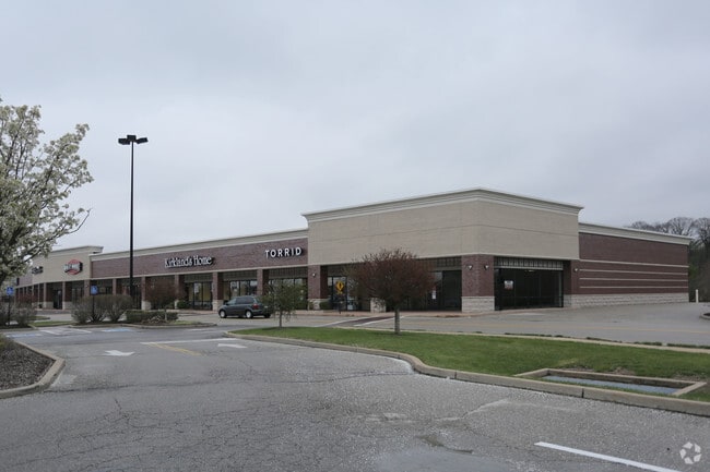
Property Detail
64 Thf Blvd
17T-14-0321
CHESTERFIELD COMMONS EAST PLAT TWO LOT PT 11
Stripcommercialcenter
Saint Louis
105PC
Missouri
AH Areas with a 1% annual chance of shallow flooding, usually in the form of a pond, withan average depth ranging from 1 to 3 feet. These areas have a 26% chance of flooding over the life of a 30-year mortgage.
11
2024
9.39 AC
2025
Chesterfield Region
221629
St. Louis
71,684 SF
St. Louis, MO-IL
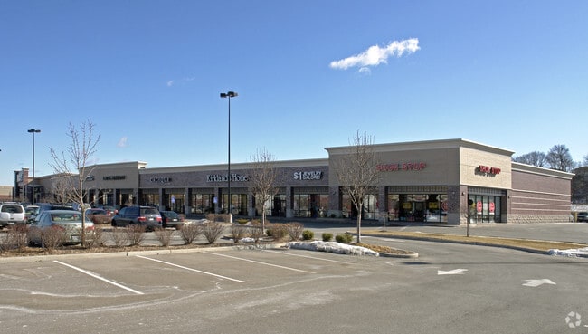
NEARBY LISTINGS FOR SALE OR LEASE
DEMOGRAPHICS near 64 Thf Blvd
1 mile
3 mile
5 mile
2025 Total Population
3,723
26,590
95,621
2030 Population
3,856
26,636
95,696
Pop Growth 2025-2030
+ 3.57%
+ 0.17%
+ 0.08%
Average Age
42
44
44
2025 Total Households
1,363
10,724
36,544
HH Growth 2025-2030
+ 3.52%
+ 0.31%
+ 0.09%
Median Household Inc
$150,282
$141,434
$139,389
Avg Household Size
2.70
2.40
2.60
2025 Avg HH Vehicles
2.00
2.00
2.00
Median Home Value
$638,732
$521,353
$454,437
Median Year Built
1997
1987
1984
Nearby Places
Map Layers
Map Styles
 Street
 Aerial
Layers
 Traffic
 Biking
Places
Listings with unknown addresses are not visible on the map
- Restaurants
- Banks
- Shops
- Fitness
- Groceries
PUBLIC TRANSPORTATION
AIRPORT
St Louis Lambert International
Drive
Walk
Distance
St Louis Lambert International
33 min
22.9 mi
Freight Ports
Tulsa Port of Inola
Drive
Walk
Distance
Tulsa Port of Inola
415 min
370.0 mi
Nearby Properties
Address
Land Use
TOTAL SIZE
Lot Size
Zoning
Address
Land Use
TOTAL SIZE
Lot Size
Zoning
200,372 SF
121.45 AC
105FPNU
Address
Land Use
TOTAL SIZE
Lot Size
Zoning
8.21 AC
105C8
Address
Land Use
TOTAL SIZE
Lot Size
Zoning
1,298,224 SF
194.08 AC
C-8
Address
Land Use
TOTAL SIZE
Lot Size
Zoning
420,140 SF
16.49 AC
105C8
Address
Land Use
TOTAL SIZE
Lot Size
Zoning
462,876 SF
12.89 AC
105R8
Address
Land Use
TOTAL SIZE
Lot Size
Zoning
157,315 SF
41.71 AC
105C8
Address
Land Use
TOTAL SIZE
Lot Size
Zoning
587,809 SF
36.69 AC
105NU
Address
Land Use
TOTAL SIZE
Lot Size
Zoning
352,152 SF
31.79 AC
105C8
Address
Land Use
TOTAL SIZE
Lot Size
Zoning
Address
Land Use
TOTAL SIZE
Lot Size
Zoning
70.42 AC
87A
Address
Land Use
TOTAL SIZE
Lot Size
Zoning
269,687 SF
38.30 AC
105C8
Address
Land Use
TOTAL SIZE
Lot Size
Zoning
218,130 SF
7.31 AC
105PC&R
Address
Land Use
TOTAL SIZE
Lot Size
Zoning
363,584 SF
48.15 AC
FPNU
Address
Land Use
TOTAL SIZE
Lot Size
Zoning
344,386 SF
41.26 AC
R2
Address
Land Use
TOTAL SIZE
Lot Size
Zoning
359,937 SF
26.91 AC
R4
Address
Land Use
TOTAL SIZE
Lot Size
Zoning
42,037 SF
193.91 AC
NU
Address
Land Use
TOTAL SIZE
Lot Size
Zoning
242,380 SF
12.60 AC
105PC&R
Address
Land Use
TOTAL SIZE
Lot Size
Zoning
288,733 SF
36.80 AC
R5
Address
Land Use
TOTAL SIZE
Lot Size
Zoning
182,939 SF
3.80 AC
105PC
Address
Land Use
TOTAL SIZE
Lot Size
Zoning
285,752 SF
23.98 AC
105PC
Address
Land Use
TOTAL SIZE
Lot Size
Zoning
197,927 SF
16.61 AC
105C8
Address
Land Use
TOTAL SIZE
Lot Size
Zoning
204,940 SF
16.35 AC
FPNU
Address
Land Use
TOTAL SIZE
Lot Size
Zoning
2,164 SF
22.98 AC
105PS
Address
Land Use
TOTAL SIZE
Lot Size
Zoning
89,348 SF
2.61 AC
105C8
Address
Land Use
TOTAL SIZE
Lot Size
Zoning
58,710 SF
14.75 AC
105PC
Address
Land Use
TOTAL SIZE
Lot Size
Zoning
117,704 SF
9.27 AC
105PI
Address
Land Use
TOTAL SIZE
Lot Size
Zoning
153,316 SF
6.44 AC
105PC
Address
Land Use
TOTAL SIZE
Lot Size
Zoning
150,788 SF
4.91 AC
105C8
Address
Land Use
TOTAL SIZE
Lot Size
Zoning
7,860 SF
223.24 AC
105M3
Address
Land Use
TOTAL SIZE
Lot Size
Zoning
185.56 AC
105FPNU
The World's #1 Commercial Real Estate Marketplace
Connect with us
© 2026 CoStar Group
The information above has been obtained from sources believed reliable. While we do not doubt its accuracy we have not verified it and make no guarantee, warranty or representation about it. It is your responsibility to independently confirm its accuracy and completeness. Any projections, opinions, assumptions, or estimates used are for example only and do not represent the current or future performance of the property. The value of this transaction to you depends on tax and other factors which should be evaluated by your tax, financial, and legal advisors. You and your advisors should conduct a careful, independent investigation of the property to determine to your satisfaction the suitability of the property for your needs.