Property Record
640 54Th Ave N, Saint Cloud, MN 56303


Property Detail
640 54Th Ave N
82.43752.0000
9.31 A PART OF SE4 DESC AS FOL BEG AT A PT 788.9' N OF INT OF RR & W L OF SE4-E723' -N577.09'-W ON N L 639.22'- SW&S ON CR138
Multifamilydwelling
Stearns
I3
Minnesota
AE The base floodplain where base flood elevations are provided. AE Zones are now used on new format FIRMs instead of A1-A30 Zones.
9.02 AC
2026
Stearns County
2025
Minneapolis/St Paul
000701
St. Cloud, MN
71,840 SF
NEARBY LISTINGS FOR SALE OR LEASE
DEMOGRAPHICS near 640 54Th Ave N
1 mile
3 mile
5 mile
2025 Total Population
5,757
49,681
116,413
2030 Population
5,975
51,707
120,361
Pop Growth 2025-2030
+ 3.79%
+ 4.08%
+ 3.39%
Average Age
40
38
37
2025 Total Households
2,603
20,699
45,882
HH Growth 2025-2030
+ 3.88%
+ 4.10%
+ 3.45%
Median Household Inc
$61,427
$66,022
$64,676
Avg Household Size
2.10
2.30
2.40
2025 Avg HH Vehicles
2.00
2.00
2.00
Median Home Value
$245,090
$233,435
$250,163
Median Year Built
1988
1986
1986
Nearby Places
Map Layers
Map Styles
 Street
 Aerial
Layers
 Traffic
 Biking
Places
Listings with unknown addresses are not visible on the map
- Restaurants
- Banks
- Shops
- Fitness
- Groceries
PUBLIC TRANSPORTATION
COMMUTER RAIL
St. Cloud Amtrak Station (Empire Builder - Amtrak)
Drive
Walk
Distance
St. Cloud Amtrak Station (Empire Builder - Amtrak)
10 min
4.6 mi
Freight Ports
Port Milwaukee
Drive
Walk
Distance
Port Milwaukee
453 min
406.8 mi
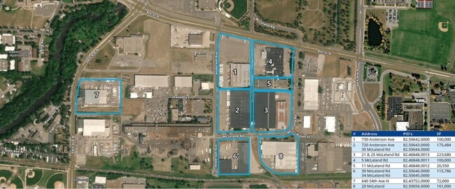
Nearby Properties
Address
Land Use
TOTAL SIZE
Lot Size
Zoning
Address
Land Use
TOTAL SIZE
Lot Size
Zoning
16.60 AC
MD
Address
Land Use
TOTAL SIZE
Lot Size
Zoning
38.97 AC
Address
Land Use
TOTAL SIZE
Lot Size
Zoning
639,000 SF
216.67 AC
PUD28
Address
Land Use
TOTAL SIZE
Lot Size
Zoning
113,316 SF
31.99 AC
Address
Land Use
TOTAL SIZE
Lot Size
Zoning
52,983 SF
22 AC
Address
Land Use
TOTAL SIZE
Lot Size
Zoning
157,266 SF
0.94 AC
R2
Address
Land Use
TOTAL SIZE
Lot Size
Zoning
70,971 SF
11.40 AC
PUD57
Address
Land Use
TOTAL SIZE
Lot Size
Zoning
30,096 SF
8.47 AC
Address
Land Use
TOTAL SIZE
Lot Size
Zoning
19.06 AC
Address
Land Use
TOTAL SIZE
Lot Size
Zoning
365,299 SF
28.68 AC
R1
Address
Land Use
TOTAL SIZE
Lot Size
Zoning
125,278 SF
11.01 AC
C5
Address
Land Use
TOTAL SIZE
Lot Size
Zoning
10.46 AC
Address
Land Use
TOTAL SIZE
Lot Size
Zoning
344,031 SF
64.88 AC
PUD28
Address
Land Use
TOTAL SIZE
Lot Size
Zoning
184,285 SF
13.37 AC
Address
Land Use
TOTAL SIZE
Lot Size
Zoning
628,000 SF
40.51 AC
PUD16
Address
Land Use
TOTAL SIZE
Lot Size
Zoning
115,298 SF
8.50 AC
R5
Address
Land Use
TOTAL SIZE
Lot Size
Zoning
5.34 AC
Address
Land Use
TOTAL SIZE
Lot Size
Zoning
233,354 SF
7.30 AC
R5
Address
Land Use
TOTAL SIZE
Lot Size
Zoning
113,268 SF
12 AC
PUD32
Address
Land Use
TOTAL SIZE
Lot Size
Zoning
269,390 SF
15.77 AC
Address
Land Use
TOTAL SIZE
Lot Size
Zoning
15.78 AC
Address
Land Use
TOTAL SIZE
Lot Size
Zoning
146,285 SF
19.10 AC
Address
Land Use
TOTAL SIZE
Lot Size
Zoning
105,123 SF
36.87 AC
R1
Address
Land Use
TOTAL SIZE
Lot Size
Zoning
51.70 AC
PL20B2
Address
Land Use
TOTAL SIZE
Lot Size
Zoning
555,652 SF
26.04 AC
PUD16
Address
Land Use
TOTAL SIZE
Lot Size
Zoning
25,608 SF
6.96 AC
R5
Address
Land Use
TOTAL SIZE
Lot Size
Zoning
36,393 SF
6.28 AC
Address
Land Use
TOTAL SIZE
Lot Size
Zoning
83,317 SF
6.43 AC
C5
Address
Land Use
TOTAL SIZE
Lot Size
Zoning
289,470 SF
23 AC
I3
Address
Land Use
TOTAL SIZE
Lot Size
Zoning
44,223 SF
12.31 AC
The World's #1 Commercial Real Estate Marketplace
Connect with us
© 2026 CoStar Group
The information above has been obtained from sources believed reliable. While we do not doubt its accuracy we have not verified it and make no guarantee, warranty or representation about it. It is your responsibility to independently confirm its accuracy and completeness. Any projections, opinions, assumptions, or estimates used are for example only and do not represent the current or future performance of the property. The value of this transaction to you depends on tax and other factors which should be evaluated by your tax, financial, and legal advisors. You and your advisors should conduct a careful, independent investigation of the property to determine to your satisfaction the suitability of the property for your needs.