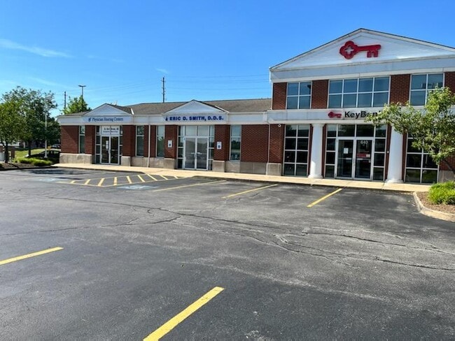
Property Record
640 E Aurora Rd, Macedonia, OH 44056


Property Detail
640 E Aurora Rd
Akron, OH
MACEDONIA COMMONS SUBDN OUTLOT A LESS PT FOR RTE 82
33-10538
Summit
Financialbuilding
Ohio
B and X Area of moderate flood hazard, usually the area between the limits of the 100-year and 500-year floods.
a
2023
0.78 AC
2025
Akron
532701
Cleveland
5,915 SF
NEARBY LISTINGS FOR SALE OR LEASE
DEMOGRAPHICS near 640 E Aurora Rd
1 mile
3 mile
5 mile
2024 Total Population
3,803
35,110
68,872
2029 Population
3,767
34,807
68,419
Pop Growth 2024-2029
(0.95%)
(0.86%)
(0.66%)
Average Age
46
45
44
2024 Total Households
1,596
14,635
27,871
HH Growth 2024-2029
(0.94%)
(0.90%)
(0.69%)
Median Household Inc
$103,451
$102,476
$102,653
Avg Household Size
2.40
2.40
2.40
2024 Avg HH Vehicles
2.00
2.00
2.00
Median Home Value
$300,444
$280,879
$303,202
Median Year Built
1990
1983
1983
Nearby Places
Map Layers
Map Styles
 Street
 Aerial
Transit
 Traffic
 Biking
Places
Listings with unknown addresses are not visible on the map
- Restaurants
- Banks
- Shops
- Fitness
- Groceries
PUBLIC TRANSPORTATION
COMMUTER RAIL
Drive
Walk
Distance
12 min
4.6 mi
Drive
Walk
Distance
15 min
7.3 mi
AIRPORT
Cleveland-Hopkins International
Drive
Walk
Distance
Cleveland-Hopkins International
40 min
26.9 mi
Akron-Canton Regional
Drive
Walk
Distance
Akron-Canton Regional
41 min
30.5 mi
SALE & LEASE HISTORY
LISTING DATE
SALE/LEASE

Sep 25, 2016
For Lease
Oct 06, 2022
For Lease
Nearby Properties
Address
Land Use
TOTAL SIZE
Lot Size
Zoning
Address
Land Use
TOTAL SIZE
Lot Size
Zoning
Address
Land Use
TOTAL SIZE
Lot Size
Zoning
49.31 AC
Address
Land Use
TOTAL SIZE
Lot Size
Zoning
315,935 SF
44.94 AC
Address
Land Use
TOTAL SIZE
Lot Size
Zoning
Address
Land Use
TOTAL SIZE
Lot Size
Zoning
270,968 SF
21.68 AC
Address
Land Use
TOTAL SIZE
Lot Size
Zoning
109.65 AC
MUD
Address
Land Use
TOTAL SIZE
Lot Size
Zoning
230,501 SF
39.59 AC
Address
Land Use
TOTAL SIZE
Lot Size
Zoning
155,897 SF
19.81 AC
Address
Land Use
TOTAL SIZE
Lot Size
Zoning
32,400 SF
89.36 AC
IG
Address
Land Use
TOTAL SIZE
Lot Size
Zoning
254,828 SF
15.41 AC
Address
Land Use
TOTAL SIZE
Lot Size
Zoning
418,992 SF
27.87 AC
Address
Land Use
TOTAL SIZE
Lot Size
Zoning
210,136 SF
21.69 AC
Address
Land Use
TOTAL SIZE
Lot Size
Zoning
247,000 SF
18.44 AC
IG
Address
Land Use
TOTAL SIZE
Lot Size
Zoning
Address
Land Use
TOTAL SIZE
Lot Size
Zoning
130,822 SF
17.50 AC
Address
Land Use
TOTAL SIZE
Lot Size
Zoning
320,818 SF
12 AC
Address
Land Use
TOTAL SIZE
Lot Size
Zoning
105,438 SF
9.59 AC
Address
Land Use
TOTAL SIZE
Lot Size
Zoning
60,908 SF
46.85 AC
Address
Land Use
TOTAL SIZE
Lot Size
Zoning
204,490 SF
14.52 AC
Address
Land Use
TOTAL SIZE
Lot Size
Zoning
99,400 SF
3.96 AC
Address
Land Use
TOTAL SIZE
Lot Size
Zoning
85,808 SF
10.20 AC
Address
Land Use
TOTAL SIZE
Lot Size
Zoning
Address
Land Use
TOTAL SIZE
Lot Size
Zoning
Address
Land Use
TOTAL SIZE
Lot Size
Zoning
211,548 SF
14.01 AC
Address
Land Use
TOTAL SIZE
Lot Size
Zoning
14,247 SF
262 AC
Address
Land Use
TOTAL SIZE
Lot Size
Zoning
Address
Land Use
TOTAL SIZE
Lot Size
Zoning
227,086 SF
16.65 AC
IG
Address
Land Use
TOTAL SIZE
Lot Size
Zoning
Address
Land Use
TOTAL SIZE
Lot Size
Zoning
113,882 SF
24.09 AC
Address
Land Use
TOTAL SIZE
Lot Size
Zoning
141,290 SF
11.53 AC
The World's #1 Commercial Real Estate Marketplace
Connect with us
© 2026 CoStar Group
The information above has been obtained from sources believed reliable. While we do not doubt its accuracy we have not verified it and make no guarantee, warranty or representation about it. It is your responsibility to independently confirm its accuracy and completeness. Any projections, opinions, assumptions, or estimates used are for example only and do not represent the current or future performance of the property. The value of this transaction to you depends on tax and other factors which should be evaluated by your tax, financial, and legal advisors. You and your advisors should conduct a careful, independent investigation of the property to determine to your satisfaction the suitability of the property for your needs.