Property Record
6400 Stewart Ave, Las Vegas, NV 89110
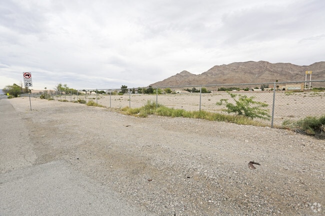


This Property Is For Sale
NEARBY LISTINGS FOR SALE OR LEASE
Property Detail
6400 Stewart Ave
140-34-601-010
PT SW4 NE4 SEC 34 20 62
Vacantlandnec
Clark
X
Nevada
32003C2195F
9.16 AC
2024
North Las Vegas
2025
Las Vegas
004907
Las Vegas-Henderson-North Las Vegas, NV
DEMOGRAPHICS near 6400 Stewart Ave
1 Mile
3 Mile
5 Mile
2024 Total Population
19,510
153,868
332,749
2029 Population
20,762
164,163
355,531
Pop Growth 2024-2029
+ 6.42%
+ 6.69%
+ 6.85%
Average Age
38
36
37
2024 Total Households
5,730
48,748
110,000
HH Growth 2024-2029
+ 6.35%
+ 6.69%
+ 6.82%
Median Household Inc
$70,167
$48,916
$43,768
Avg Household Size
3.30
3.10
2.90
2024 Avg HH Vehicles
2.00
2.00
2.00
Median Home Value
$339,275
$263,354
$244,454
Median Year Built
1993
1991
1986
Nearby Places
Map Layers
Map Styles
 Street
 Aerial
- Restaurants
- Banks
- Shops
- Fitness
- Groceries
PUBLIC TRANSPORTATION
AIRPORT
Harry Reid International
DRIVE
WALK
Distance
Harry Reid International
22 min
13.1 mi
Boulder City Municipal
DRIVE
WALK
Distance
Boulder City Municipal
37 min
26.6 mi
Freight Ports
Port of Long Beach
DRIVE
WALK
Distance
Port of Long Beach
327 min
291.4 mi
Nearby Properties
Address
Land Use
TOTAL SIZE
Lot Size
Zoning
Address
Land Use
TOTAL SIZE
Lot Size
Zoning
3,356 SF
336.99 AC
RE
Address
Land Use
TOTAL SIZE
Lot Size
Zoning
90.41 AC
Address
Land Use
TOTAL SIZE
Lot Size
Zoning
35.95 AC
PF
Address
Land Use
TOTAL SIZE
Lot Size
Zoning
137.65 AC
Address
Land Use
TOTAL SIZE
Lot Size
Zoning
43.25 AC
PF
Address
Land Use
TOTAL SIZE
Lot Size
Zoning
20.91 AC
PF
Address
Land Use
TOTAL SIZE
Lot Size
Zoning
9.37 AC
RE
Address
Land Use
TOTAL SIZE
Lot Size
Zoning
1,008 SF
31.47 AC
PF
Address
Land Use
TOTAL SIZE
Lot Size
Zoning
4.34 AC
RE
Address
Land Use
TOTAL SIZE
Lot Size
Zoning
19.30 AC
RE
Address
Land Use
TOTAL SIZE
Lot Size
Zoning
7,908 SF
24.13 AC
R4
Address
Land Use
TOTAL SIZE
Lot Size
Zoning
223,422 SF
18.21 AC
R3
Address
Land Use
TOTAL SIZE
Lot Size
Zoning
9,044 SF
8.62 AC
Address
Land Use
TOTAL SIZE
Lot Size
Zoning
3,183 SF
18.35 AC
R3
Address
Land Use
TOTAL SIZE
Lot Size
Zoning
3,424 SF
14.53 AC
R3
Address
Land Use
TOTAL SIZE
Lot Size
Zoning
9.11 AC
PF
Address
Land Use
TOTAL SIZE
Lot Size
Zoning
11.81 AC
RE
Address
Land Use
TOTAL SIZE
Lot Size
Zoning
4,236 SF
0.61 AC
R4
Address
Land Use
TOTAL SIZE
Lot Size
Zoning
5,425 SF
14.38 AC
C:R-4
Address
Land Use
TOTAL SIZE
Lot Size
Zoning
13.84 AC
PF
Address
Land Use
TOTAL SIZE
Lot Size
Zoning
3,886 SF
14.26 AC
R4
Address
Land Use
TOTAL SIZE
Lot Size
Zoning
133,481 SF
6.17 AC
MD
Address
Land Use
TOTAL SIZE
Lot Size
Zoning
216,643 SF
17.62 AC
C1
Address
Land Use
TOTAL SIZE
Lot Size
Zoning
3,632 SF
12.64 AC
RPD18
Address
Land Use
TOTAL SIZE
Lot Size
Zoning
20 AC
PF
Address
Land Use
TOTAL SIZE
Lot Size
Zoning
33,009 SF
16.84 AC
PF
Address
Land Use
TOTAL SIZE
Lot Size
Zoning
3,260 SF
0.04 AC
Address
Land Use
TOTAL SIZE
Lot Size
Zoning
5,478 SF
8.87 AC
R4
Address
Land Use
TOTAL SIZE
Lot Size
Zoning
36.52 AC
PF
Address
Land Use
TOTAL SIZE
Lot Size
Zoning
2,304 SF
12.36 AC
RPD16
The World's #1 Commercial Real Estate Marketplace
Connect with us
© 2026 CoStar Group
The information above has been obtained from sources believed reliable. While we do not doubt its accuracy we have not verified it and make no guarantee, warranty or representation about it. It is your responsibility to independently confirm its accuracy and completeness. Any projections, opinions, assumptions, or estimates used are for example only and do not represent the current or future performance of the property. The value of this transaction to you depends on tax and other factors which should be evaluated by your tax, financial, and legal advisors. You and your advisors should conduct a careful, independent investigation of the property to determine to your satisfaction the suitability of the property for your needs.