Property Record
6401 No Address Rd, San Ramon, CA 94583
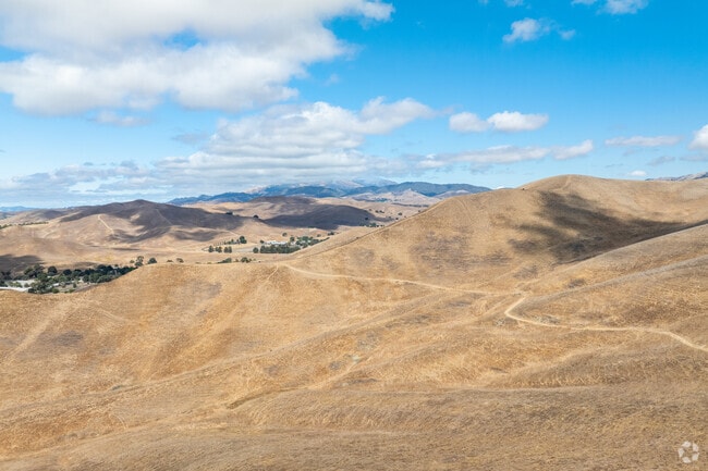

This Property Is For Sale
NEARBY LISTINGS FOR SALE OR LEASE
Property Detail
6401 No Address Rd
205-060-009-3
PCL MAP 127 PG 32 PCL D
Agriculturalland
Contra Costa
X
California
06001C0326G
287.32 AC
2025
San Ramon
2025
East Bay/Oakland
345111
Oakland-Fremont-Berkeley, CA
DEMOGRAPHICS near 6401 No Address Rd
1 mile
3 mile
5 mile
2024 Total Population
2,285
55,475
171,720
2029 Population
2,246
54,221
167,692
Pop Growth 2024-2029
(1.71%)
(2.26%)
(2.35%)
Average Age
36
37
39
2024 Total Households
674
16,378
56,400
HH Growth 2024-2029
(1.93%)
(2.55%)
(2.63%)
Median Household Inc
$269,884
$236,817
$196,809
Avg Household Size
3.40
3.30
2.90
2024 Avg HH Vehicles
2.00
2.00
2.00
Median Home Value
$1,134,151
$1,127,221
$1,114,308
Median Year Built
2010
2007
1998
Nearby Places
Map Layers
Map Styles
 Street
 Aerial
Transit
 Traffic
 Biking
Places
Listings with unknown addresses are not visible on the map
- Restaurants
- Banks
- Shops
- Fitness
- Groceries
PUBLIC TRANSPORTATION
AIRPORT
Metro Oakland International
Drive
Walk
Distance
Metro Oakland International
40 min
26.5 mi
Norman Y Mineta San Jose International
Drive
Walk
Distance
Norman Y Mineta San Jose International
54 min
37.4 mi
San Francisco International
Drive
Walk
Distance
San Francisco International
60 min
41.1 mi
Freight Ports
Port of Oakland
Drive
Walk
Distance
Port of Oakland
44 min
31.1 mi
Nearby Properties
Address
Land Use
TOTAL SIZE
Lot Size
Zoning
Address
Land Use
TOTAL SIZE
Lot Size
Zoning
54.05 AC
Address
Land Use
TOTAL SIZE
Lot Size
Zoning
381,060 SF
13.59 AC
Address
Land Use
TOTAL SIZE
Lot Size
Zoning
280,224 SF
11.76 AC
Address
Land Use
TOTAL SIZE
Lot Size
Zoning
237,894 SF
9.08 AC
Address
Land Use
TOTAL SIZE
Lot Size
Zoning
287,046 SF
11.90 AC
Address
Land Use
TOTAL SIZE
Lot Size
Zoning
Address
Land Use
TOTAL SIZE
Lot Size
Zoning
11.02 AC
Address
Land Use
TOTAL SIZE
Lot Size
Zoning
Address
Land Use
TOTAL SIZE
Lot Size
Zoning
Address
Land Use
TOTAL SIZE
Lot Size
Zoning
10.44 AC
Address
Land Use
TOTAL SIZE
Lot Size
Zoning
29,291 SF
20 AC
A80
Address
Land Use
TOTAL SIZE
Lot Size
Zoning
2,011 SF
233.20 AC
A80
Address
Land Use
TOTAL SIZE
Lot Size
Zoning
14,869 SF
2.09 AC
Address
Land Use
TOTAL SIZE
Lot Size
Zoning
12,879 SF
1 AC
Address
Land Use
TOTAL SIZE
Lot Size
Zoning
126.31 AC
A80
Address
Land Use
TOTAL SIZE
Lot Size
Zoning
10,454 SF
1.18 AC
Address
Land Use
TOTAL SIZE
Lot Size
Zoning
6,112 SF
0.40 AC
Address
Land Use
TOTAL SIZE
Lot Size
Zoning
6,308 SF
6.16 AC
A2
Address
Land Use
TOTAL SIZE
Lot Size
Zoning
2.57 AC
Address
Land Use
TOTAL SIZE
Lot Size
Zoning
4,862 SF
0.69 AC
Address
Land Use
TOTAL SIZE
Lot Size
Zoning
7,520 SF
1.08 AC
Address
Land Use
TOTAL SIZE
Lot Size
Zoning
1.68 AC
Address
Land Use
TOTAL SIZE
Lot Size
Zoning
5,806 SF
0.47 AC
Address
Land Use
TOTAL SIZE
Lot Size
Zoning
5,282 SF
5.37 AC
A2
Address
Land Use
TOTAL SIZE
Lot Size
Zoning
4,862 SF
0.51 AC
Address
Land Use
TOTAL SIZE
Lot Size
Zoning
1,538 SF
297.49 AC
A80
Address
Land Use
TOTAL SIZE
Lot Size
Zoning
4,862 SF
0.49 AC
Address
Land Use
TOTAL SIZE
Lot Size
Zoning
6,112 SF
0.48 AC
Address
Land Use
TOTAL SIZE
Lot Size
Zoning
3,350 SF
29.67 AC
A20
Address
Land Use
TOTAL SIZE
Lot Size
Zoning
4,741 SF
0.72 AC
The World's #1 Commercial Real Estate Marketplace
Connect with us
© 2026 CoStar Group
The information above has been obtained from sources believed reliable. While we do not doubt its accuracy we have not verified it and make no guarantee, warranty or representation about it. It is your responsibility to independently confirm its accuracy and completeness. Any projections, opinions, assumptions, or estimates used are for example only and do not represent the current or future performance of the property. The value of this transaction to you depends on tax and other factors which should be evaluated by your tax, financial, and legal advisors. You and your advisors should conduct a careful, independent investigation of the property to determine to your satisfaction the suitability of the property for your needs.