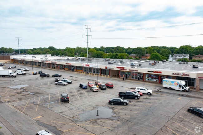
Property Record
6406 N 76Th St, Milwaukee, WI 53223


NEARBY LISTINGS FOR SALE OR LEASE
Property Detail
6406 N 76Th St
Milwaukee-Waukesha-West Allis, WI
Cert Surv Map 7577
141-0813-000-9
CERTIFIED SURVEY MAP NO 7577 IN SW 1/4 SEC 22-8-21 PARCEL 1 BID #31
Regionalshoppingcenterormallwithanchorstore
Milwaukee
A
Wisconsin
55089C0245G
1
2024
7.96 AC
2024
Milwaukee NW
000600
Milwaukee/Madison
102,401 SF
DEMOGRAPHICS near 6406 N 76Th St
1 Mile
3 Mile
5 Mile
2024 Total Population
13,501
112,782
257,502
2029 Population
13,225
110,687
253,444
Pop Growth 2024-2029
(2.04%)
(1.86%)
(1.58%)
Average Age
35
36
38
2024 Total Households
4,658
42,824
103,274
HH Growth 2024-2029
(2.19%)
(1.93%)
(1.66%)
Median Household Inc
$46,637
$48,180
$50,872
Avg Household Size
2.80
2.50
2.40
2024 Avg HH Vehicles
1.00
1.00
1.00
Median Home Value
$137,348
$139,121
$166,523
Median Year Built
1958
1959
1957
Nearby Places
Map Layers
Map Styles
 Street
 Aerial
- Restaurants
- Banks
- Shops
- Fitness
- Groceries
PUBLIC TRANSPORTATION
AIRPORT
General Mitchell International
DRIVE
WALK
Distance
General Mitchell International
34 min
17.3 mi
Freight Ports
Port Milwaukee
DRIVE
WALK
Distance
Port Milwaukee
27 min
13.1 mi
SALE & LEASE HISTORY
LISTING DATE
SALE/LEASE

Sep 24, 2016
For Lease
Oct 27, 2017
For Sale
Nearby Properties
Address
Land Use
TOTAL SIZE
Lot Size
Zoning
Address
Land Use
TOTAL SIZE
Lot Size
Zoning
33.49 AC
TL
Address
Land Use
TOTAL SIZE
Lot Size
Zoning
145,218 SF
10.23 AC
Address
Land Use
TOTAL SIZE
Lot Size
Zoning
197,426 SF
26.34 AC
PD
Address
Land Use
TOTAL SIZE
Lot Size
Zoning
206,529 SF
7.88 AC
PD
Address
Land Use
TOTAL SIZE
Lot Size
Zoning
298,666 SF
5.09 AC
PD
Address
Land Use
TOTAL SIZE
Lot Size
Zoning
326,619 SF
30.69 AC
PD
Address
Land Use
TOTAL SIZE
Lot Size
Zoning
12.49 AC
TL
Address
Land Use
TOTAL SIZE
Lot Size
Zoning
104,365 SF
9.85 AC
PD
Address
Land Use
TOTAL SIZE
Lot Size
Zoning
66.42 AC
IL1
Address
Land Use
TOTAL SIZE
Lot Size
Zoning
18.54 AC
RS6
Address
Land Use
TOTAL SIZE
Lot Size
Zoning
17.91 AC
RS5
Address
Land Use
TOTAL SIZE
Lot Size
Zoning
297,894 SF
19.67 AC
IL1
Address
Land Use
TOTAL SIZE
Lot Size
Zoning
238,129 SF
54.57 AC
PD
Address
Land Use
TOTAL SIZE
Lot Size
Zoning
333,971 SF
16.93 AC
IL1
Address
Land Use
TOTAL SIZE
Lot Size
Zoning
166,245 SF
55 AC
PD
Address
Land Use
TOTAL SIZE
Lot Size
Zoning
28.12 AC
RM1
Address
Land Use
TOTAL SIZE
Lot Size
Zoning
116,862 SF
14.39 AC
RM1
Address
Land Use
TOTAL SIZE
Lot Size
Zoning
23.38 AC
RS6
Address
Land Use
TOTAL SIZE
Lot Size
Zoning
13.08 AC
Address
Land Use
TOTAL SIZE
Lot Size
Zoning
163,539 SF
7.17 AC
PUD
Address
Land Use
TOTAL SIZE
Lot Size
Zoning
49.03 AC
PK
Address
Land Use
TOTAL SIZE
Lot Size
Zoning
88,259 SF
14.70 AC
PD
Address
Land Use
TOTAL SIZE
Lot Size
Zoning
9.94 AC
IL1
Address
Land Use
TOTAL SIZE
Lot Size
Zoning
92,303 SF
19.02 AC
PD
Address
Land Use
TOTAL SIZE
Lot Size
Zoning
118,520 SF
7.69 AC
RM1
Address
Land Use
TOTAL SIZE
Lot Size
Zoning
73,748 SF
5.76 AC
PD
Address
Land Use
TOTAL SIZE
Lot Size
Zoning
7.84 AC
Address
Land Use
TOTAL SIZE
Lot Size
Zoning
157,000 SF
17.15 AC
PD
Address
Land Use
TOTAL SIZE
Lot Size
Zoning
75,221 SF
7.46 AC
RM1
Address
Land Use
TOTAL SIZE
Lot Size
Zoning
344,223 SF
26.39 AC
IL1
The World's #1 Commercial Real Estate Marketplace
Connect with us
© 2026 CoStar Group
The information above has been obtained from sources believed reliable. While we do not doubt its accuracy we have not verified it and make no guarantee, warranty or representation about it. It is your responsibility to independently confirm its accuracy and completeness. Any projections, opinions, assumptions, or estimates used are for example only and do not represent the current or future performance of the property. The value of this transaction to you depends on tax and other factors which should be evaluated by your tax, financial, and legal advisors. You and your advisors should conduct a careful, independent investigation of the property to determine to your satisfaction the suitability of the property for your needs.