Property Record
6407 Sw Crain Hwy, Upper Marlboro, MD 20772


NEARBY LISTINGS FOR SALE OR LEASE
-
-
View all Upper Marlboro listings for lease on LoopNet.com
Property Detail
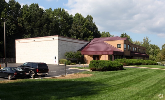
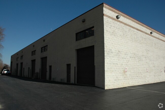
6407 Sw Crain Hwy
Washington-Arlington-Alexandria, DC-VA-MD-WV
Queensland Office Park
03-3349008
PTA 1175-09
Officebuilding
Prince George's
X
Maryland
24033C0270E
1
2024
2.85 AC
2025
Greater Upper Marlboro
800707
Washington, DC
20,150 SF
DEMOGRAPHICS near 6407 Sw Crain Hwy
1 Mile
3 Mile
5 Mile
2024 Total Population
645
21,209
58,330
2029 Population
632
20,773
57,217
Pop Growth 2024-2029
(2.02%)
(2.06%)
(1.91%)
Average Age
44
40
41
2024 Total Households
256
8,120
21,118
HH Growth 2024-2029
(1.95%)
(2.17%)
(1.99%)
Median Household Inc
$98,097
$116,976
$129,458
Avg Household Size
2.50
2.50
2.70
2024 Avg HH Vehicles
2.00
2.00
2.00
Median Home Value
$471,999
$363,343
$418,961
Median Year Built
1985
1992
1994
Nearby Places
Map Layers
Map Styles
 Street
 Aerial
- Restaurants
- Banks
- Shops
- Fitness
- Groceries
PUBLIC TRANSPORTATION
AIRPORT
Ronald Reagan Washington Ntl
DRIVE
WALK
Distance
Ronald Reagan Washington Ntl
38 min
21.5 mi
Baltimore/Washington International Thurgood Marshall
DRIVE
WALK
Distance
Baltimore/Washington International Thurgood Marshall
49 min
33.0 mi
Freight Ports
Port of Baltimore
DRIVE
WALK
Distance
Port of Baltimore
57 min
38.6 mi
SALE & LEASE HISTORY
LISTING DATE
SALE/LEASE

Sep 28, 2018
For Lease
Mar 30, 2022
For Lease
Dec 28, 2016
For Lease
Aug 19, 2019
For Lease
Nearby Properties
Address
Land Use
TOTAL SIZE
Lot Size
Zoning
Address
Land Use
TOTAL SIZE
Lot Size
Zoning
643,009 SF
2.15 AC
CGO
Address
Land Use
TOTAL SIZE
Lot Size
Zoning
28.85 AC
RR
Address
Land Use
TOTAL SIZE
Lot Size
Zoning
219.84 AC
ROS
Address
Land Use
TOTAL SIZE
Lot Size
Zoning
54.63 AC
RE
Address
Land Use
TOTAL SIZE
Lot Size
Zoning
6.65 AC
LCD
Address
Land Use
TOTAL SIZE
Lot Size
Zoning
135,099 SF
147.75 AC
AR
Address
Land Use
TOTAL SIZE
Lot Size
Zoning
147,395 SF
8.28 AC
LCD
Address
Land Use
TOTAL SIZE
Lot Size
Zoning
190,603 SF
16.08 AC
RMF20
Address
Land Use
TOTAL SIZE
Lot Size
Zoning
117,395 SF
12.84 AC
IE
Address
Land Use
TOTAL SIZE
Lot Size
Zoning
55,450 SF
7.76 AC
CGO
Address
Land Use
TOTAL SIZE
Lot Size
Zoning
2,538 SF
36.50 AC
C3
Address
Land Use
TOTAL SIZE
Lot Size
Zoning
113,997 SF
15.72 AC
IE
Address
Land Use
TOTAL SIZE
Lot Size
Zoning
88,689 SF
12.71 AC
LCD
Address
Land Use
TOTAL SIZE
Lot Size
Zoning
132,574 SF
25 AC
AR
Address
Land Use
TOTAL SIZE
Lot Size
Zoning
68,096 SF
10.54 AC
CGO
Address
Land Use
TOTAL SIZE
Lot Size
Zoning
109,507 SF
10.21 AC
RSF95
Address
Land Use
TOTAL SIZE
Lot Size
Zoning
284,580 SF
4.77 AC
CGO
Address
Land Use
TOTAL SIZE
Lot Size
Zoning
48,247 SF
26.15 AC
AR
Address
Land Use
TOTAL SIZE
Lot Size
Zoning
62,250 SF
8.36 AC
IE
Address
Land Use
TOTAL SIZE
Lot Size
Zoning
106,182 SF
7.07 AC
RMF20
Address
Land Use
TOTAL SIZE
Lot Size
Zoning
343,409 SF
0.43 AC
CGO
Address
Land Use
TOTAL SIZE
Lot Size
Zoning
201,975 SF
3.09 AC
CGO
Address
Land Use
TOTAL SIZE
Lot Size
Zoning
69,527 SF
4.95 AC
IE
Address
Land Use
TOTAL SIZE
Lot Size
Zoning
80,939 SF
13.50 AC
C4
Address
Land Use
TOTAL SIZE
Lot Size
Zoning
55,600 SF
8.87 AC
CGO
Address
Land Use
TOTAL SIZE
Lot Size
Zoning
29,206 SF
4.57 AC
CGO
Address
Land Use
TOTAL SIZE
Lot Size
Zoning
1,624 SF
4.26 AC
RMF48
Address
Land Use
TOTAL SIZE
Lot Size
Zoning
55,547 SF
10 AC
RR
Address
Land Use
TOTAL SIZE
Lot Size
Zoning
77,751 SF
27.24 AC
IE
Address
Land Use
TOTAL SIZE
Lot Size
Zoning
53,958 SF
10.40 AC
RR
The World's #1 Commercial Real Estate Marketplace
Connect with us
© 2025 CoStar Group
The information above has been obtained from sources believed reliable. While we do not doubt its accuracy we have not verified it and make no guarantee, warranty or representation about it. It is your responsibility to independently confirm its accuracy and completeness. Any projections, opinions, assumptions, or estimates used are for example only and do not represent the current or future performance of the property. The value of this transaction to you depends on tax and other factors which should be evaluated by your tax, financial, and legal advisors. You and your advisors should conduct a careful, independent investigation of the property to determine to your satisfaction the suitability of the property for your needs.