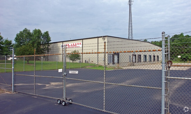
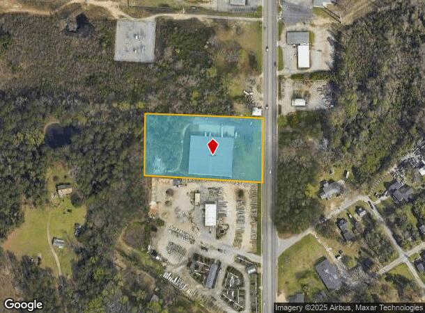
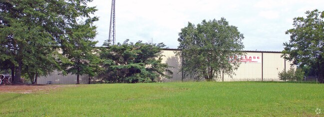
Property Record
6407 Fairfield Rd, Columbia, SC 29203
NEARBY LISTINGS FOR SALE OR LEASE
Property Detail
6407 Fairfield Rd
11806-01-06
299.6X512.4X289.9X523.1
Commercialnec
Richland
X
South Carolina
45079C0234L
3.50 AC
2025
North Columbia
2024
Columbia
010701
Columbia, SC
35,000 SF
DEMOGRAPHICS near 6407 Fairfield Rd
1 Mile
3 Mile
5 Mile
2024 Total Population
3,163
35,274
109,803
2029 Population
3,255
36,039
111,772
Pop Growth 2024-2029
+ 2.91%
+ 2.17%
+ 1.79%
Average Age
41
40
39
2024 Total Households
1,315
14,937
47,211
HH Growth 2024-2029
+ 2.97%
+ 2.23%
+ 1.89%
Median Household Inc
$33,119
$33,404
$41,613
Avg Household Size
2.30
2.30
2.10
2024 Avg HH Vehicles
2.00
1.00
1.00
Median Home Value
$82,722
$103,258
$167,672
Median Year Built
1966
1966
1970
Nearby Places
Map Layers
Map Styles
 Street
 Aerial
- Restaurants
- Banks
- Shops
- Fitness
- Groceries
PUBLIC TRANSPORTATION
COMMUTER RAIL
DRIVE
WALK
Distance
14 min
6.3 mi
AIRPORT
Columbia Metro
DRIVE
WALK
Distance
Columbia Metro
29 min
16.6 mi
Nearby Properties
Address
Land Use
TOTAL SIZE
Lot Size
Zoning
Address
Land Use
TOTAL SIZE
Lot Size
Zoning
20,434 SF
17.20 AC
C-1
Address
Land Use
TOTAL SIZE
Lot Size
Zoning
2,456 SF
5 AC
C-1
Address
Land Use
TOTAL SIZE
Lot Size
Zoning
23,379 SF
3.76 AC
M-1
Address
Land Use
TOTAL SIZE
Lot Size
Zoning
1,199.74 AC
OI
Address
Land Use
TOTAL SIZE
Lot Size
Zoning
124,272 SF
7.06 AC
RM-HD
Address
Land Use
TOTAL SIZE
Lot Size
Zoning
63,842 SF
3.52 AC
C-3
Address
Land Use
TOTAL SIZE
Lot Size
Zoning
4,986 SF
5.74 AC
PUD-C
Address
Land Use
TOTAL SIZE
Lot Size
Zoning
134,400 SF
5.85 AC
RG-2
Address
Land Use
TOTAL SIZE
Lot Size
Zoning
199,962 SF
40.13 AC
RG-1
Address
Land Use
TOTAL SIZE
Lot Size
Zoning
96,248 SF
5.97 AC
RM-2
Address
Land Use
TOTAL SIZE
Lot Size
Zoning
8,032 SF
3.20 AC
C-1
Address
Land Use
TOTAL SIZE
Lot Size
Zoning
194,212 SF
15.10 AC
RG-2
Address
Land Use
TOTAL SIZE
Lot Size
Zoning
107,302 SF
16.77 AC
EC
Address
Land Use
TOTAL SIZE
Lot Size
Zoning
58,094 SF
4.43 AC
M-1
Address
Land Use
TOTAL SIZE
Lot Size
Zoning
183,690 SF
16.17 AC
RG-2
Address
Land Use
TOTAL SIZE
Lot Size
Zoning
70,275 SF
9.65 AC
C-3
Address
Land Use
TOTAL SIZE
Lot Size
Zoning
83,296 SF
5.33 AC
RS-3
Address
Land Use
TOTAL SIZE
Lot Size
Zoning
82,852 SF
4.46 AC
C-3
Address
Land Use
TOTAL SIZE
Lot Size
Zoning
50,027 SF
3.44 AC
C-3
Address
Land Use
TOTAL SIZE
Lot Size
Zoning
2,244 SF
8.15 AC
GC
Address
Land Use
TOTAL SIZE
Lot Size
Zoning
31,218 SF
2.89 AC
RS-3
Address
Land Use
TOTAL SIZE
Lot Size
Zoning
62,130 SF
5.04 AC
RG-1
Address
Land Use
TOTAL SIZE
Lot Size
Zoning
21,743 SF
4.60 AC
RG-1
Address
Land Use
TOTAL SIZE
Lot Size
Zoning
190,561 SF
12.58 AC
RM-HD
Address
Land Use
TOTAL SIZE
Lot Size
Zoning
8,680 SF
5.65 AC
GC
Address
Land Use
TOTAL SIZE
Lot Size
Zoning
71,832 SF
4.54 AC
RG-2
Address
Land Use
TOTAL SIZE
Lot Size
Zoning
26,839 SF
2.07 AC
RS-1
Address
Land Use
TOTAL SIZE
Lot Size
Zoning
33,072 SF
0.67 AC
MU-2
Address
Land Use
TOTAL SIZE
Lot Size
Zoning
99,554 SF
13.60 AC
M-1
Address
Land Use
TOTAL SIZE
Lot Size
Zoning
13,216 SF
10.45 AC
C-3
The World's #1 Commercial Real Estate Marketplace
Connect with us
© 2026 CoStar Group
The information above has been obtained from sources believed reliable. While we do not doubt its accuracy we have not verified it and make no guarantee, warranty or representation about it. It is your responsibility to independently confirm its accuracy and completeness. Any projections, opinions, assumptions, or estimates used are for example only and do not represent the current or future performance of the property. The value of this transaction to you depends on tax and other factors which should be evaluated by your tax, financial, and legal advisors. You and your advisors should conduct a careful, independent investigation of the property to determine to your satisfaction the suitability of the property for your needs.