Property Record
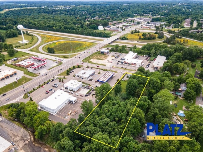
6407 S Raccoon Rd, Canfield, OH 44406


NEARBY LISTINGS FOR SALE OR LEASE
Property Detail
6407 S Raccoon Rd
Youngstown-Warren-Boardman, OH-PA
GL 48 DIV 2
26-071-0-012.00-0
Mahoning
Recreationalacreage
Ohio
2024
2 AC
2024
Mahoning County
812101
Youngstown/Warren/Boardman
1,630 SF
DEMOGRAPHICS near 6407 S Raccoon Rd
1 Mile
3 Mile
5 Mile
2024 Total Population
3,161
26,210
86,450
2029 Population
3,084
25,480
84,457
Pop Growth 2024-2029
(2.44%)
(2.79%)
(2.31%)
Average Age
46
44
43
2024 Total Households
1,499
11,428
38,390
HH Growth 2024-2029
(2.47%)
(2.83%)
(2.41%)
Median Household Inc
$82,083
$75,320
$58,986
Avg Household Size
2.10
2.30
2.20
2024 Avg HH Vehicles
2.00
2.00
2.00
Median Home Value
$243,080
$216,577
$155,542
Median Year Built
1981
1975
1966
Nearby Places
Map Layers
Map Styles
 Street
 Aerial
- Restaurants
- Banks
- Shops
- Fitness
- Groceries
SALE & LEASE HISTORY
LISTING DATE
SALE/LEASE

Jul 12, 2021
For Sale
Nearby Properties
Address
Land Use
TOTAL SIZE
Lot Size
Zoning
Address
Land Use
TOTAL SIZE
Lot Size
Zoning
326,658 SF
78.41 AC
S
Address
Land Use
TOTAL SIZE
Lot Size
Zoning
Address
Land Use
TOTAL SIZE
Lot Size
Zoning
161,184 SF
29.51 AC
S
Address
Land Use
TOTAL SIZE
Lot Size
Zoning
47,538 SF
16.14 AC
C
Address
Land Use
TOTAL SIZE
Lot Size
Zoning
213,207 SF
18.39 AC
M1
Address
Land Use
TOTAL SIZE
Lot Size
Zoning
78,660 SF
22.36 AC
R3
Address
Land Use
TOTAL SIZE
Lot Size
Zoning
100,565 SF
15.03 AC
R3
Address
Land Use
TOTAL SIZE
Lot Size
Zoning
Address
Land Use
TOTAL SIZE
Lot Size
Zoning
33,854 SF
3.36 AC
R1
Address
Land Use
TOTAL SIZE
Lot Size
Zoning
2.10 AC
Address
Land Use
TOTAL SIZE
Lot Size
Zoning
332.96 AC
A
Address
Land Use
TOTAL SIZE
Lot Size
Zoning
69,651 SF
2.82 AC
Address
Land Use
TOTAL SIZE
Lot Size
Zoning
163,207 SF
9.19 AC
S
Address
Land Use
TOTAL SIZE
Lot Size
Zoning
46,813 SF
8.40 AC
Address
Land Use
TOTAL SIZE
Lot Size
Zoning
59,999 SF
6.07 AC
B
Address
Land Use
TOTAL SIZE
Lot Size
Zoning
31,512 SF
5.25 AC
R3
Address
Land Use
TOTAL SIZE
Lot Size
Zoning
56,432 SF
8.42 AC
B3
Address
Land Use
TOTAL SIZE
Lot Size
Zoning
62,010 SF
5.02 AC
R3
Address
Land Use
TOTAL SIZE
Lot Size
Zoning
20 AC
AG
Address
Land Use
TOTAL SIZE
Lot Size
Zoning
54,832 SF
2.01 AC
R2
Address
Land Use
TOTAL SIZE
Lot Size
Zoning
58,972 SF
23.65 AC
S
Address
Land Use
TOTAL SIZE
Lot Size
Zoning
133,122 SF
39.19 AC
R1
Address
Land Use
TOTAL SIZE
Lot Size
Zoning
43,930 SF
3.07 AC
C
Address
Land Use
TOTAL SIZE
Lot Size
Zoning
25,941 SF
6.10 AC
C
Address
Land Use
TOTAL SIZE
Lot Size
Zoning
48,546 SF
1.75 AC
B
Address
Land Use
TOTAL SIZE
Lot Size
Zoning
43,236 SF
13.30 AC
S
Address
Land Use
TOTAL SIZE
Lot Size
Zoning
26,649 SF
23.60 AC
A
Address
Land Use
TOTAL SIZE
Lot Size
Zoning
19,348 SF
3.40 AC
B
Address
Land Use
TOTAL SIZE
Lot Size
Zoning
36,619 SF
76.78 AC
A
Address
Land Use
TOTAL SIZE
Lot Size
Zoning
39,684 SF
4.48 AC
B3
The World's #1 Commercial Real Estate Marketplace
Connect with us
© 2026 CoStar Group
The information above has been obtained from sources believed reliable. While we do not doubt its accuracy we have not verified it and make no guarantee, warranty or representation about it. It is your responsibility to independently confirm its accuracy and completeness. Any projections, opinions, assumptions, or estimates used are for example only and do not represent the current or future performance of the property. The value of this transaction to you depends on tax and other factors which should be evaluated by your tax, financial, and legal advisors. You and your advisors should conduct a careful, independent investigation of the property to determine to your satisfaction the suitability of the property for your needs.