Property Record
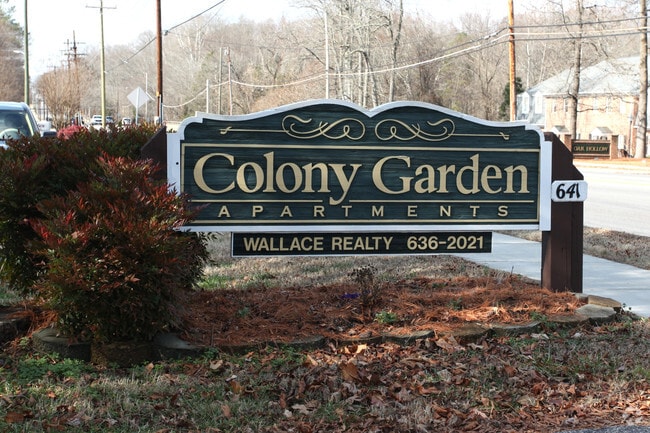
641 Statesville Blvd, Salisbury, NC 28144


Property Detail
641 Statesville Blvd
022-005
12.34AC
Commercialnec
Rowan
AE The base floodplain where base flood elevations are provided. AE Zones are now used on new format FIRMs instead of A1-A30 Zones.
North Carolina
2025
12.34 AC
2025
Outlying Rowan County
050500
Charlotte
25,160 SF
Charlotte-Concord-Gastonia, NC-SC
NEARBY LISTINGS FOR SALE OR LEASE
-
-
View all Salisbury listings for sale on LoopNet.com
DEMOGRAPHICS near 641 Statesville Blvd
1 mile
3 mile
5 mile
2025 Total Population
5,329
33,492
56,942
2030 Population
5,554
34,982
59,475
Pop Growth 2025-2030
+ 4.22%
+ 4.45%
+ 4.45%
Average Age
37
40
41
2025 Total Households
1,686
13,303
22,701
HH Growth 2025-2030
+ 5.10%
+ 4.73%
+ 4.66%
Median Household Inc
$45,088
$52,259
$58,205
Avg Household Size
2.30
2.30
2.30
2025 Avg HH Vehicles
2.00
2.00
2.00
Median Home Value
$218,151
$251,416
$257,499
Median Year Built
1970
1974
1977
Nearby Places
Map Layers
Map Styles
 Street
 Aerial
Layers
 Traffic
 Biking
Places
Listings with unknown addresses are not visible on the map
- Restaurants
- Banks
- Shops
- Fitness
- Groceries
PUBLIC TRANSPORTATION
COMMUTER RAIL
Salisbury Station (Piedmont - North Carolina by Train (NC Train))
Drive
Walk
Distance
Salisbury Station (Piedmont - North Carolina by Train (NC Train))
8 min
2.6 mi
AIRPORT
Concord-Padgett Regional
Drive
Walk
Distance
Concord-Padgett Regional
44 min
30.7 mi
Freight Ports
Port of Wilmington
Drive
Walk
Distance
Port of Wilmington
276 min
209.6 mi
Nearby Properties
Address
Land Use
TOTAL SIZE
Lot Size
Zoning
Address
Land Use
TOTAL SIZE
Lot Size
Zoning
221,875 SF
7.31 AC
Address
Land Use
TOTAL SIZE
Lot Size
Zoning
193,040 SF
73.85 AC
Address
Land Use
TOTAL SIZE
Lot Size
Zoning
116,333 SF
30.31 AC
Address
Land Use
TOTAL SIZE
Lot Size
Zoning
61,191 SF
33.96 AC
Address
Land Use
TOTAL SIZE
Lot Size
Zoning
165,360 SF
76.51 AC
Address
Land Use
TOTAL SIZE
Lot Size
Zoning
48,865 SF
55.30 AC
HB:HIGHWAY
Address
Land Use
TOTAL SIZE
Lot Size
Zoning
360,312 SF
106.52 AC
Address
Land Use
TOTAL SIZE
Lot Size
Zoning
27,456 SF
22.41 AC
Address
Land Use
TOTAL SIZE
Lot Size
Zoning
27,321 SF
11.66 AC
Address
Land Use
TOTAL SIZE
Lot Size
Zoning
27,932 SF
108.40 AC
Address
Land Use
TOTAL SIZE
Lot Size
Zoning
59,528 SF
25.35 AC
Address
Land Use
TOTAL SIZE
Lot Size
Zoning
206,758 SF
24.40 AC
Address
Land Use
TOTAL SIZE
Lot Size
Zoning
12,864 SF
17.69 AC
Address
Land Use
TOTAL SIZE
Lot Size
Zoning
102,088 SF
5.78 AC
Address
Land Use
TOTAL SIZE
Lot Size
Zoning
7,680 SF
18 AC
Address
Land Use
TOTAL SIZE
Lot Size
Zoning
12,960 SF
22.04 AC
Address
Land Use
TOTAL SIZE
Lot Size
Zoning
86,517 SF
14 AC
Address
Land Use
TOTAL SIZE
Lot Size
Zoning
25,068 SF
7.18 AC
HB:HIGHWAY
Address
Land Use
TOTAL SIZE
Lot Size
Zoning
59,092 SF
1.73 AC
Address
Land Use
TOTAL SIZE
Lot Size
Zoning
31,327 SF
1.86 AC
Address
Land Use
TOTAL SIZE
Lot Size
Zoning
141,593 SF
34.61 AC
HB:HIGHWAY
Address
Land Use
TOTAL SIZE
Lot Size
Zoning
19,626 SF
2.29 AC
HB:HIGHWAY
Address
Land Use
TOTAL SIZE
Lot Size
Zoning
63,227 SF
9.23 AC
HB:HIGHWAY
Address
Land Use
TOTAL SIZE
Lot Size
Zoning
151.25 AC
Address
Land Use
TOTAL SIZE
Lot Size
Zoning
81,700 SF
9.67 AC
HB:HIGHWAY
Address
Land Use
TOTAL SIZE
Lot Size
Zoning
37,692 SF
2.80 AC
Address
Land Use
TOTAL SIZE
Lot Size
Zoning
23,526 SF
9.36 AC
Address
Land Use
TOTAL SIZE
Lot Size
Zoning
18,200 SF
2.94 AC
Address
Land Use
TOTAL SIZE
Lot Size
Zoning
53,296 SF
1.92 AC
Address
Land Use
TOTAL SIZE
Lot Size
Zoning
57,072 SF
2.53 AC
HB:HIGHWAY
The World's #1 Commercial Real Estate Marketplace
Connect with us
© 2026 CoStar Group
The information above has been obtained from sources believed reliable. While we do not doubt its accuracy we have not verified it and make no guarantee, warranty or representation about it. It is your responsibility to independently confirm its accuracy and completeness. Any projections, opinions, assumptions, or estimates used are for example only and do not represent the current or future performance of the property. The value of this transaction to you depends on tax and other factors which should be evaluated by your tax, financial, and legal advisors. You and your advisors should conduct a careful, independent investigation of the property to determine to your satisfaction the suitability of the property for your needs.