Property Record
6415 Hester Dr, Amarillo, TX 79124
Property Detail
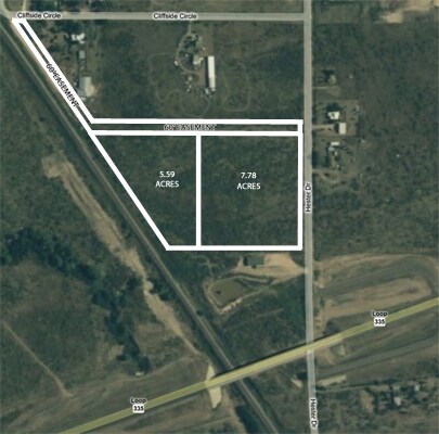
6415 Hester Dr
R-005-5350-6800-0
BOB BURGESS SUB, IRREG TR BEG 177.06FT W OF N E COR OF TR 16, 1.0200 ACRES
Officebuilding
Potter
B and X Area of moderate flood hazard, usually the area between the limits of the 100-year and 500-year floods.
Texas
2024
13.37 AC
2025
Amarillo
013400
Other Market Areas
24,104 SF
Amarillo, TX
NEARBY LISTINGS FOR SALE OR LEASE
DEMOGRAPHICS near 6415 Hester Dr
1 mile
3 mile
5 mile
2025 Total Population
143
7,416
47,913
2030 Population
143
7,348
47,516
Pop Growth 2025-2030
0.00%
(0.92%)
(0.83%)
Average Age
42
43
39
2025 Total Households
53
2,756
19,316
HH Growth 2025-2030
0.00%
(1.12%)
(0.95%)
Median Household Inc
$114,999
$111,820
$54,037
Avg Household Size
2.60
2.60
2.40
2025 Avg HH Vehicles
2.00
2.00
2.00
Median Home Value
$289,999
$293,881
$174,526
Median Year Built
2000
1995
1966
Nearby Places
Map Layers
Map Styles
 Street
 Aerial
Layers
 Traffic
 Biking
Places
Listings with unknown addresses are not visible on the map
- Restaurants
- Banks
- Shops
- Fitness
- Groceries
PUBLIC TRANSPORTATION
AIRPORT
Rick Husband Amarillo International
Drive
Walk
Distance
Rick Husband Amarillo International
23 min
17.6 mi
Freight Ports
Tulsa Port Of Catoosa
Drive
Walk
Distance
Tulsa Port Of Catoosa
405 min
384.3 mi
Nearby Properties
Address
Land Use
TOTAL SIZE
Lot Size
Zoning
Address
Land Use
TOTAL SIZE
Lot Size
Zoning
108,219 SF
21.87 AC
Address
Land Use
TOTAL SIZE
Lot Size
Zoning
96,942 SF
14.98 AC
PD
Address
Land Use
TOTAL SIZE
Lot Size
Zoning
67,312 SF
13.82 AC
Address
Land Use
TOTAL SIZE
Lot Size
Zoning
54,962 SF
10.94 AC
R2
Address
Land Use
TOTAL SIZE
Lot Size
Zoning
95,337 SF
10.47 AC
I1
Address
Land Use
TOTAL SIZE
Lot Size
Zoning
144,210 SF
11.47 AC
PD
Address
Land Use
TOTAL SIZE
Lot Size
Zoning
30,130 SF
5 AC
PD
Address
Land Use
TOTAL SIZE
Lot Size
Zoning
25,782 SF
3.22 AC
PD
Address
Land Use
TOTAL SIZE
Lot Size
Zoning
10,392 SF
5.01 AC
Address
Land Use
TOTAL SIZE
Lot Size
Zoning
Address
Land Use
TOTAL SIZE
Lot Size
Zoning
18,417 SF
5 AC
R2
Address
Land Use
TOTAL SIZE
Lot Size
Zoning
26,275 SF
5.01 AC
R2
Address
Land Use
TOTAL SIZE
Lot Size
Zoning
16,830 SF
5.11 AC
A
Address
Land Use
TOTAL SIZE
Lot Size
Zoning
9,514 SF
3.13 AC
Address
Land Use
TOTAL SIZE
Lot Size
Zoning
20,936 SF
8 AC
R2
Address
Land Use
TOTAL SIZE
Lot Size
Zoning
19,120 SF
5.04 AC
Address
Land Use
TOTAL SIZE
Lot Size
Zoning
32,115 SF
16.30 AC
Address
Land Use
TOTAL SIZE
Lot Size
Zoning
42,428 SF
9.21 AC
PD
Address
Land Use
TOTAL SIZE
Lot Size
Zoning
1,674 SF
649.07 AC
Address
Land Use
TOTAL SIZE
Lot Size
Zoning
73,711 SF
2.91 AC
I1
Address
Land Use
TOTAL SIZE
Lot Size
Zoning
8,110 SF
2.70 AC
I1
Address
Land Use
TOTAL SIZE
Lot Size
Zoning
4,959 SF
1.61 AC
Address
Land Use
TOTAL SIZE
Lot Size
Zoning
5,513 SF
1.98 AC
PD
Address
Land Use
TOTAL SIZE
Lot Size
Zoning
29,320 SF
7.44 AC
Address
Land Use
TOTAL SIZE
Lot Size
Zoning
90,046 SF
5 AC
PD
Address
Land Use
TOTAL SIZE
Lot Size
Zoning
39,823 SF
14.45 AC
Address
Land Use
TOTAL SIZE
Lot Size
Zoning
26,593 SF
15 AC
Address
Land Use
TOTAL SIZE
Lot Size
Zoning
3,913 SF
1.41 AC
PD
Address
Land Use
TOTAL SIZE
Lot Size
Zoning
35,700 SF
46.25 AC
Address
Land Use
TOTAL SIZE
Lot Size
Zoning
7,980 SF
1.54 AC
GR
The World's #1 Commercial Real Estate Marketplace
Connect with us
© 2026 CoStar Group
The information above has been obtained from sources believed reliable. While we do not doubt its accuracy we have not verified it and make no guarantee, warranty or representation about it. It is your responsibility to independently confirm its accuracy and completeness. Any projections, opinions, assumptions, or estimates used are for example only and do not represent the current or future performance of the property. The value of this transaction to you depends on tax and other factors which should be evaluated by your tax, financial, and legal advisors. You and your advisors should conduct a careful, independent investigation of the property to determine to your satisfaction the suitability of the property for your needs.