Property Record
6415 Osborne Tpke, Henrico, VA 23231


NEARBY LISTINGS FOR SALE OR LEASE
Property Detail
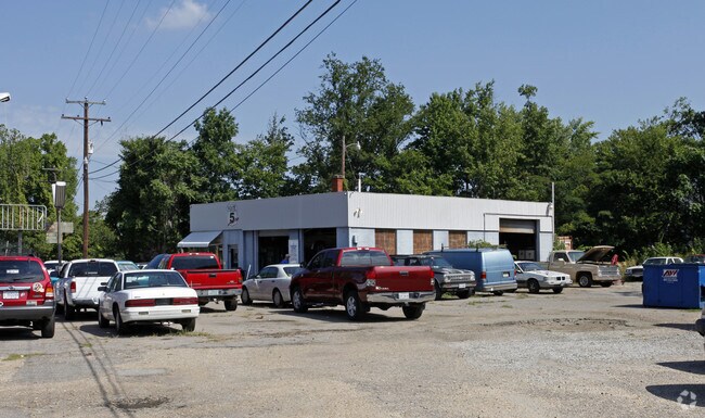
6415 Osborne Tpke
801-704-2109
01910A0000 0042A; OSBORNE TURNPIKE AC 3.921 18 A2 38
Autorepair
Henrico
X
Virginia
5101290085E
3.92 AC
2025
East End
2025
Richmond VA
201503
Richmond, VA
1,808 SF
DEMOGRAPHICS near 6415 Osborne Tpke
1 Mile
3 Mile
5 Mile
2024 Total Population
4,412
46,588
172,190
2029 Population
4,396
47,997
178,342
Pop Growth 2024-2029
(0.36%)
+ 3.02%
+ 3.57%
Average Age
40
38
37
2024 Total Households
1,656
19,994
73,109
HH Growth 2024-2029
(0.36%)
+ 3.26%
+ 3.69%
Median Household Inc
$82,920
$53,336
$47,522
Avg Household Size
2.70
2.30
2.20
2024 Avg HH Vehicles
2.00
2.00
1.00
Median Home Value
$235,135
$225,687
$223,048
Median Year Built
1991
1970
1969
Nearby Places
Map Layers
Map Styles
 Street
 Aerial
- Restaurants
- Banks
- Shops
- Fitness
- Groceries
PUBLIC TRANSPORTATION
COMMUTER RAIL
DRIVE
WALK
Distance
7 min
3.5 mi
AIRPORT
Richmond International
DRIVE
WALK
Distance
Richmond International
17 min
9.3 mi
Freight Ports
Virginia Port Authority - Richmond
DRIVE
WALK
Distance
Virginia Port Authority - Richmond
15 min
8.4 mi
Nearby Properties
Address
Land Use
TOTAL SIZE
Lot Size
Zoning
Address
Land Use
TOTAL SIZE
Lot Size
Zoning
543,477 SF
142.90 AC
MULTIPLE Z
Address
Land Use
TOTAL SIZE
Lot Size
Zoning
1,200,540 SF
75.49 AC
MULTIPLE Z
Address
Land Use
TOTAL SIZE
Lot Size
Zoning
155.45 AC
M-2 HEAVY
Address
Land Use
TOTAL SIZE
Lot Size
Zoning
564,480 SF
115.62 AC
M-1 LIGHT
Address
Land Use
TOTAL SIZE
Lot Size
Zoning
462,732 SF
24.94 AC
M-2 HEAVY
Address
Land Use
TOTAL SIZE
Lot Size
Zoning
920,673 SF
99.01 AC
MIXE
Address
Land Use
TOTAL SIZE
Lot Size
Zoning
235,854 SF
1.86 AC
RF-2 RIVER
Address
Land Use
TOTAL SIZE
Lot Size
Zoning
448,888 SF
35.33 AC
M-2 HEAVY
Address
Land Use
TOTAL SIZE
Lot Size
Zoning
100,000 SF
0.79 AC
MULTIPLE Z
Address
Land Use
TOTAL SIZE
Lot Size
Zoning
224,994 SF
2.92 AC
MULTIPLE Z
Address
Land Use
TOTAL SIZE
Lot Size
Zoning
15,894 SF
35.63 AC
A-1
Address
Land Use
TOTAL SIZE
Lot Size
Zoning
306,439 SF
48.81 AC
M-2 HEAVY
Address
Land Use
TOTAL SIZE
Lot Size
Zoning
196,227 SF
15.50 AC
M-1 LIGHT
Address
Land Use
TOTAL SIZE
Lot Size
Zoning
407,205 SF
286.12 AC
MIXE
Address
Land Use
TOTAL SIZE
Lot Size
Zoning
195,415 SF
15.59 AC
M-1 LIGHT
Address
Land Use
TOTAL SIZE
Lot Size
Zoning
85,272 SF
1.82 AC
B-5 CENTRA
Address
Land Use
TOTAL SIZE
Lot Size
Zoning
189,225 SF
1.29 AC
UMUC
Address
Land Use
TOTAL SIZE
Lot Size
Zoning
190,000 SF
16.65 AC
R-5C
Address
Land Use
TOTAL SIZE
Lot Size
Zoning
139,515 SF
0.99 AC
B-7 CENTRA
Address
Land Use
TOTAL SIZE
Lot Size
Zoning
221,730 SF
5.72 AC
B-6 CENTRA
Address
Land Use
TOTAL SIZE
Lot Size
Zoning
4,556 SF
8.76 AC
R-5C
Address
Land Use
TOTAL SIZE
Lot Size
Zoning
329,984 SF
4.10 AC
B-7 CENTRA
Address
Land Use
TOTAL SIZE
Lot Size
Zoning
1.52 AC
UMUC
Address
Land Use
TOTAL SIZE
Lot Size
Zoning
8.57 AC
MULTIPLE Z
Address
Land Use
TOTAL SIZE
Lot Size
Zoning
1.04 AC
B-5 CENTRA
Address
Land Use
TOTAL SIZE
Lot Size
Zoning
1.03 AC
B-5 CENTRA
Address
Land Use
TOTAL SIZE
Lot Size
Zoning
165,931 SF
4.22 AC
M-1 LIGHT
Address
Land Use
TOTAL SIZE
Lot Size
Zoning
162,289 SF
35 AC
A-1
Address
Land Use
TOTAL SIZE
Lot Size
Zoning
191,325 SF
1.46 AC
B-5 CENTRA
Address
Land Use
TOTAL SIZE
Lot Size
Zoning
206,097 SF
1.84 AC
B-5 CENTRA
The World's #1 Commercial Real Estate Marketplace
Connect with us
© 2026 CoStar Group
The information above has been obtained from sources believed reliable. While we do not doubt its accuracy we have not verified it and make no guarantee, warranty or representation about it. It is your responsibility to independently confirm its accuracy and completeness. Any projections, opinions, assumptions, or estimates used are for example only and do not represent the current or future performance of the property. The value of this transaction to you depends on tax and other factors which should be evaluated by your tax, financial, and legal advisors. You and your advisors should conduct a careful, independent investigation of the property to determine to your satisfaction the suitability of the property for your needs.