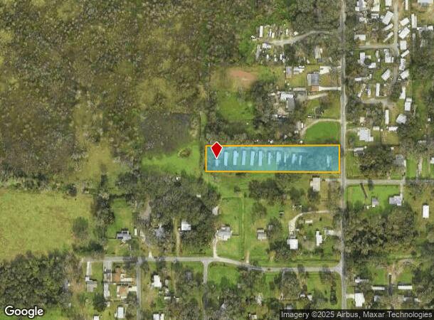
Property Record
6416 Black Dairy Rd, Seffner, FL 33584
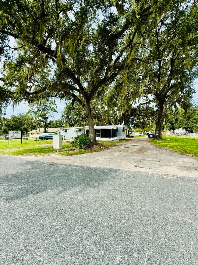
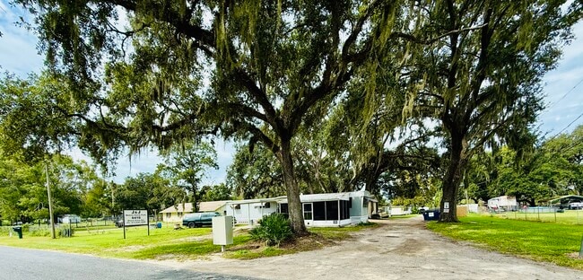
This Property Is For Sale
NEARBY LISTINGS FOR SALE OR LEASE
Property Detail
6416 Black Dairy Rd
Tampa-St. Petersburg-Clearwater, FL
Unplatted
U-28-28-20-ZZZ-000002-21400.0
Hillsborough
Mobilemanufacturedhomeregardlessoflandownership
Florida
AE
1.90 AC
12057C0245H
Northeast Tampa
11,806 SF
Tampa/St Petersburg
DEMOGRAPHICS near 6416 Black Dairy Rd
1 Mile
3 Mile
5 Mile
2024 Total Population
1,724
41,299
121,961
2029 Population
1,870
44,768
131,035
Pop Growth 2024-2029
+ 8.47%
+ 8.40%
+ 7.44%
Average Age
41
38
39
2024 Total Households
580
15,047
44,796
HH Growth 2024-2029
+ 8.62%
+ 8.57%
+ 7.71%
Median Household Inc
$64,312
$64,299
$69,560
Avg Household Size
2.80
2.70
2.60
2024 Avg HH Vehicles
2.00
2.00
2.00
Median Home Value
$394,444
$326,253
$334,839
Median Year Built
1996
1991
1987
Nearby Places
- Restaurants
- Banks
- Shops
- Fitness
- Groceries
PUBLIC TRANSPORTATION
AIRPORT
Tampa International
DRIVE
WALK
Distance
Tampa International
31 min
20.3 mi
St Pete-Clearwater International
DRIVE
WALK
Distance
St Pete-Clearwater International
48 min
29.6 mi
Freight Ports
Port of Tampa Bay
DRIVE
WALK
Distance
Port of Tampa Bay
24 min
13.8 mi
Nearby Properties
Address
Land Use
TOTAL SIZE
Lot Size
Zoning
Address
Land Use
TOTAL SIZE
Lot Size
Zoning
2,604,100 SF
83.27 AC
PD
Address
Land Use
TOTAL SIZE
Lot Size
Zoning
472,855 SF
34.23 AC
PD
Address
Land Use
TOTAL SIZE
Lot Size
Zoning
466,038 SF
26.75 AC
PD
Address
Land Use
TOTAL SIZE
Lot Size
Zoning
491,498 SF
35.60 AC
PD
Address
Land Use
TOTAL SIZE
Lot Size
Zoning
333,142 SF
51.21 AC
AR
Address
Land Use
TOTAL SIZE
Lot Size
Zoning
425,350 SF
38.72 AC
PD
Address
Land Use
TOTAL SIZE
Lot Size
Zoning
635,413 SF
43.44 AC
PD
Address
Land Use
TOTAL SIZE
Lot Size
Zoning
174,144 SF
79.80 AC
PD
Address
Land Use
TOTAL SIZE
Lot Size
Zoning
155,769 SF
18.53 AC
CMU-12
Address
Land Use
TOTAL SIZE
Lot Size
Zoning
388,082 SF
30.28 AC
PD
Address
Land Use
TOTAL SIZE
Lot Size
Zoning
159,876 SF
19.37 AC
PD
Address
Land Use
TOTAL SIZE
Lot Size
Zoning
165,277 SF
27.50 AC
AR
Address
Land Use
TOTAL SIZE
Lot Size
Zoning
236,297 SF
15.58 AC
PD
Address
Land Use
TOTAL SIZE
Lot Size
Zoning
292,586 SF
478.91 AC
SPI-AP-V
Address
Land Use
TOTAL SIZE
Lot Size
Zoning
131,808 SF
8.77 AC
PD
Address
Land Use
TOTAL SIZE
Lot Size
Zoning
129,696 SF
8.93 AC
PD
Address
Land Use
TOTAL SIZE
Lot Size
Zoning
175,203 SF
16.05 AC
UMU-20
Address
Land Use
TOTAL SIZE
Lot Size
Zoning
213,686 SF
12.33 AC
PD
Address
Land Use
TOTAL SIZE
Lot Size
Zoning
128,267 SF
38.76 AC
PD
Address
Land Use
TOTAL SIZE
Lot Size
Zoning
101,256 SF
5.91 AC
PD
Address
Land Use
TOTAL SIZE
Lot Size
Zoning
94,653 SF
17.31 AC
PD
Address
Land Use
TOTAL SIZE
Lot Size
Zoning
87,856 SF
3.53 AC
PD
Address
Land Use
TOTAL SIZE
Lot Size
Zoning
223,779 SF
9.13 AC
PD
Address
Land Use
TOTAL SIZE
Lot Size
Zoning
109,284 SF
5.95 AC
PD
Address
Land Use
TOTAL SIZE
Lot Size
Zoning
174,275 SF
13.70 AC
PD
Address
Land Use
TOTAL SIZE
Lot Size
Zoning
95,520 SF
41.88 AC
PD
Address
Land Use
TOTAL SIZE
Lot Size
Zoning
115,298 SF
14.93 AC
PD
Address
Land Use
TOTAL SIZE
Lot Size
Zoning
81,002 SF
80.36 AC
PD
Address
Land Use
TOTAL SIZE
Lot Size
Zoning
277,763 SF
15.46 AC
PD
Address
Land Use
TOTAL SIZE
Lot Size
Zoning
97,416 SF
5.32 AC
PD
The World's #1 Commercial Real Estate Marketplace
Connect with us
© 2025 CoStar Group
The information above has been obtained from sources believed reliable. While we do not doubt its accuracy we have not verified it and make no guarantee, warranty or representation about it. It is your responsibility to independently confirm its accuracy and completeness. Any projections, opinions, assumptions, or estimates used are for example only and do not represent the current or future performance of the property. The value of this transaction to you depends on tax and other factors which should be evaluated by your tax, financial, and legal advisors. You and your advisors should conduct a careful, independent investigation of the property to determine to your satisfaction the suitability of the property for your needs.