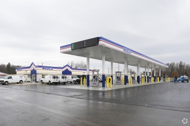
Property Record
6419 Airline Rd, Fruitport, MI 49415


NEARBY LISTINGS FOR SALE OR LEASE
Property Detail
6419 Airline Rd
15-125-300-0022-35
Orth
Commercialnec
FRUITPORT CHARTER TOWNSHIP PART OF THE SOUTH 1/2 OF SECTION 25 TOWN 9 NORTH RANGE 16 WEST DESCRIBED AS COMMENCING AT THE SOUT
X
Muskegon
26121C0294E
Michigan
2024
1.60 AC
2025
Norton Shores
002800
West Michigan
4,032 SF
Muskegon-Norton Shores, MI
DEMOGRAPHICS near 6419 Airline Rd
1 Mile
3 Mile
5 Mile
2024 Total Population
1,840
12,532
41,985
2029 Population
1,856
12,884
43,217
Pop Growth 2024-2029
+ 0.87%
+ 2.81%
+ 2.93%
Average Age
42
42
42
2024 Total Households
722
4,913
16,863
HH Growth 2024-2029
+ 0.83%
+ 2.89%
+ 3.06%
Median Household Inc
$85,348
$73,729
$69,213
Avg Household Size
2.50
2.50
2.40
2024 Avg HH Vehicles
2.00
2.00
2.00
Median Home Value
$188,749
$249,772
$234,624
Median Year Built
1972
1989
1982
Nearby Places
Map Layers
Map Styles
 Street
 Aerial
- Restaurants
- Banks
- Shops
- Fitness
- Groceries
PUBLIC TRANSPORTATION
AIRPORT
Gerald R Ford International
DRIVE
WALK
Distance
Gerald R Ford International
54 min
44.7 mi
Nearby Properties
Address
Land Use
TOTAL SIZE
Lot Size
Zoning
Address
Land Use
TOTAL SIZE
Lot Size
Zoning
273,059 SF
30.59 AC
PUD
Address
Land Use
TOTAL SIZE
Lot Size
Zoning
207,571 SF
22 AC
LI
Address
Land Use
TOTAL SIZE
Lot Size
Zoning
65,152 SF
9.77 AC
PUD
Address
Land Use
TOTAL SIZE
Lot Size
Zoning
237,612 SF
13.40 AC
PUD
Address
Land Use
TOTAL SIZE
Lot Size
Zoning
55,600 SF
LI
Address
Land Use
TOTAL SIZE
Lot Size
Zoning
250,000 SF
19.08 AC
GI
Address
Land Use
TOTAL SIZE
Lot Size
Zoning
250,000 SF
15.60 AC
GI
Address
Land Use
TOTAL SIZE
Lot Size
Zoning
169,420 SF
15.20 AC
PUD
Address
Land Use
TOTAL SIZE
Lot Size
Zoning
91,682 SF
21.93 AC
PUD
Address
Land Use
TOTAL SIZE
Lot Size
Zoning
118,532 SF
8.16 AC
REC
Address
Land Use
TOTAL SIZE
Lot Size
Zoning
63,512 SF
6.22 AC
PUD
Address
Land Use
TOTAL SIZE
Lot Size
Zoning
215,706 SF
23.21 AC
PUD
Address
Land Use
TOTAL SIZE
Lot Size
Zoning
356,647 SF
53.83 AC
PUD
Address
Land Use
TOTAL SIZE
Lot Size
Zoning
65,204 SF
2.43 AC
PUD
Address
Land Use
TOTAL SIZE
Lot Size
Zoning
250,000 SF
17.53 AC
GI
Address
Land Use
TOTAL SIZE
Lot Size
Zoning
250,000 SF
18.72 AC
GI
Address
Land Use
TOTAL SIZE
Lot Size
Zoning
54,100 SF
6.60 AC
PUD
Address
Land Use
TOTAL SIZE
Lot Size
Zoning
88,970 SF
6.46 AC
PUD
Address
Land Use
TOTAL SIZE
Lot Size
Zoning
25,250 SF
2.81 AC
PUD
Address
Land Use
TOTAL SIZE
Lot Size
Zoning
38,563 SF
B-3
Address
Land Use
TOTAL SIZE
Lot Size
Zoning
71,360 SF
8.27 AC
B-3
Address
Land Use
TOTAL SIZE
Lot Size
Zoning
84,290 SF
7.23 AC
PUD
Address
Land Use
TOTAL SIZE
Lot Size
Zoning
60,762 SF
4.61 AC
PUD
Address
Land Use
TOTAL SIZE
Lot Size
Zoning
19,108 SF
2 AC
PUD
Address
Land Use
TOTAL SIZE
Lot Size
Zoning
107,120 SF
5.93 AC
PUD
Address
Land Use
TOTAL SIZE
Lot Size
Zoning
27,184 SF
3.89 AC
PUD
Address
Land Use
TOTAL SIZE
Lot Size
Zoning
13 AC
MHP
Address
Land Use
TOTAL SIZE
Lot Size
Zoning
105,948 SF
6.71 AC
PUD
Address
Land Use
TOTAL SIZE
Lot Size
Zoning
167,290 SF
33.43 AC
B-3
Address
Land Use
TOTAL SIZE
Lot Size
Zoning
32,797 SF
B-3
The World's #1 Commercial Real Estate Marketplace
Connect with us
© 2026 CoStar Group
The information above has been obtained from sources believed reliable. While we do not doubt its accuracy we have not verified it and make no guarantee, warranty or representation about it. It is your responsibility to independently confirm its accuracy and completeness. Any projections, opinions, assumptions, or estimates used are for example only and do not represent the current or future performance of the property. The value of this transaction to you depends on tax and other factors which should be evaluated by your tax, financial, and legal advisors. You and your advisors should conduct a careful, independent investigation of the property to determine to your satisfaction the suitability of the property for your needs.