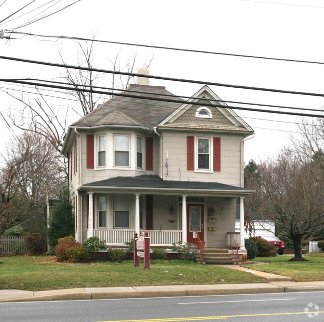
Property Record
642 Main St, Reisterstown, MD 21136


NEARBY LISTINGS FOR SALE OR LEASE
Property Detail
642 Main St
04-0419007375
WS REISTERSTOWN RD
Officebuilding
Baltimore
X
Maryland
2400100205G
861
2024
0.50 AC
2025
Reisterstown Rd Corridor
404501
Baltimore
1,012 SF
Baltimore-Columbia-Towson, MD
DEMOGRAPHICS near 642 Main St
1 mile
3 mile
5 mile
2024 Total Population
13,489
52,515
93,936
2029 Population
13,256
51,866
93,045
Pop Growth 2024-2029
(1.73%)
(1.24%)
(0.95%)
Average Age
39
40
39
2024 Total Households
5,130
20,356
36,503
HH Growth 2024-2029
(1.77%)
(1.27%)
(1.00%)
Median Household Inc
$71,297
$85,220
$90,877
Avg Household Size
2.50
2.50
2.50
2024 Avg HH Vehicles
2.00
2.00
2.00
Median Home Value
$299,552
$356,401
$344,686
Median Year Built
1976
1985
1990
Nearby Places
Map Layers
Map Styles
 Street
 Aerial
Transit
 Traffic
 Biking
Places
Listings with unknown addresses are not visible on the map
- Restaurants
- Banks
- Shops
- Fitness
- Groceries
PUBLIC TRANSPORTATION
AIRPORT
Baltimore/Washington International Thurgood Marshall
Drive
Walk
Distance
Baltimore/Washington International Thurgood Marshall
36 min
23.9 mi
Freight Ports
Port of Baltimore
Drive
Walk
Distance
Port of Baltimore
36 min
23.7 mi
Nearby Properties
Address
Land Use
TOTAL SIZE
Lot Size
Zoning
Address
Land Use
TOTAL SIZE
Lot Size
Zoning
Address
Land Use
TOTAL SIZE
Lot Size
Zoning
18.87 AC
DR16
Address
Land Use
TOTAL SIZE
Lot Size
Zoning
151,140 SF
39.06 AC
Address
Land Use
TOTAL SIZE
Lot Size
Zoning
16.86 AC
Address
Land Use
TOTAL SIZE
Lot Size
Zoning
199,573 SF
6.35 AC
ML
Address
Land Use
TOTAL SIZE
Lot Size
Zoning
114,141 SF
54.89 AC
Address
Land Use
TOTAL SIZE
Lot Size
Zoning
15.86 AC
DR16
Address
Land Use
TOTAL SIZE
Lot Size
Zoning
4,762 SF
15.93 AC
BMCCC
Address
Land Use
TOTAL SIZE
Lot Size
Zoning
125,171 SF
8.80 AC
Address
Land Use
TOTAL SIZE
Lot Size
Zoning
205,549 SF
7.32 AC
OT
Address
Land Use
TOTAL SIZE
Lot Size
Zoning
11.76 AC
DR3.5
Address
Land Use
TOTAL SIZE
Lot Size
Zoning
8.47 AC
DR16
Address
Land Use
TOTAL SIZE
Lot Size
Zoning
212,692 SF
6.15 AC
DR16
Address
Land Use
TOTAL SIZE
Lot Size
Zoning
8.70 AC
DR16
Address
Land Use
TOTAL SIZE
Lot Size
Zoning
7.75 AC
DR5.5
Address
Land Use
TOTAL SIZE
Lot Size
Zoning
174,647 SF
37.40 AC
RC3
Address
Land Use
TOTAL SIZE
Lot Size
Zoning
12.96 AC
DR16
Address
Land Use
TOTAL SIZE
Lot Size
Zoning
11.14 AC
DR16
Address
Land Use
TOTAL SIZE
Lot Size
Zoning
107,713 SF
3.85 AC
Address
Land Use
TOTAL SIZE
Lot Size
Zoning
91,300 SF
9.21 AC
ML-IM
Address
Land Use
TOTAL SIZE
Lot Size
Zoning
9.70 AC
DR16
Address
Land Use
TOTAL SIZE
Lot Size
Zoning
10.04 AC
DR16
Address
Land Use
TOTAL SIZE
Lot Size
Zoning
116,416 SF
16.23 AC
ML
Address
Land Use
TOTAL SIZE
Lot Size
Zoning
157,975 SF
5.49 AC
BL
Address
Land Use
TOTAL SIZE
Lot Size
Zoning
7.13 AC
DR16
Address
Land Use
TOTAL SIZE
Lot Size
Zoning
6.97 AC
DR3.5
Address
Land Use
TOTAL SIZE
Lot Size
Zoning
7.93 AC
DR16
Address
Land Use
TOTAL SIZE
Lot Size
Zoning
6.97 AC
DR16
Address
Land Use
TOTAL SIZE
Lot Size
Zoning
87,871 SF
7.88 AC
ML-IM
Address
Land Use
TOTAL SIZE
Lot Size
Zoning
7.94 AC
DR16
The World's #1 Commercial Real Estate Marketplace
Connect with us
© 2026 CoStar Group
The information above has been obtained from sources believed reliable. While we do not doubt its accuracy we have not verified it and make no guarantee, warranty or representation about it. It is your responsibility to independently confirm its accuracy and completeness. Any projections, opinions, assumptions, or estimates used are for example only and do not represent the current or future performance of the property. The value of this transaction to you depends on tax and other factors which should be evaluated by your tax, financial, and legal advisors. You and your advisors should conduct a careful, independent investigation of the property to determine to your satisfaction the suitability of the property for your needs.