Property Record
6420 S 23Rd St, Mcallen, TX 78503

Property Detail
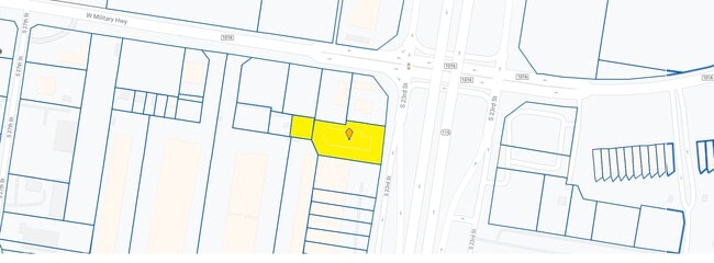
6420 S 23Rd St
McAllen-Edinburg-Mission, TX
MCALLEN PRODUCE TERMINAL MARKET LOT 5C
M2320-00-000-005C-00
Hidalgo
Hotel
Texas
2024
5c
2025
1.17 AC
020510
McAllen
21,573 SF
McAllen/Edinburg/Pharr
NEARBY LISTINGS FOR SALE OR LEASE
-
-
View all Mcallen listings for sale on LoopNet.com
DEMOGRAPHICS near 6420 S 23Rd St
1 mile
3 mile
5 mile
2025 Total Population
2,974
29,452
134,325
2030 Population
3,053
30,681
141,193
Pop Growth 2025-2030
+ 2.66%
+ 4.17%
+ 5.11%
Average Age
33
36
36
2025 Total Households
811
9,005
42,238
HH Growth 2025-2030
+ 2.34%
+ 4.16%
+ 5.32%
Median Household Inc
$41,330
$59,147
$53,254
Avg Household Size
3.50
3.20
3.10
2025 Avg HH Vehicles
2.00
2.00
2.00
Median Home Value
$149,731
$177,682
$163,417
Median Year Built
2003
2002
2000
Nearby Places
Map Layers
Map Styles
 Street
 Aerial
Layers
 Traffic
 Biking
Places
Listings with unknown addresses are not visible on the map
- Restaurants
- Banks
- Shops
- Fitness
- Groceries
PUBLIC TRANSPORTATION
AIRPORT
McAllen International
Drive
Walk
Distance
McAllen International
9 min
4.1 mi
Nearby Properties
Address
Land Use
TOTAL SIZE
Lot Size
Zoning
Address
Land Use
TOTAL SIZE
Lot Size
Zoning
1,199,590 SF
47.93 AC
Address
Land Use
TOTAL SIZE
Lot Size
Zoning
291,859 SF
10.11 AC
CO
Address
Land Use
TOTAL SIZE
Lot Size
Zoning
16,600 SF
23.27 AC
Address
Land Use
TOTAL SIZE
Lot Size
Zoning
105,440 SF
19.84 AC
Address
Land Use
TOTAL SIZE
Lot Size
Zoning
236,124 SF
14.03 AC
Address
Land Use
TOTAL SIZE
Lot Size
Zoning
287,691 SF
33.57 AC
Address
Land Use
TOTAL SIZE
Lot Size
Zoning
3,000 SF
16 AC
Address
Land Use
TOTAL SIZE
Lot Size
Zoning
158,844 SF
36.09 AC
Address
Land Use
TOTAL SIZE
Lot Size
Zoning
73,507 SF
23.84 AC
Address
Land Use
TOTAL SIZE
Lot Size
Zoning
323,400 SF
17.29 AC
Address
Land Use
TOTAL SIZE
Lot Size
Zoning
370,000 SF
24.54 AC
Address
Land Use
TOTAL SIZE
Lot Size
Zoning
177,334 SF
10.31 AC
Address
Land Use
TOTAL SIZE
Lot Size
Zoning
289,443 SF
12.91 AC
CO
Address
Land Use
TOTAL SIZE
Lot Size
Zoning
215,000 SF
17.80 AC
Address
Land Use
TOTAL SIZE
Lot Size
Zoning
288,657 SF
16.75 AC
IN
Address
Land Use
TOTAL SIZE
Lot Size
Zoning
180,548 SF
21.62 AC
Address
Land Use
TOTAL SIZE
Lot Size
Zoning
285,360 SF
13.67 AC
CO
Address
Land Use
TOTAL SIZE
Lot Size
Zoning
352,000 SF
18 AC
Address
Land Use
TOTAL SIZE
Lot Size
Zoning
370,736 SF
16.52 AC
Address
Land Use
TOTAL SIZE
Lot Size
Zoning
251,422 SF
15.01 AC
Address
Land Use
TOTAL SIZE
Lot Size
Zoning
46,195 SF
13.58 AC
Address
Land Use
TOTAL SIZE
Lot Size
Zoning
71,964 SF
2.22 AC
CO
Address
Land Use
TOTAL SIZE
Lot Size
Zoning
240,292 SF
38.55 AC
RS
Address
Land Use
TOTAL SIZE
Lot Size
Zoning
216,116 SF
13.21 AC
IN
Address
Land Use
TOTAL SIZE
Lot Size
Zoning
215,740 SF
11.17 AC
CO
Address
Land Use
TOTAL SIZE
Lot Size
Zoning
16,884 SF
148.62 AC
Address
Land Use
TOTAL SIZE
Lot Size
Zoning
79,756 SF
3.72 AC
Address
Land Use
TOTAL SIZE
Lot Size
Zoning
232,385 SF
10.44 AC
Address
Land Use
TOTAL SIZE
Lot Size
Zoning
151,240 SF
11 AC
IN
Address
Land Use
TOTAL SIZE
Lot Size
Zoning
180,971 SF
10.16 AC
IN
The World's #1 Commercial Real Estate Marketplace
Connect with us
© 2026 CoStar Group
The information above has been obtained from sources believed reliable. While we do not doubt its accuracy we have not verified it and make no guarantee, warranty or representation about it. It is your responsibility to independently confirm its accuracy and completeness. Any projections, opinions, assumptions, or estimates used are for example only and do not represent the current or future performance of the property. The value of this transaction to you depends on tax and other factors which should be evaluated by your tax, financial, and legal advisors. You and your advisors should conduct a careful, independent investigation of the property to determine to your satisfaction the suitability of the property for your needs.