Property Record
6421 Bridge Rd, Madison, WI 53713
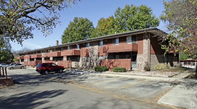


Property Detail
6421 Bridge Rd
0710-203-0095-2
LOT 1 OF CERTIFIED SURVEY MAP NO 971 RECORDED IN DANE CO REGISTER OF DEEDS IN VO L 4 PAGE 225 OF CERTIFIED SURVEYS
Commercialnec
Dane
SR-V2
Wisconsin
B and X Area of moderate flood hazard, usually the area between the limits of the 100-year and 500-year floods.
1,4
2025
6.06 AC
2025
South Madison
001501
Milwaukee/Madison
115,804 SF
Madison, WI
NEARBY LISTINGS FOR SALE OR LEASE
DEMOGRAPHICS near 6421 Bridge Rd
1 mile
3 mile
5 mile
2025 Total Population
7,075
51,788
214,775
2030 Population
7,350
53,800
228,851
Pop Growth 2025-2030
+ 3.89%
+ 3.89%
+ 6.55%
Average Age
42
39
36
2025 Total Households
3,274
25,528
95,571
HH Growth 2025-2030
+ 4.28%
+ 4.18%
+ 6.92%
Median Household Inc
$82,774
$73,876
$67,455
Avg Household Size
2.10
1.90
2.10
2025 Avg HH Vehicles
2.00
1.00
1.00
Median Home Value
$392,559
$361,217
$371,279
Median Year Built
1968
1971
1982
Nearby Places
Map Layers
Map Styles
 Street
 Aerial
Layers
 Traffic
 Biking
Places
Listings with unknown addresses are not visible on the map
- Restaurants
- Banks
- Shops
- Fitness
- Groceries
PUBLIC TRANSPORTATION
AIRPORT
Dane County Regional/Truax Field
Drive
Walk
Distance
Dane County Regional/Truax Field
18 min
10.0 mi
Freight Ports
Port Milwaukee
Drive
Walk
Distance
Port Milwaukee
96 min
81.0 mi
Nearby Properties
Address
Land Use
TOTAL SIZE
Lot Size
Zoning
Address
Land Use
TOTAL SIZE
Lot Size
Zoning
177,906 SF
5.49 AC
CC-T
Address
Land Use
TOTAL SIZE
Lot Size
Zoning
188,206 SF
0.80 AC
UMX
Address
Land Use
TOTAL SIZE
Lot Size
Zoning
158,832 SF
0.58 AC
WP-17
Address
Land Use
TOTAL SIZE
Lot Size
Zoning
403,079 SF
1.08 AC
WP-17
Address
Land Use
TOTAL SIZE
Lot Size
Zoning
412,945 SF
1.30 AC
WP-17
Address
Land Use
TOTAL SIZE
Lot Size
Zoning
296,708 SF
1 AC
WP-24
Address
Land Use
TOTAL SIZE
Lot Size
Zoning
211,457 SF
329.05 AC
WP-24
Address
Land Use
TOTAL SIZE
Lot Size
Zoning
145,539 SF
0.60 AC
UMX
Address
Land Use
TOTAL SIZE
Lot Size
Zoning
194,232 SF
2.25 AC
TR-U2
Address
Land Use
TOTAL SIZE
Lot Size
Zoning
202,376 SF
1.59 AC
PD
Address
Land Use
TOTAL SIZE
Lot Size
Zoning
230,007 SF
0.76 AC
PD
Address
Land Use
TOTAL SIZE
Lot Size
Zoning
268,388 SF
1 AC
WP-24
Address
Land Use
TOTAL SIZE
Lot Size
Zoning
168,685 SF
14.05 AC
IL
Address
Land Use
TOTAL SIZE
Lot Size
Zoning
425,812 SF
1 AC
WP-17
Address
Land Use
TOTAL SIZE
Lot Size
Zoning
269,098 SF
0.98 AC
DC
Address
Land Use
TOTAL SIZE
Lot Size
Zoning
20,965 SF
10.98 AC
IL
Address
Land Use
TOTAL SIZE
Lot Size
Zoning
141,058 SF
WP-24
Address
Land Use
TOTAL SIZE
Lot Size
Zoning
115,920 SF
2.38 AC
WP-24
Address
Land Use
TOTAL SIZE
Lot Size
Zoning
13.40 AC
Address
Land Use
TOTAL SIZE
Lot Size
Zoning
137,835 SF
1.49 AC
WP-17
Address
Land Use
TOTAL SIZE
Lot Size
Zoning
169,491 SF
0.79 AC
PD
Address
Land Use
TOTAL SIZE
Lot Size
Zoning
2.03 AC
Address
Land Use
TOTAL SIZE
Lot Size
Zoning
169,326 SF
0.37 AC
WP-17
Address
Land Use
TOTAL SIZE
Lot Size
Zoning
148,747 SF
0.83 AC
WP-24
Address
Land Use
TOTAL SIZE
Lot Size
Zoning
3.59 AC
Address
Land Use
TOTAL SIZE
Lot Size
Zoning
128,676 SF
1.66 AC
PD
Address
Land Use
TOTAL SIZE
Lot Size
Zoning
156,054 SF
9.40 AC
SE
Address
Land Use
TOTAL SIZE
Lot Size
Zoning
2.38 AC
Address
Land Use
TOTAL SIZE
Lot Size
Zoning
117,253 SF
0.81 AC
PD
Address
Land Use
TOTAL SIZE
Lot Size
Zoning
172,052 SF
4.09 AC
SE
The World's #1 Commercial Real Estate Marketplace
Connect with us
© 2026 CoStar Group
The information above has been obtained from sources believed reliable. While we do not doubt its accuracy we have not verified it and make no guarantee, warranty or representation about it. It is your responsibility to independently confirm its accuracy and completeness. Any projections, opinions, assumptions, or estimates used are for example only and do not represent the current or future performance of the property. The value of this transaction to you depends on tax and other factors which should be evaluated by your tax, financial, and legal advisors. You and your advisors should conduct a careful, independent investigation of the property to determine to your satisfaction the suitability of the property for your needs.