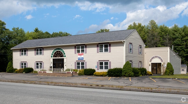
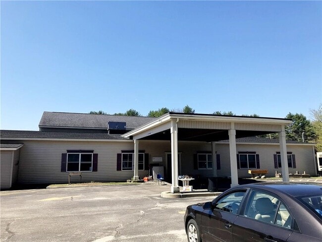
Property Record
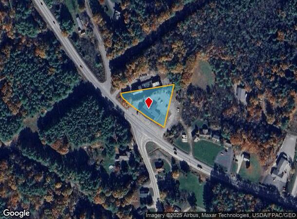
643 Lewiston Rd, Topsham, ME 04086
NEARBY LISTINGS FOR SALE OR LEASE
Property Detail
643 Lewiston Rd
TOPM-000002-000000-000059R
Sagadahoc
Officebuilding
Maine
X
59
23005C0334F
0.91 AC
2025
Sagadahoc County
2025
Portland/South Portland
970301
Portland-South Portland, ME
8,692 SF
DEMOGRAPHICS near 643 Lewiston Rd
1 Mile
3 Mile
5 Mile
2024 Total Population
314
5,573
27,404
2029 Population
326
5,748
28,215
Pop Growth 2024-2029
+ 3.82%
+ 3.14%
+ 2.96%
Average Age
44
43
44
2024 Total Households
132
2,296
11,810
HH Growth 2024-2029
+ 3.79%
+ 3.14%
+ 3.01%
Median Household Inc
$88,749
$86,361
$76,016
Avg Household Size
2.40
2.40
2.20
2024 Avg HH Vehicles
2.00
2.00
2.00
Median Home Value
$263,541
$283,899
$294,672
Median Year Built
1990
1986
1974
Nearby Places
- Restaurants
- Banks
- Shops
- Fitness
- Groceries
PUBLIC TRANSPORTATION
COMMUTER RAIL
Brunswick Amtrak Station (Downeaster - Amtrak)
DRIVE
WALK
Distance
Brunswick Amtrak Station (Downeaster - Amtrak)
7 min
5.0 mi
AIRPORT
Portland International Jetport
DRIVE
WALK
Distance
Portland International Jetport
42 min
31.4 mi
Freight Ports
Portland, ME
DRIVE
WALK
Distance
Portland, ME
36 min
28.4 mi
SALE & LEASE HISTORY
LISTING DATE
SALE/LEASE

Jun 05, 2018
For Sale
Jan 28, 2020
For Sale
Apr 09, 2020
For Lease
Nearby Properties
Address
Land Use
TOTAL SIZE
Lot Size
Zoning
Address
Land Use
TOTAL SIZE
Lot Size
Zoning
616.11 AC
NO
Address
Land Use
TOTAL SIZE
Lot Size
Zoning
199,222 SF
46.56 AC
NO
Address
Land Use
TOTAL SIZE
Lot Size
Zoning
30.78 AC
NO
Address
Land Use
TOTAL SIZE
Lot Size
Zoning
124,514 SF
10.76 AC
NO
Address
Land Use
TOTAL SIZE
Lot Size
Zoning
6,944 SF
0.93 AC
NO
Address
Land Use
TOTAL SIZE
Lot Size
Zoning
94,968 SF
16.88 AC
NO
Address
Land Use
TOTAL SIZE
Lot Size
Zoning
78,120 SF
28.71 AC
NO
Address
Land Use
TOTAL SIZE
Lot Size
Zoning
86,743 SF
10.94 AC
NO
Address
Land Use
TOTAL SIZE
Lot Size
Zoning
46,303 SF
4.44 AC
NO
Address
Land Use
TOTAL SIZE
Lot Size
Zoning
64,339 SF
6.69 AC
NO
Address
Land Use
TOTAL SIZE
Lot Size
Zoning
53.19 AC
NO
Address
Land Use
TOTAL SIZE
Lot Size
Zoning
36,568 SF
9.41 AC
NO
Address
Land Use
TOTAL SIZE
Lot Size
Zoning
44,520 SF
5.40 AC
NO
Address
Land Use
TOTAL SIZE
Lot Size
Zoning
76,126 SF
4.92 AC
NO
Address
Land Use
TOTAL SIZE
Lot Size
Zoning
6.47 AC
NO
Address
Land Use
TOTAL SIZE
Lot Size
Zoning
54,334 SF
2.25 AC
NO
Address
Land Use
TOTAL SIZE
Lot Size
Zoning
13.40 AC
Address
Land Use
TOTAL SIZE
Lot Size
Zoning
26,296 SF
2.12 AC
NO
Address
Land Use
TOTAL SIZE
Lot Size
Zoning
14,320 SF
1.49 AC
NO
Address
Land Use
TOTAL SIZE
Lot Size
Zoning
38,800 SF
2.63 AC
NO
Address
Land Use
TOTAL SIZE
Lot Size
Zoning
2.07 AC
NO
Address
Land Use
TOTAL SIZE
Lot Size
Zoning
7,684 SF
1.51 AC
NO
Address
Land Use
TOTAL SIZE
Lot Size
Zoning
17.55 AC
NO
Address
Land Use
TOTAL SIZE
Lot Size
Zoning
11,468 SF
2 AC
NO
Address
Land Use
TOTAL SIZE
Lot Size
Zoning
25.76 AC
NO
Address
Land Use
TOTAL SIZE
Lot Size
Zoning
13,966 SF
1.79 AC
NO
Address
Land Use
TOTAL SIZE
Lot Size
Zoning
8,674 SF
1.09 AC
NO
Address
Land Use
TOTAL SIZE
Lot Size
Zoning
18,737 SF
9.48 AC
NO
Address
Land Use
TOTAL SIZE
Lot Size
Zoning
36,360 SF
5.59 AC
NO
Address
Land Use
TOTAL SIZE
Lot Size
Zoning
5,968 SF
1.38 AC
NO
The World's #1 Commercial Real Estate Marketplace
Connect with us
© 2025 CoStar Group
The information above has been obtained from sources believed reliable. While we do not doubt its accuracy we have not verified it and make no guarantee, warranty or representation about it. It is your responsibility to independently confirm its accuracy and completeness. Any projections, opinions, assumptions, or estimates used are for example only and do not represent the current or future performance of the property. The value of this transaction to you depends on tax and other factors which should be evaluated by your tax, financial, and legal advisors. You and your advisors should conduct a careful, independent investigation of the property to determine to your satisfaction the suitability of the property for your needs.