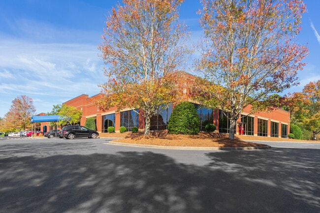
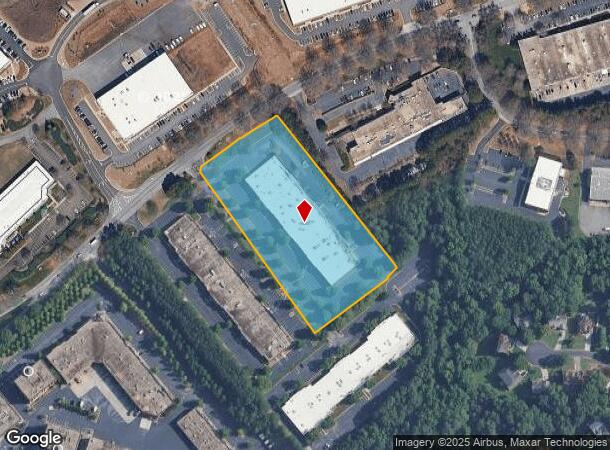
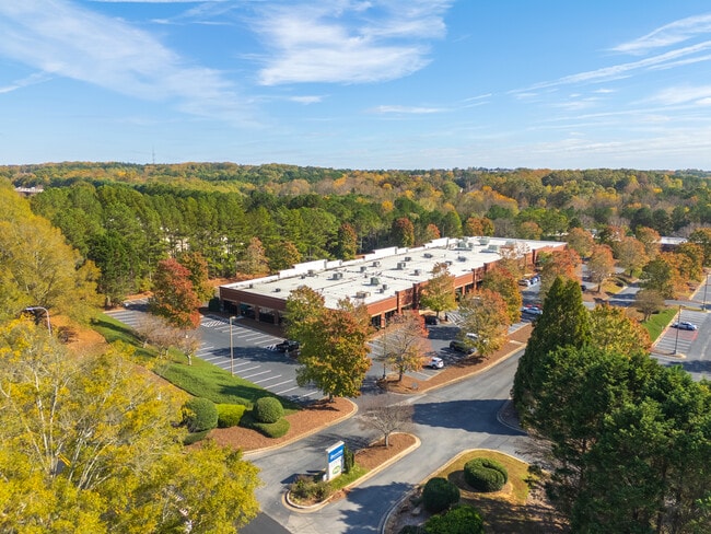
Property Record
6435 Shiloh Rd, Alpharetta, GA 30005
Current Lease Availabilities
NEARBY LISTINGS FOR SALE OR LEASE
Property Detail
6435 Shiloh Rd
065-045
2-1 912-961
Officebuilding
Forsyth
X
Georgia
13121C0077F
912
2024
4.38 AC
2025
N Fulton/Forsyth Cnty
130603
Atlanta
52,824 SF
Atlanta-Sandy Springs-Roswell, GA
DEMOGRAPHICS near 6435 Shiloh Rd
1 Mile
3 Mile
5 Mile
2024 Total Population
3,834
66,019
179,701
2029 Population
4,479
73,545
196,188
Pop Growth 2024-2029
+ 16.82%
+ 11.40%
+ 9.17%
Average Age
38
38
38
2024 Total Households
1,415
22,612
61,057
HH Growth 2024-2029
+ 17.53%
+ 11.41%
+ 8.92%
Median Household Inc
$145,214
$132,180
$136,311
Avg Household Size
2.70
2.90
2.90
2024 Avg HH Vehicles
2.00
2.00
2.00
Median Home Value
$477,909
$481,367
$478,233
Median Year Built
2010
2001
1999
Nearby Places
- Restaurants
- Banks
- Shops
- Fitness
- Groceries
Nearby Properties
Address
Land Use
TOTAL SIZE
Lot Size
Zoning
Address
Land Use
TOTAL SIZE
Lot Size
Zoning
383,859 SF
9.55 AC
CBD
Address
Land Use
TOTAL SIZE
Lot Size
Zoning
4,519,676 SF
29 AC
AC
Address
Land Use
TOTAL SIZE
Lot Size
Zoning
406,800 SF
11.61 AC
MP
Address
Land Use
TOTAL SIZE
Lot Size
Zoning
477,112 SF
20.58 AC
MP
Address
Land Use
TOTAL SIZE
Lot Size
Zoning
5,168,439 SF
45 AC
AC
Address
Land Use
TOTAL SIZE
Lot Size
Zoning
2,044,910 SF
30.61 AC
CUP
Address
Land Use
TOTAL SIZE
Lot Size
Zoning
997,824 SF
32.63 AC
CUP
Address
Land Use
TOTAL SIZE
Lot Size
Zoning
328,265 SF
4 AC
MP
Address
Land Use
TOTAL SIZE
Lot Size
Zoning
281,780 SF
19.08 AC
PUD
Address
Land Use
TOTAL SIZE
Lot Size
Zoning
2,308,770 SF
32 AC
C1C
Address
Land Use
TOTAL SIZE
Lot Size
Zoning
311,452 SF
29.19 AC
CUP
Address
Land Use
TOTAL SIZE
Lot Size
Zoning
9.04 AC
CBD
Address
Land Use
TOTAL SIZE
Lot Size
Zoning
56,313 SF
13.37 AC
MP
Address
Land Use
TOTAL SIZE
Lot Size
Zoning
10,908 SF
107.57 AC
RES3
Address
Land Use
TOTAL SIZE
Lot Size
Zoning
309,293 SF
16 AC
CBD
Address
Land Use
TOTAL SIZE
Lot Size
Zoning
47,721 SF
12.99 AC
CBD
Address
Land Use
TOTAL SIZE
Lot Size
Zoning
2.12 AC
MP
Address
Land Use
TOTAL SIZE
Lot Size
Zoning
90,671 SF
11.03 AC
MP
Address
Land Use
TOTAL SIZE
Lot Size
Zoning
504,893 SF
17.14 AC
CUP
Address
Land Use
TOTAL SIZE
Lot Size
Zoning
435,455 SF
40.09 AC
CUP
Address
Land Use
TOTAL SIZE
Lot Size
Zoning
119,926 SF
23.23 AC
M1
Address
Land Use
TOTAL SIZE
Lot Size
Zoning
249,386 SF
33.24 AC
RES6
Address
Land Use
TOTAL SIZE
Lot Size
Zoning
4,616 SF
12.30 AC
R3
Address
Land Use
TOTAL SIZE
Lot Size
Zoning
387,678 SF
23.09 AC
CUP
Address
Land Use
TOTAL SIZE
Lot Size
Zoning
170,400 SF
24.98 AC
M1
Address
Land Use
TOTAL SIZE
Lot Size
Zoning
222,893 SF
103.13 AC
M1
Address
Land Use
TOTAL SIZE
Lot Size
Zoning
141,728 SF
32.45 AC
M1
Address
Land Use
TOTAL SIZE
Lot Size
Zoning
255,201 SF
19.87 AC
CUP
Address
Land Use
TOTAL SIZE
Lot Size
Zoning
182,039 SF
19.40 AC
CUP
Address
Land Use
TOTAL SIZE
Lot Size
Zoning
1,121,442 SF
13 AC
A0
The World's #1 Commercial Real Estate Marketplace
Connect with us
© 2025 CoStar Group
The information above has been obtained from sources believed reliable. While we do not doubt its accuracy we have not verified it and make no guarantee, warranty or representation about it. It is your responsibility to independently confirm its accuracy and completeness. Any projections, opinions, assumptions, or estimates used are for example only and do not represent the current or future performance of the property. The value of this transaction to you depends on tax and other factors which should be evaluated by your tax, financial, and legal advisors. You and your advisors should conduct a careful, independent investigation of the property to determine to your satisfaction the suitability of the property for your needs.