Property Record
6435 S Pulaski Rd, Chicago, IL 60629


NEARBY LISTINGS FOR SALE OR LEASE
Property Detail
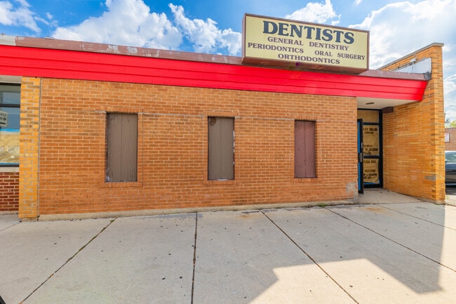
6435 S Pulaski Rd
19-23-112-002-0000
Mandells Sub
Commercialbuilding
Cook
X
Illinois
17031C0515J
6
2023
0.74 AC
2024
South Chicago
650302
Chicago
2,430 SF
Chicago-Naperville-Elgin, IL-IN-WI
DEMOGRAPHICS near 6435 S Pulaski Rd
1 Mile
3 Mile
5 Mile
2024 Total Population
42,099
252,623
604,638
2029 Population
39,632
237,905
571,130
Pop Growth 2024-2029
(5.86%)
(5.83%)
(5.54%)
Average Age
36
37
38
2024 Total Households
11,339
75,184
194,970
HH Growth 2024-2029
(6.24%)
(6.15%)
(5.77%)
Median Household Inc
$58,117
$54,011
$52,528
Avg Household Size
3.60
3.20
2.90
2024 Avg HH Vehicles
2.00
2.00
2.00
Median Home Value
$223,137
$213,624
$219,318
Median Year Built
1952
1953
1952
Nearby Places
Map Layers
Map Styles
 Street
 Aerial
- Restaurants
- Banks
- Shops
- Fitness
- Groceries
PUBLIC TRANSPORTATION
COMMUTER RAIL
Ashburn Station (SouthWest Service - Northeast Illinois Regional Commuter Railroad (Metra))
DRIVE
WALK
Distance
Ashburn Station (SouthWest Service - Northeast Illinois Regional Commuter Railroad (Metra))
6 min
2.8 mi
Wrightwood Station (SouthWest Service - Northeast Illinois Regional Commuter Railroad (Metra))
DRIVE
WALK
Distance
Wrightwood Station (SouthWest Service - Northeast Illinois Regional Commuter Railroad (Metra))
6 min
2.9 mi
AIRPORT
Chicago Midway International
DRIVE
WALK
Distance
Chicago Midway International
5 min
2.0 mi
Chicago O'Hare International
DRIVE
WALK
Distance
Chicago O'Hare International
60 min
24.5 mi
SALE & LEASE HISTORY
LISTING DATE
SALE/LEASE

Oct 19, 2023
For Sale
Nearby Properties
Address
Land Use
TOTAL SIZE
Lot Size
Zoning
Address
Land Use
TOTAL SIZE
Lot Size
Zoning
4.71 AC
PD 1196
Address
Land Use
TOTAL SIZE
Lot Size
Zoning
2.98 AC
PD 1196
Address
Land Use
TOTAL SIZE
Lot Size
Zoning
134,800 SF
2.53 AC
PD 1273
Address
Land Use
TOTAL SIZE
Lot Size
Zoning
1,269,112 SF
39.99 AC
M2-1
Address
Land Use
TOTAL SIZE
Lot Size
Zoning
2,155,128 SF
63.23 AC
PMD13
Address
Land Use
TOTAL SIZE
Lot Size
Zoning
87,830 SF
0.76 AC
B1-1
Address
Land Use
TOTAL SIZE
Lot Size
Zoning
798,998 SF
B3-2
Address
Land Use
TOTAL SIZE
Lot Size
Zoning
133,354 SF
PD 1198
Address
Land Use
TOTAL SIZE
Lot Size
Zoning
124,324 SF
11.26 AC
Address
Land Use
TOTAL SIZE
Lot Size
Zoning
0.84 AC
B1-3
Address
Land Use
TOTAL SIZE
Lot Size
Zoning
796,454 SF
25.68 AC
PMD13
Address
Land Use
TOTAL SIZE
Lot Size
Zoning
1,615,006 SF
41.91 AC
PMD13
Address
Land Use
TOTAL SIZE
Lot Size
Zoning
139,493 SF
9.06 AC
PD 965
Address
Land Use
TOTAL SIZE
Lot Size
Zoning
57,366 SF
10 AC
Address
Land Use
TOTAL SIZE
Lot Size
Zoning
131,261 SF
7.04 AC
PD 172
Address
Land Use
TOTAL SIZE
Lot Size
Zoning
151,303 SF
0.88 AC
PD 568
Address
Land Use
TOTAL SIZE
Lot Size
Zoning
134,078 SF
17.31 AC
Address
Land Use
TOTAL SIZE
Lot Size
Zoning
PD 610
Address
Land Use
TOTAL SIZE
Lot Size
Zoning
310,775 SF
12.46 AC
M2-3
Address
Land Use
TOTAL SIZE
Lot Size
Zoning
102,534 SF
3.87 AC
Address
Land Use
TOTAL SIZE
Lot Size
Zoning
148,474 SF
17.68 AC
Address
Land Use
TOTAL SIZE
Lot Size
Zoning
93,438 SF
3.13 AC
Address
Land Use
TOTAL SIZE
Lot Size
Zoning
86,703 SF
3.37 AC
Address
Land Use
TOTAL SIZE
Lot Size
Zoning
307,400 SF
7.89 AC
M2-3
Address
Land Use
TOTAL SIZE
Lot Size
Zoning
435,677 SF
12.37 AC
M1-2
Address
Land Use
TOTAL SIZE
Lot Size
Zoning
101,034 SF
1.92 AC
Address
Land Use
TOTAL SIZE
Lot Size
Zoning
Address
Land Use
TOTAL SIZE
Lot Size
Zoning
90,808 SF
3.27 AC
Address
Land Use
TOTAL SIZE
Lot Size
Zoning
8,400 SF
0.53 AC
M1-1
Address
Land Use
TOTAL SIZE
Lot Size
Zoning
470,160 SF
23.66 AC
The World's #1 Commercial Real Estate Marketplace
Connect with us
© 2025 CoStar Group
The information above has been obtained from sources believed reliable. While we do not doubt its accuracy we have not verified it and make no guarantee, warranty or representation about it. It is your responsibility to independently confirm its accuracy and completeness. Any projections, opinions, assumptions, or estimates used are for example only and do not represent the current or future performance of the property. The value of this transaction to you depends on tax and other factors which should be evaluated by your tax, financial, and legal advisors. You and your advisors should conduct a careful, independent investigation of the property to determine to your satisfaction the suitability of the property for your needs.