Property Record
645 Anchors St Nw, Fort Walton Beach, FL 32548


NEARBY LISTINGS FOR SALE OR LEASE
Property Detail
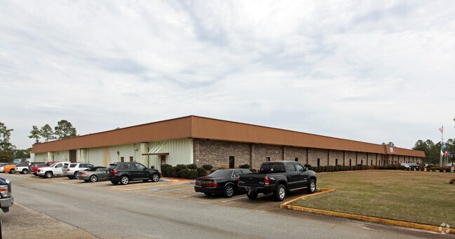
645 Anchors St Nw
09-2S-24-0000-0093-0180
COM SW COR SEC NLY TO R/W OF STATE RD 189-A E1109.34 FT TO BEG E245.98 FT S643.95 FT TO R/W W445.98 FT N321.97 FT E200 FT N321.98 FT TO BEG
Lightindustrial
Okaloosa
X
Florida
12091C0441J
180
2025
5.11 AC
2025
Fort Walton Beach
022900
Other Market Areas
74,560 SF
Crestview-Fort Walton Beach-Destin, FL
DEMOGRAPHICS near 645 Anchors St Nw
1 Mile
3 Mile
5 Mile
2024 Total Population
6,305
42,212
68,055
2029 Population
6,605
44,166
71,569
Pop Growth 2024-2029
+ 4.76%
+ 4.63%
+ 5.16%
Average Age
39
39
40
2024 Total Households
2,447
17,605
29,098
HH Growth 2024-2029
+ 4.70%
+ 4.64%
+ 5.36%
Median Household Inc
$60,943
$58,806
$58,856
Avg Household Size
2.50
2.30
2.20
2024 Avg HH Vehicles
2.00
2.00
2.00
Median Home Value
$231,750
$246,819
$270,932
Median Year Built
1983
1981
1981
Nearby Places
Map Layers
Map Styles
 Street
 Aerial
- Restaurants
- Banks
- Shops
- Fitness
- Groceries
PUBLIC TRANSPORTATION
AIRPORT
Eglin AFB/Destin-Ft Walton Beach
DRIVE
WALK
Distance
Eglin AFB/Destin-Ft Walton Beach
32 min
13.4 mi
Pensacola International
DRIVE
WALK
Distance
Pensacola International
74 min
43.2 mi
Nearby Properties
Address
Land Use
TOTAL SIZE
Lot Size
Zoning
Address
Land Use
TOTAL SIZE
Lot Size
Zoning
1,954.92 AC
Address
Land Use
TOTAL SIZE
Lot Size
Zoning
173,879 SF
9 AC
Address
Land Use
TOTAL SIZE
Lot Size
Zoning
342,628 SF
14.83 AC
Address
Land Use
TOTAL SIZE
Lot Size
Zoning
120,159 SF
14.82 AC
Address
Land Use
TOTAL SIZE
Lot Size
Zoning
8,066.36 AC
Address
Land Use
TOTAL SIZE
Lot Size
Zoning
Address
Land Use
TOTAL SIZE
Lot Size
Zoning
282,804 SF
78.70 AC
Address
Land Use
TOTAL SIZE
Lot Size
Zoning
216,839 SF
9.63 AC
Address
Land Use
TOTAL SIZE
Lot Size
Zoning
55,566 SF
5.40 AC
Address
Land Use
TOTAL SIZE
Lot Size
Zoning
85,571 SF
4.54 AC
Address
Land Use
TOTAL SIZE
Lot Size
Zoning
Address
Land Use
TOTAL SIZE
Lot Size
Zoning
182,844 SF
20.62 AC
Address
Land Use
TOTAL SIZE
Lot Size
Zoning
159,550 SF
31.10 AC
Address
Land Use
TOTAL SIZE
Lot Size
Zoning
140,945 SF
80.64 AC
Address
Land Use
TOTAL SIZE
Lot Size
Zoning
76,342 SF
6.04 AC
Address
Land Use
TOTAL SIZE
Lot Size
Zoning
62,097 SF
4.86 AC
Address
Land Use
TOTAL SIZE
Lot Size
Zoning
75,892 SF
1.72 AC
Address
Land Use
TOTAL SIZE
Lot Size
Zoning
59,257 SF
2.99 AC
Address
Land Use
TOTAL SIZE
Lot Size
Zoning
3,894 SF
315.07 AC
Address
Land Use
TOTAL SIZE
Lot Size
Zoning
121,164 SF
5.78 AC
Address
Land Use
TOTAL SIZE
Lot Size
Zoning
51,030 SF
1.82 AC
Address
Land Use
TOTAL SIZE
Lot Size
Zoning
216,395 SF
5.08 AC
Address
Land Use
TOTAL SIZE
Lot Size
Zoning
108,284 SF
5.47 AC
Address
Land Use
TOTAL SIZE
Lot Size
Zoning
287,257 SF
13.86 AC
Address
Land Use
TOTAL SIZE
Lot Size
Zoning
229,805 SF
19.31 AC
Address
Land Use
TOTAL SIZE
Lot Size
Zoning
Address
Land Use
TOTAL SIZE
Lot Size
Zoning
71,050 SF
2.52 AC
Address
Land Use
TOTAL SIZE
Lot Size
Zoning
78,958 SF
7.88 AC
Address
Land Use
TOTAL SIZE
Lot Size
Zoning
146,143 SF
19.39 AC
Address
Land Use
TOTAL SIZE
Lot Size
Zoning
51,195 SF
6.10 AC
The World's #1 Commercial Real Estate Marketplace
Connect with us
© 2026 CoStar Group
The information above has been obtained from sources believed reliable. While we do not doubt its accuracy we have not verified it and make no guarantee, warranty or representation about it. It is your responsibility to independently confirm its accuracy and completeness. Any projections, opinions, assumptions, or estimates used are for example only and do not represent the current or future performance of the property. The value of this transaction to you depends on tax and other factors which should be evaluated by your tax, financial, and legal advisors. You and your advisors should conduct a careful, independent investigation of the property to determine to your satisfaction the suitability of the property for your needs.