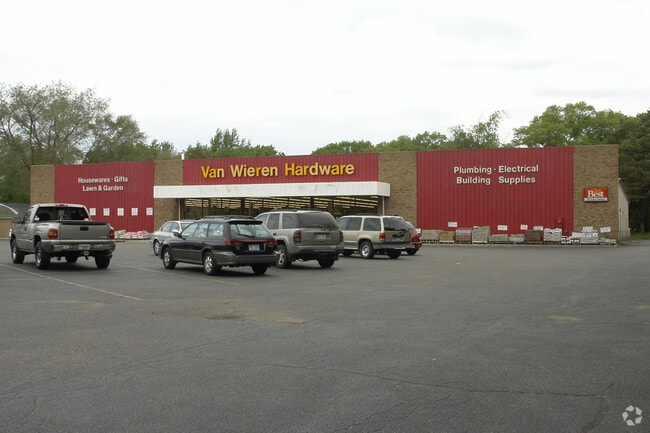
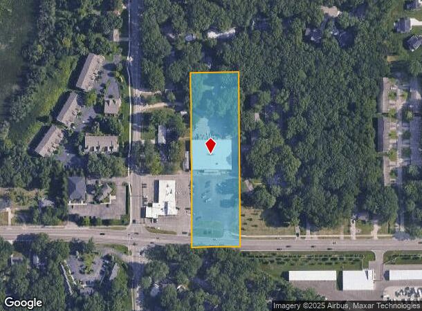
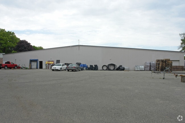
Property Record
645 Douglas Ave, Holland, MI 49424
NEARBY LISTINGS FOR SALE OR LEASE
Property Detail
645 Douglas Ave
70-16-19-300-049
PART SW 1/4 OF SW 1/4 COM 220 FT E OF SW COR, TH N 725 FT, E 200 FT, S 725 FT, TH W 200 FT TO BEG SEC 19 T5N R15W 33 A
Wholesaleoutletdiscountstore
Ottawa
X
Michigan
26005C0020G
3.18 AC
2025
Holland West
2025
West Michigan
025102
Grand Rapids-Wyoming, MI
1,086 SF
DEMOGRAPHICS near 645 Douglas Ave
1 Mile
3 Mile
5 Mile
2024 Total Population
4,794
57,023
92,708
2029 Population
5,037
59,467
96,917
Pop Growth 2024-2029
+ 5.07%
+ 4.29%
+ 4.54%
Average Age
42
39
39
2024 Total Households
1,905
21,008
34,706
HH Growth 2024-2029
+ 5.20%
+ 4.44%
+ 4.70%
Median Household Inc
$73,361
$72,304
$75,608
Avg Household Size
2.50
2.50
2.50
2024 Avg HH Vehicles
2.00
2.00
2.00
Median Home Value
$274,012
$231,603
$248,964
Median Year Built
1981
1975
1982
Nearby Places
Map Layers
Map Styles
 Street
 Aerial
- Restaurants
- Banks
- Shops
- Fitness
- Groceries
PUBLIC TRANSPORTATION
COMMUTER RAIL
Holland Amtrak Station (Pere Marquette - Amtrak)
DRIVE
WALK
Distance
Holland Amtrak Station (Pere Marquette - Amtrak)
7 min
3.1 mi
Freight Ports
Port Milwaukee
DRIVE
WALK
Distance
Port Milwaukee
282 min
237.5 mi
Nearby Properties
Address
Land Use
TOTAL SIZE
Lot Size
Zoning
Address
Land Use
TOTAL SIZE
Lot Size
Zoning
572,832 SF
10.89 AC
PUD
Address
Land Use
TOTAL SIZE
Lot Size
Zoning
362,916 SF
19.23 AC
I-2
Address
Land Use
TOTAL SIZE
Lot Size
Zoning
391,255 SF
40.67 AC
I-2
Address
Land Use
TOTAL SIZE
Lot Size
Zoning
660,002 SF
32.13 AC
I-2
Address
Land Use
TOTAL SIZE
Lot Size
Zoning
320,270 SF
33.25 AC
PUD
Address
Land Use
TOTAL SIZE
Lot Size
Zoning
329,784 SF
38.51 AC
I-2
Address
Land Use
TOTAL SIZE
Lot Size
Zoning
131,497 SF
37.54 AC
I-2
Address
Land Use
TOTAL SIZE
Lot Size
Zoning
83,100 SF
Address
Land Use
TOTAL SIZE
Lot Size
Zoning
137,732 SF
12.94 AC
C-2
Address
Land Use
TOTAL SIZE
Lot Size
Zoning
94,790 SF
1.74 AC
C-2
Address
Land Use
TOTAL SIZE
Lot Size
Zoning
58,710 SF
6.96 AC
C-2
Address
Land Use
TOTAL SIZE
Lot Size
Zoning
209,455 SF
17 AC
C-2
Address
Land Use
TOTAL SIZE
Lot Size
Zoning
Address
Land Use
TOTAL SIZE
Lot Size
Zoning
177,800 SF
12.34 AC
I-2
Address
Land Use
TOTAL SIZE
Lot Size
Zoning
114,088 SF
10.79 AC
PRD
Address
Land Use
TOTAL SIZE
Lot Size
Zoning
144,764 SF
16.32 AC
R-3
Address
Land Use
TOTAL SIZE
Lot Size
Zoning
134,490 SF
15.76 AC
C-2
Address
Land Use
TOTAL SIZE
Lot Size
Zoning
149,348 SF
9.22 AC
I-2
Address
Land Use
TOTAL SIZE
Lot Size
Zoning
65.75 AC
PUD
Address
Land Use
TOTAL SIZE
Lot Size
Zoning
180,160 SF
Address
Land Use
TOTAL SIZE
Lot Size
Zoning
372,017 SF
17.60 AC
R-2
Address
Land Use
TOTAL SIZE
Lot Size
Zoning
127,432 SF
3.77 AC
C-2
Address
Land Use
TOTAL SIZE
Lot Size
Zoning
122,026 SF
15.03 AC
R3
Address
Land Use
TOTAL SIZE
Lot Size
Zoning
90,865 SF
4.14 AC
C-2
Address
Land Use
TOTAL SIZE
Lot Size
Zoning
22,344 SF
8.16 AC
R-3
Address
Land Use
TOTAL SIZE
Lot Size
Zoning
2,173 SF
77.26 AC
R-4
Address
Land Use
TOTAL SIZE
Lot Size
Zoning
152,926 SF
8.83 AC
I-2
Address
Land Use
TOTAL SIZE
Lot Size
Zoning
131,573 SF
13.04 AC
C-2
Address
Land Use
TOTAL SIZE
Lot Size
Zoning
386,644 SF
22.74 AC
I
Address
Land Use
TOTAL SIZE
Lot Size
Zoning
201,907 SF
15.96 AC
I-2
The World's #1 Commercial Real Estate Marketplace
Connect with us
© 2026 CoStar Group
The information above has been obtained from sources believed reliable. While we do not doubt its accuracy we have not verified it and make no guarantee, warranty or representation about it. It is your responsibility to independently confirm its accuracy and completeness. Any projections, opinions, assumptions, or estimates used are for example only and do not represent the current or future performance of the property. The value of this transaction to you depends on tax and other factors which should be evaluated by your tax, financial, and legal advisors. You and your advisors should conduct a careful, independent investigation of the property to determine to your satisfaction the suitability of the property for your needs.