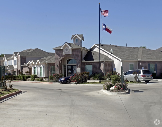
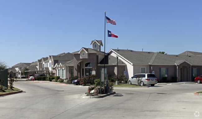
Property Record
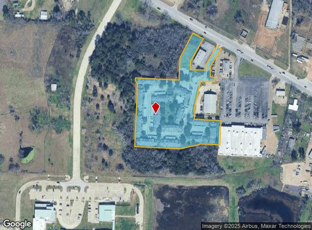
645 Highway 290 E, Hempstead, TX 77445
Property Detail
645 Highway 290 E
Houston-Pasadena-The Woodlands, TX
S519065 HEMPSTEAD TRADE MART S/D LOT PT 2-A ACRES 5.777
208140
WALLER
Apartment
Texas
B and X Area of moderate flood hazard, usually the area between the limits of the 100-year and 500-year floods.
2
2023
5.78 AC
2025
Waller County
680501
Houston
100,365 SF
NEARBY LISTINGS FOR SALE OR LEASE
-
-
View all Hempstead listings for sale on LoopNet.com
DEMOGRAPHICS near 645 Highway 290 E
1 mile
3 mile
5 mile
2025 Total Population
2,420
7,150
11,007
2030 Population
2,660
7,880
12,138
Pop Growth 2025-2030
+ 9.92%
+ 10.21%
+ 10.28%
Average Age
38
37
38
2025 Total Households
890
2,567
3,980
HH Growth 2025-2030
+ 9.78%
+ 9.89%
+ 10.05%
Median Household Inc
$53,417
$55,515
$54,624
Avg Household Size
2.60
2.70
2.70
2025 Avg HH Vehicles
1.00
2.00
2.00
Median Home Value
$185,999
$216,783
$238,617
Median Year Built
1985
1986
1987
Nearby Places
Map Layers
Map Styles
 Street
 Aerial
Transit
 Traffic
 Biking
Places
Listings with unknown addresses are not visible on the map
- Restaurants
- Banks
- Shops
- Fitness
- Groceries
Nearby Properties
Address
Land Use
TOTAL SIZE
Lot Size
Zoning
Address
Land Use
TOTAL SIZE
Lot Size
Zoning
153,346 SF
8.52 AC
Address
Land Use
TOTAL SIZE
Lot Size
Zoning
52,080 SF
1 AC
Address
Land Use
TOTAL SIZE
Lot Size
Zoning
115,850 SF
58.30 AC
Address
Land Use
TOTAL SIZE
Lot Size
Zoning
76,137 SF
15 AC
Address
Land Use
TOTAL SIZE
Lot Size
Zoning
672 SF
136.86 AC
Address
Land Use
TOTAL SIZE
Lot Size
Zoning
169,905 SF
33.06 AC
Address
Land Use
TOTAL SIZE
Lot Size
Zoning
40,382 SF
145.93 AC
Address
Land Use
TOTAL SIZE
Lot Size
Zoning
2 SF
25 AC
Address
Land Use
TOTAL SIZE
Lot Size
Zoning
5,120 SF
114.96 AC
Address
Land Use
TOTAL SIZE
Lot Size
Zoning
16,188 SF
8.48 AC
Address
Land Use
TOTAL SIZE
Lot Size
Zoning
100,861 SF
28.29 AC
Address
Land Use
TOTAL SIZE
Lot Size
Zoning
57,132 SF
5 AC
Address
Land Use
TOTAL SIZE
Lot Size
Zoning
45,864 SF
4.47 AC
Address
Land Use
TOTAL SIZE
Lot Size
Zoning
127,162 SF
11 AC
Address
Land Use
TOTAL SIZE
Lot Size
Zoning
52,544 SF
5.76 AC
Address
Land Use
TOTAL SIZE
Lot Size
Zoning
62,315 SF
10.57 AC
Address
Land Use
TOTAL SIZE
Lot Size
Zoning
84,537 SF
4.80 AC
Address
Land Use
TOTAL SIZE
Lot Size
Zoning
31,193 SF
12.04 AC
Address
Land Use
TOTAL SIZE
Lot Size
Zoning
30,255 SF
19.61 AC
Address
Land Use
TOTAL SIZE
Lot Size
Zoning
19,840 SF
1.44 AC
Address
Land Use
TOTAL SIZE
Lot Size
Zoning
0.72 AC
Address
Land Use
TOTAL SIZE
Lot Size
Zoning
42,142 SF
6.82 AC
Address
Land Use
TOTAL SIZE
Lot Size
Zoning
27,966 SF
9.38 AC
Address
Land Use
TOTAL SIZE
Lot Size
Zoning
14,800 SF
1.49 AC
Address
Land Use
TOTAL SIZE
Lot Size
Zoning
10,855 SF
1.45 AC
Address
Land Use
TOTAL SIZE
Lot Size
Zoning
28,224 SF
0.72 AC
Address
Land Use
TOTAL SIZE
Lot Size
Zoning
13,200 SF
17.99 AC
Address
Land Use
TOTAL SIZE
Lot Size
Zoning
46,384 SF
9.86 AC
The World's #1 Commercial Real Estate Marketplace
Connect with us
© 2026 CoStar Group
The information above has been obtained from sources believed reliable. While we do not doubt its accuracy we have not verified it and make no guarantee, warranty or representation about it. It is your responsibility to independently confirm its accuracy and completeness. Any projections, opinions, assumptions, or estimates used are for example only and do not represent the current or future performance of the property. The value of this transaction to you depends on tax and other factors which should be evaluated by your tax, financial, and legal advisors. You and your advisors should conduct a careful, independent investigation of the property to determine to your satisfaction the suitability of the property for your needs.