Property Record
49 E Magnolia St, Mc Rae Helena, GA 31055
NEARBY LISTINGS FOR SALE OR LEASE
-
-
View all Mc Rae Helena listings for sale on LoopNet.com
Property Detail
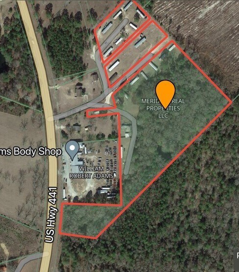
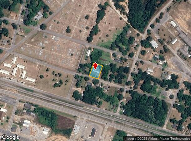
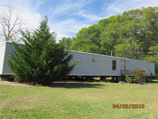
49 E Magnolia St
Other Market Areas
Mcrae 004
MC2000-054
Telfair
Mobilemanufacturedhomeregardlessoflandownership
Georgia
X
0.34 AC
13271C0075C
Georgia South Area
924 SF
DEMOGRAPHICS near 49 E Magnolia St
1 Mile
3 Mile
5 Mile
2024 Total Population
848
6,874
8,160
2029 Population
830
6,807
8,076
Pop Growth 2024-2029
(2.12%)
(0.97%)
(1.03%)
Average Age
42
42
42
2024 Total Households
129
1,877
2,206
HH Growth 2024-2029
(3.88%)
(0.75%)
(0.91%)
Median Household Inc
$27,272
$48,043
$46,896
Avg Household Size
2.40
2.40
2.40
2024 Avg HH Vehicles
2.00
2.00
2.00
Median Home Value
$88,749
$90,542
$87,827
Median Year Built
1973
1973
1974
Nearby Places
Map Layers
Map Styles
 Street
 Aerial
- Restaurants
- Banks
- Shops
- Fitness
- Groceries
SALE & LEASE HISTORY
LISTING DATE
SALE/LEASE

Mar 28, 2024
For Sale
Nearby Properties
Address
Land Use
TOTAL SIZE
Lot Size
Zoning
Address
Land Use
TOTAL SIZE
Lot Size
Zoning
301,398 SF
69.48 AC
RESIDENTIA
Address
Land Use
TOTAL SIZE
Lot Size
Zoning
54,206 SF
16.68 AC
RESIDENTIA
Address
Land Use
TOTAL SIZE
Lot Size
Zoning
3,633 SF
8.31 AC
RESIDENTIA
Address
Land Use
TOTAL SIZE
Lot Size
Zoning
17,572 SF
2.73 AC
RESIDENTIA
Address
Land Use
TOTAL SIZE
Lot Size
Zoning
42,706 SF
4.42 AC
RESIDENTIA
Address
Land Use
TOTAL SIZE
Lot Size
Zoning
1,764 SF
0.30 AC
001
Address
Land Use
TOTAL SIZE
Lot Size
Zoning
6,720 SF
4.08 AC
RESIDENTIA
Address
Land Use
TOTAL SIZE
Lot Size
Zoning
54,050 SF
12 AC
RESIDENTIA
Address
Land Use
TOTAL SIZE
Lot Size
Zoning
29,250 SF
7.05 AC
RESIDENTIA
Address
Land Use
TOTAL SIZE
Lot Size
Zoning
15,775 SF
0.73 AC
RESIDENTIA
Address
Land Use
TOTAL SIZE
Lot Size
Zoning
1,567 SF
2.10 AC
RESIDENTIA
Address
Land Use
TOTAL SIZE
Lot Size
Zoning
4,627 SF
0.28 AC
RESIDENTIA
Address
Land Use
TOTAL SIZE
Lot Size
Zoning
816 SF
7.87 AC
RESIDENTIA
Address
Land Use
TOTAL SIZE
Lot Size
Zoning
39,946 SF
2.20 AC
RESIDENTIA
Address
Land Use
TOTAL SIZE
Lot Size
Zoning
4,400 SF
0.69 AC
RESIDENTIA
Address
Land Use
TOTAL SIZE
Lot Size
Zoning
30,247 SF
2.11 AC
RESIDENTIA
Address
Land Use
TOTAL SIZE
Lot Size
Zoning
9,502 SF
6.67 AC
RESIDENTIA
Address
Land Use
TOTAL SIZE
Lot Size
Zoning
28,458 SF
2.88 AC
RESIDENTIA
Address
Land Use
TOTAL SIZE
Lot Size
Zoning
10,696 SF
2.44 AC
RESIDENTIA
Address
Land Use
TOTAL SIZE
Lot Size
Zoning
8,576 SF
1.22 AC
RESIDENTIA
Address
Land Use
TOTAL SIZE
Lot Size
Zoning
12,804 SF
11.80 AC
RESIDENTIA
Address
Land Use
TOTAL SIZE
Lot Size
Zoning
13,250 SF
11.98 AC
RESIDENTIA
Address
Land Use
TOTAL SIZE
Lot Size
Zoning
20,800 SF
4.74 AC
RESIDENTIA
Address
Land Use
TOTAL SIZE
Lot Size
Zoning
30,000 SF
4.40 AC
RESIDENTIA
Address
Land Use
TOTAL SIZE
Lot Size
Zoning
41,864 SF
14.04 AC
RESIDENTIA
Address
Land Use
TOTAL SIZE
Lot Size
Zoning
9,813 SF
1.02 AC
RESIDENTIA
The World's #1 Commercial Real Estate Marketplace
Connect with us
© 2025 CoStar Group
The information above has been obtained from sources believed reliable. While we do not doubt its accuracy we have not verified it and make no guarantee, warranty or representation about it. It is your responsibility to independently confirm its accuracy and completeness. Any projections, opinions, assumptions, or estimates used are for example only and do not represent the current or future performance of the property. The value of this transaction to you depends on tax and other factors which should be evaluated by your tax, financial, and legal advisors. You and your advisors should conduct a careful, independent investigation of the property to determine to your satisfaction the suitability of the property for your needs.