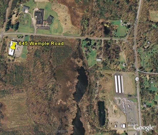
Property Record
645 Wemple Rd, Glenmont, NY 12077


NEARBY LISTINGS FOR SALE OR LEASE
-
-
View all Glenmont listings for sale on LoopNet.com
Property Detail
645 Wemple Rd
012200-110-000-0002-008-022-0000
EASTERN INGREDIENTS
Warehouse
Albany
X
New York
36083C0334D
8.022
2025
6.68 AC
2024
W Outer Albany County
014301
Albany/Schenectady/Troy
23,185 SF
Albany-Schenectady-Troy, NY
DEMOGRAPHICS near 645 Wemple Rd
1 Mile
3 Mile
5 Mile
2024 Total Population
252
11,000
63,074
2029 Population
252
10,943
62,333
Pop Growth 2024-2029
0.00%
(0.52%)
(1.17%)
Average Age
44
42
41
2024 Total Households
107
4,372
26,258
HH Growth 2024-2029
0.00%
(0.57%)
(1.24%)
Median Household Inc
$76,136
$103,996
$84,837
Avg Household Size
2.10
2.40
2.30
2024 Avg HH Vehicles
2.00
2.00
2.00
Median Home Value
$277,499
$317,915
$256,911
Median Year Built
1977
1983
1964
Nearby Places
Map Layers
Map Styles
 Street
 Aerial
- Restaurants
- Banks
- Shops
- Fitness
- Groceries
PUBLIC TRANSPORTATION
COMMUTER RAIL
DRIVE
WALK
Distance
15 min
6.5 mi
AIRPORT
Albany International
DRIVE
WALK
Distance
Albany International
30 min
16.4 mi
Freight Ports
Albany, NY Port
DRIVE
WALK
Distance
Albany, NY Port
9 min
4.5 mi
Nearby Properties
Address
Land Use
TOTAL SIZE
Lot Size
Zoning
Address
Land Use
TOTAL SIZE
Lot Size
Zoning
83.50 AC
Address
Land Use
TOTAL SIZE
Lot Size
Zoning
102,995 SF
153.50 AC
RR
Address
Land Use
TOTAL SIZE
Lot Size
Zoning
203,781 SF
39.30 AC
C
Address
Land Use
TOTAL SIZE
Lot Size
Zoning
0.01 AC
I
Address
Land Use
TOTAL SIZE
Lot Size
Zoning
45,898 SF
12.91 AC
CH
Address
Land Use
TOTAL SIZE
Lot Size
Zoning
6,388 SF
28.34 AC
A-R
Address
Land Use
TOTAL SIZE
Lot Size
Zoning
115,080 SF
18.20 AC
ME
Address
Land Use
TOTAL SIZE
Lot Size
Zoning
121,323 SF
13.54 AC
CH
Address
Land Use
TOTAL SIZE
Lot Size
Zoning
9,120 SF
12.95 AC
H
Address
Land Use
TOTAL SIZE
Lot Size
Zoning
80,096 SF
14.67 AC
H
Address
Land Use
TOTAL SIZE
Lot Size
Zoning
12,088 SF
42.30 AC
I
Address
Land Use
TOTAL SIZE
Lot Size
Zoning
134,567 SF
32.80 AC
C
Address
Land Use
TOTAL SIZE
Lot Size
Zoning
57.32 AC
R-4 P
Address
Land Use
TOTAL SIZE
Lot Size
Zoning
Address
Land Use
TOTAL SIZE
Lot Size
Zoning
16.80 AC
Address
Land Use
TOTAL SIZE
Lot Size
Zoning
30,459 SF
14 AC
C
Address
Land Use
TOTAL SIZE
Lot Size
Zoning
71,721 SF
16.65 AC
C
Address
Land Use
TOTAL SIZE
Lot Size
Zoning
17,212 SF
88.10 AC
I
Address
Land Use
TOTAL SIZE
Lot Size
Zoning
77,626 SF
54.30 AC
R
Address
Land Use
TOTAL SIZE
Lot Size
Zoning
0.01 AC
Address
Land Use
TOTAL SIZE
Lot Size
Zoning
7,494 SF
28.78 AC
RH
Address
Land Use
TOTAL SIZE
Lot Size
Zoning
49,813 SF
17.80 AC
RA
Address
Land Use
TOTAL SIZE
Lot Size
Zoning
13,267 SF
1.87 AC
CH
Address
Land Use
TOTAL SIZE
Lot Size
Zoning
57.24 AC
R
Address
Land Use
TOTAL SIZE
Lot Size
Zoning
10,752 SF
20 AC
RH
Address
Land Use
TOTAL SIZE
Lot Size
Zoning
7,018 SF
10.20 AC
MR
Address
Land Use
TOTAL SIZE
Lot Size
Zoning
22,640 SF
4.52 AC
I
Address
Land Use
TOTAL SIZE
Lot Size
Zoning
10,374 SF
7.44 AC
R
Address
Land Use
TOTAL SIZE
Lot Size
Zoning
29,246 SF
58.10 AC
RLI
Address
Land Use
TOTAL SIZE
Lot Size
Zoning
22,841 SF
15.24 AC
RH
The World's #1 Commercial Real Estate Marketplace
Connect with us
© 2026 CoStar Group
The information above has been obtained from sources believed reliable. While we do not doubt its accuracy we have not verified it and make no guarantee, warranty or representation about it. It is your responsibility to independently confirm its accuracy and completeness. Any projections, opinions, assumptions, or estimates used are for example only and do not represent the current or future performance of the property. The value of this transaction to you depends on tax and other factors which should be evaluated by your tax, financial, and legal advisors. You and your advisors should conduct a careful, independent investigation of the property to determine to your satisfaction the suitability of the property for your needs.