Property Record
6450 Lockheed Dr, Redding, CA 96002
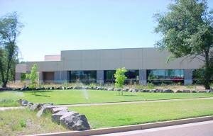


Property Detail
6450 Lockheed Dr
Wholesaleoutletdiscountstore
Shasta
B and X Area of moderate flood hazard, usually the area between the limits of the 100-year and 500-year floods.
California
2024
10.33 AC
2025
Other Market Areas
011501
Redding, CA
72,000 SF
054-280-004-000
NEARBY LISTINGS FOR SALE OR LEASE
-
-
View all Redding listings for sale on LoopNet.com
DEMOGRAPHICS near 6450 Lockheed Dr
1 mile
3 mile
5 mile
2025 Total Population
1,027
14,017
62,749
2030 Population
1,061
14,018
62,695
Pop Growth 2025-2030
+ 3.31%
+ 0.01%
(0.09%)
Average Age
45
44
41
2025 Total Households
364
5,261
24,026
HH Growth 2025-2030
+ 3.57%
(0.02%)
(0.11%)
Median Household Inc
$115,719
$93,075
$79,065
Avg Household Size
2.60
2.60
2.50
2025 Avg HH Vehicles
2.00
2.00
2.00
Median Home Value
$620,503
$426,792
$351,812
Median Year Built
1994
1985
1980
Nearby Places
Map Layers
Map Styles
 Street
 Aerial
Transit
 Traffic
 Biking
Places
Listings with unknown addresses are not visible on the map
- Restaurants
- Banks
- Shops
- Fitness
- Groceries
PUBLIC TRANSPORTATION
COMMUTER RAIL
Drive
Walk
Distance
16 min
9.3 mi
AIRPORT
Redding Regional
Drive
Walk
Distance
Redding Regional
4 min
1.2 mi
Nearby Properties
Address
Land Use
TOTAL SIZE
Lot Size
Zoning
Address
Land Use
TOTAL SIZE
Lot Size
Zoning
97,213 SF
7.94 AC
Address
Land Use
TOTAL SIZE
Lot Size
Zoning
55,697 SF
5.08 AC
Address
Land Use
TOTAL SIZE
Lot Size
Zoning
37,651 SF
26.49 AC
M-L
Address
Land Use
TOTAL SIZE
Lot Size
Zoning
90,832 SF
12.44 AC
C-2
Address
Land Use
TOTAL SIZE
Lot Size
Zoning
86,744 SF
9.25 AC
Address
Land Use
TOTAL SIZE
Lot Size
Zoning
20.19 AC
C-M
Address
Land Use
TOTAL SIZE
Lot Size
Zoning
7.34 AC
F-1
Address
Land Use
TOTAL SIZE
Lot Size
Zoning
63,800 SF
3.69 AC
Address
Land Use
TOTAL SIZE
Lot Size
Zoning
22,276 SF
5.32 AC
Address
Land Use
TOTAL SIZE
Lot Size
Zoning
33,929 SF
4.86 AC
Address
Land Use
TOTAL SIZE
Lot Size
Zoning
972 SF
6.12 AC
Address
Land Use
TOTAL SIZE
Lot Size
Zoning
3.34 AC
Address
Land Use
TOTAL SIZE
Lot Size
Zoning
12,467 SF
2.97 AC
Address
Land Use
TOTAL SIZE
Lot Size
Zoning
59,085 SF
11.70 AC
Address
Land Use
TOTAL SIZE
Lot Size
Zoning
7.74 AC
Address
Land Use
TOTAL SIZE
Lot Size
Zoning
2,268 SF
7.43 AC
M-L
Address
Land Use
TOTAL SIZE
Lot Size
Zoning
3.58 AC
Address
Land Use
TOTAL SIZE
Lot Size
Zoning
182.49 AC
M
Address
Land Use
TOTAL SIZE
Lot Size
Zoning
3,995 SF
1.31 AC
Address
Land Use
TOTAL SIZE
Lot Size
Zoning
3.23 AC
Address
Land Use
TOTAL SIZE
Lot Size
Zoning
28,668 SF
2.11 AC
C-M-DR
Address
Land Use
TOTAL SIZE
Lot Size
Zoning
12.26 AC
Address
Land Use
TOTAL SIZE
Lot Size
Zoning
5.20 AC
M-L
Address
Land Use
TOTAL SIZE
Lot Size
Zoning
Address
Land Use
TOTAL SIZE
Lot Size
Zoning
42,088 SF
8.63 AC
Address
Land Use
TOTAL SIZE
Lot Size
Zoning
18.08 AC
Address
Land Use
TOTAL SIZE
Lot Size
Zoning
5 AC
M-L
Address
Land Use
TOTAL SIZE
Lot Size
Zoning
33,558 SF
2.10 AC
Address
Land Use
TOTAL SIZE
Lot Size
Zoning
1,027 SF
2.55 AC
M-L
The World's #1 Commercial Real Estate Marketplace
Connect with us
© 2026 CoStar Group
The information above has been obtained from sources believed reliable. While we do not doubt its accuracy we have not verified it and make no guarantee, warranty or representation about it. It is your responsibility to independently confirm its accuracy and completeness. Any projections, opinions, assumptions, or estimates used are for example only and do not represent the current or future performance of the property. The value of this transaction to you depends on tax and other factors which should be evaluated by your tax, financial, and legal advisors. You and your advisors should conduct a careful, independent investigation of the property to determine to your satisfaction the suitability of the property for your needs.