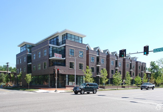
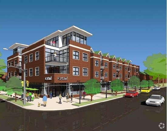
Property Record
6451 Clayton Rd, Saint Louis, MO 63117
NEARBY LISTINGS FOR SALE OR LEASE
Property Detail
6451 Clayton Rd
20J-64-2605
Demun Pointe Condominium
Storebuilding
DEMUN POINTE CONDOMINIUM UNIT CU-106 4.372% IN COMMON ELEMENTS
X
St. Louis
29189C0218K
Missouri
2024
0.04 AC
2025
Clayton
216300
St. Louis
1,621 SF
St. Louis, MO-IL
DEMOGRAPHICS near 6451 Clayton Rd
1 Mile
3 Mile
5 Mile
2024 Total Population
17,978
135,383
341,720
2029 Population
17,375
131,233
329,994
Pop Growth 2024-2029
(3.35%)
(3.07%)
(3.43%)
Average Age
35
39
40
2024 Total Households
6,910
64,652
156,974
HH Growth 2024-2029
(4.24%)
(3.30%)
(3.70%)
Median Household Inc
$83,350
$70,430
$60,658
Avg Household Size
2.00
1.90
2.00
2024 Avg HH Vehicles
2.00
1.00
1.00
Median Home Value
$351,335
$280,299
$242,816
Median Year Built
1946
1948
1948
Nearby Places
Map Layers
Map Styles
 Street
 Aerial
- Restaurants
- Banks
- Shops
- Fitness
- Groceries
PUBLIC TRANSPORTATION
COMMUTER RAIL
University City-Big Bend (Shrewsbury-Lansdowne I-44 Emerson Park - St. Louis MetroLink (MetroLink))
DRIVE
WALK
Distance
University City-Big Bend (Shrewsbury-Lansdowne I-44 Emerson Park - St. Louis MetroLink (MetroLink))
4 min
2.0 mi
Skinker (Shrewsbury-Lansdowne I-44 Emerson Park - St. Louis MetroLink (MetroLink))
DRIVE
WALK
Distance
Skinker (Shrewsbury-Lansdowne I-44 Emerson Park - St. Louis MetroLink (MetroLink))
4 min
2.2 mi
AIRPORT
St Louis Lambert International
DRIVE
WALK
Distance
St Louis Lambert International
17 min
10.6 mi
Scott AFB/Midamerica St Louis
DRIVE
WALK
Distance
Scott AFB/Midamerica St Louis
47 min
31.9 mi
Freight Ports
Port Milwaukee
DRIVE
WALK
Distance
Port Milwaukee
426 min
376.2 mi
SALE & LEASE HISTORY
LISTING DATE
SALE/LEASE

Aug 14, 2020
For Lease
Nearby Properties
Address
Land Use
TOTAL SIZE
Lot Size
Zoning
Address
Land Use
TOTAL SIZE
Lot Size
Zoning
684,846 SF
90.65 AC
R6
Address
Land Use
TOTAL SIZE
Lot Size
Zoning
136.92 AC
AI
Address
Land Use
TOTAL SIZE
Lot Size
Zoning
558,158 SF
45.66 AC
14R-2
Address
Land Use
TOTAL SIZE
Lot Size
Zoning
833,982 SF
18.70 AC
GB
Address
Land Use
TOTAL SIZE
Lot Size
Zoning
5,898 SF
21.62 AC
R2
Address
Land Use
TOTAL SIZE
Lot Size
Zoning
152.07 AC
L
Address
Land Use
TOTAL SIZE
Lot Size
Zoning
52,556 SF
68.80 AC
14R-2
Address
Land Use
TOTAL SIZE
Lot Size
Zoning
516,414 SF
2.61 AC
14C-2
Address
Land Use
TOTAL SIZE
Lot Size
Zoning
1,361,485 SF
5.45 AC
E
Address
Land Use
TOTAL SIZE
Lot Size
Zoning
361,357 SF
2.99 AC
14HDC
Address
Land Use
TOTAL SIZE
Lot Size
Zoning
238,035 SF
3.23 AC
14HDC
Address
Land Use
TOTAL SIZE
Lot Size
Zoning
5,551 SF
0.72 AC
14HDC
Address
Land Use
TOTAL SIZE
Lot Size
Zoning
501,837 SF
21.52 AC
14PUD
Address
Land Use
TOTAL SIZE
Lot Size
Zoning
390,010 SF
13.25 AC
R6
Address
Land Use
TOTAL SIZE
Lot Size
Zoning
361,605 SF
1.75 AC
14HDC
Address
Land Use
TOTAL SIZE
Lot Size
Zoning
385,676 SF
3.04 AC
C4
Address
Land Use
TOTAL SIZE
Lot Size
Zoning
7,780 SF
15.61 AC
14R-2
Address
Land Use
TOTAL SIZE
Lot Size
Zoning
354,868 SF
2.04 AC
14HDC
Address
Land Use
TOTAL SIZE
Lot Size
Zoning
7.94 AC
D
Address
Land Use
TOTAL SIZE
Lot Size
Zoning
272,933 SF
0.82 AC
14PUD
Address
Land Use
TOTAL SIZE
Lot Size
Zoning
311,264 SF
1.40 AC
14HDC
Address
Land Use
TOTAL SIZE
Lot Size
Zoning
476,403 SF
1.40 AC
14HDC
Address
Land Use
TOTAL SIZE
Lot Size
Zoning
277,568 SF
0.68 AC
14HDC
Address
Land Use
TOTAL SIZE
Lot Size
Zoning
330,896 SF
2.68 AC
14HDC
Address
Land Use
TOTAL SIZE
Lot Size
Zoning
272,940 SF
0.87 AC
14PUD
Address
Land Use
TOTAL SIZE
Lot Size
Zoning
1.33 AC
C4
Address
Land Use
TOTAL SIZE
Lot Size
Zoning
316,517 SF
3.28 AC
14C-1
Address
Land Use
TOTAL SIZE
Lot Size
Zoning
33,004 SF
1.53 AC
14HDC
Address
Land Use
TOTAL SIZE
Lot Size
Zoning
6.05 AC
J
Address
Land Use
TOTAL SIZE
Lot Size
Zoning
183,908 SF
1.08 AC
14HDC
The World's #1 Commercial Real Estate Marketplace
Connect with us
© 2025 CoStar Group
The information above has been obtained from sources believed reliable. While we do not doubt its accuracy we have not verified it and make no guarantee, warranty or representation about it. It is your responsibility to independently confirm its accuracy and completeness. Any projections, opinions, assumptions, or estimates used are for example only and do not represent the current or future performance of the property. The value of this transaction to you depends on tax and other factors which should be evaluated by your tax, financial, and legal advisors. You and your advisors should conduct a careful, independent investigation of the property to determine to your satisfaction the suitability of the property for your needs.