Property Record
6455 W 38Th Ave, Wheat Ridge, CO 80033


NEARBY LISTINGS FOR SALE OR LEASE
Property Detail
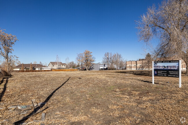
6455 W 38Th Ave
Denver-Aurora-Lakewood, CO
Cavness Huggins Minor
39-243-23-003
Jefferson
Residentialnec
Colorado
X
0.88 AC
08059C0214G
West Denver
1,433 SF
Denver
DEMOGRAPHICS near 6455 W 38Th Ave
1 Mile
3 Mile
5 Mile
2024 Total Population
17,358
150,988
393,480
2029 Population
17,308
151,975
397,153
Pop Growth 2024-2029
(0.29%)
+ 0.65%
+ 0.93%
Average Age
43
39
39
2024 Total Households
8,120
69,244
176,068
HH Growth 2024-2029
(0.31%)
+ 0.58%
+ 1.06%
Median Household Inc
$79,078
$79,418
$79,939
Avg Household Size
2.10
2.10
2.10
2024 Avg HH Vehicles
2.00
2.00
2.00
Median Home Value
$521,936
$596,137
$540,191
Median Year Built
1958
1965
1974
Nearby Places
Map Layers
Map Styles
 Street
 Aerial
- Restaurants
- Banks
- Shops
- Fitness
- Groceries
PUBLIC TRANSPORTATION
COMMUTER RAIL
DRIVE
WALK
Distance
7 min
2.9 mi
DRIVE
WALK
Distance
7 min
3.1 mi
AIRPORT
Denver International
DRIVE
WALK
Distance
Denver International
37 min
27.4 mi
SALE & LEASE HISTORY
LISTING DATE
SALE/LEASE

Oct 06, 2022
For Sale
Nearby Properties
Address
Land Use
TOTAL SIZE
Lot Size
Zoning
Address
Land Use
TOTAL SIZE
Lot Size
Zoning
860,132 SF
68.50 AC
R-5
Address
Land Use
TOTAL SIZE
Lot Size
Zoning
424,862 SF
32.28 AC
G-MU-3
Address
Land Use
TOTAL SIZE
Lot Size
Zoning
8,295 SF
2.57 AC
C-RX
Address
Land Use
TOTAL SIZE
Lot Size
Zoning
827,707 SF
19 AC
C-MU-30
Address
Land Use
TOTAL SIZE
Lot Size
Zoning
107,351 SF
5.67 AC
C-MX-5
Address
Land Use
TOTAL SIZE
Lot Size
Zoning
111,673 SF
29.06 AC
Address
Land Use
TOTAL SIZE
Lot Size
Zoning
565,418 SF
4.07 AC
C-RX
Address
Land Use
TOTAL SIZE
Lot Size
Zoning
132,874 SF
6.53 AC
G-MU-3
Address
Land Use
TOTAL SIZE
Lot Size
Zoning
298,150 SF
24.21 AC
Address
Land Use
TOTAL SIZE
Lot Size
Zoning
325,844 SF
4.08 AC
C-MX-12
Address
Land Use
TOTAL SIZE
Lot Size
Zoning
392,996 SF
7.39 AC
C-MX-12
Address
Land Use
TOTAL SIZE
Lot Size
Zoning
187,095 SF
23.42 AC
Address
Land Use
TOTAL SIZE
Lot Size
Zoning
6,731 SF
80.77 AC
Address
Land Use
TOTAL SIZE
Lot Size
Zoning
247,459 SF
2.31 AC
C-MX-8
Address
Land Use
TOTAL SIZE
Lot Size
Zoning
188,297 SF
2.11 AC
R-MU-30
Address
Land Use
TOTAL SIZE
Lot Size
Zoning
202,867 SF
2.28 AC
C-MX
Address
Land Use
TOTAL SIZE
Lot Size
Zoning
411,402 SF
6.34 AC
C-RX
Address
Land Use
TOTAL SIZE
Lot Size
Zoning
436,238 SF
13.94 AC
Address
Land Use
TOTAL SIZE
Lot Size
Zoning
197,266 SF
0.81 AC
C-MX-12
Address
Land Use
TOTAL SIZE
Lot Size
Zoning
310,267 SF
1.69 AC
C-MX
Address
Land Use
TOTAL SIZE
Lot Size
Zoning
212,995 SF
3.20 AC
R-3
Address
Land Use
TOTAL SIZE
Lot Size
Zoning
211,800 SF
1.65 AC
C-MX-12
Address
Land Use
TOTAL SIZE
Lot Size
Zoning
389,561 SF
10.73 AC
Address
Land Use
TOTAL SIZE
Lot Size
Zoning
142,635 SF
6.84 AC
U-SU-B1
Address
Land Use
TOTAL SIZE
Lot Size
Zoning
61,236 SF
3.03 AC
B-2
Address
Land Use
TOTAL SIZE
Lot Size
Zoning
100,615 SF
2.28 AC
Address
Land Use
TOTAL SIZE
Lot Size
Zoning
86,431 SF
6.48 AC
G-MU-3
Address
Land Use
TOTAL SIZE
Lot Size
Zoning
311,200 SF
0.85 AC
Address
Land Use
TOTAL SIZE
Lot Size
Zoning
174,060 SF
2.24 AC
U-SU-C
Address
Land Use
TOTAL SIZE
Lot Size
Zoning
138,204 SF
3.68 AC
The World's #1 Commercial Real Estate Marketplace
Connect with us
© 2026 CoStar Group
The information above has been obtained from sources believed reliable. While we do not doubt its accuracy we have not verified it and make no guarantee, warranty or representation about it. It is your responsibility to independently confirm its accuracy and completeness. Any projections, opinions, assumptions, or estimates used are for example only and do not represent the current or future performance of the property. The value of this transaction to you depends on tax and other factors which should be evaluated by your tax, financial, and legal advisors. You and your advisors should conduct a careful, independent investigation of the property to determine to your satisfaction the suitability of the property for your needs.