Property Record
6455 43 St S, Fargo, ND 58104
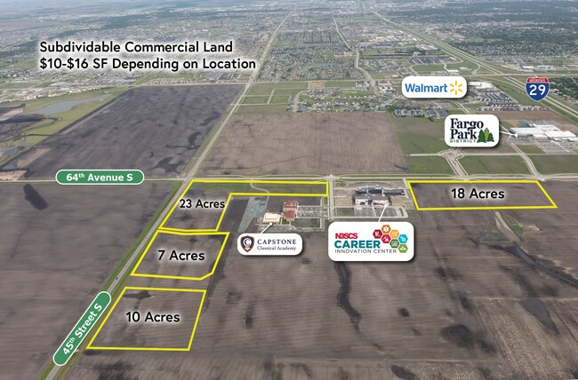
This Property Is For Sale
NEARBY LISTINGS FOR SALE OR LEASE
Property Detail
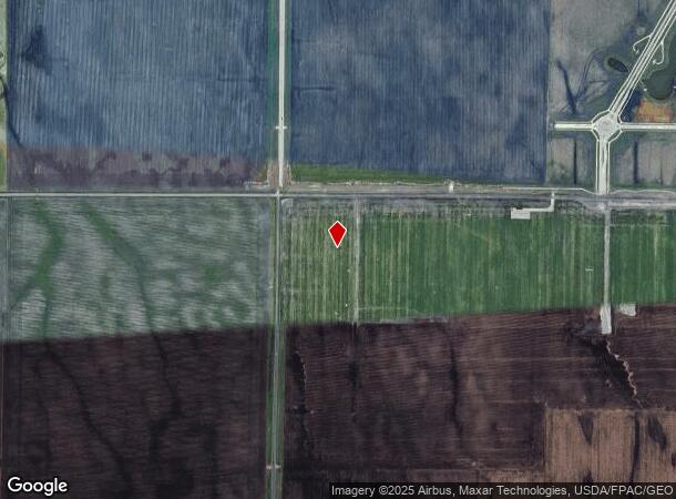
6455 43 St S
Other Market Areas
First
Fargo, ND-MN
LOT: 0 BLOCK: 10 ADDITION: ADDITIONAL: 10-138-49 PT OF THE NW 1/4 OF SEC 10 TWP 138 N R 49 W DESC AS: COMM AT A FOUND IRON
01-3525-00301-000
Cass
Miscellaneous
North Dakota
2024
1
2024
Fargo
040504
DEMOGRAPHICS near 6455 43 St S
1 Mile
3 Mile
5 Mile
2024 Total Population
467
41,872
108,259
2029 Population
516
45,197
116,025
Pop Growth 2024-2029
+ 10.49%
+ 7.94%
+ 7.17%
Average Age
33
34
35
2024 Total Households
208
16,066
45,438
HH Growth 2024-2029
+ 10.58%
+ 8.19%
+ 7.37%
Median Household Inc
$101,974
$104,984
$82,239
Avg Household Size
2.20
2.60
2.30
2024 Avg HH Vehicles
2.00
2.00
2.00
Median Home Value
$587,500
$378,950
$354,897
Median Year Built
2006
2010
2005
Nearby Places
- Restaurants
- Banks
- Shops
- Fitness
- Groceries
PUBLIC TRANSPORTATION
AIRPORT
Hector International
DRIVE
WALK
Distance
Hector International
24 min
12.6 mi
Freight Ports
Port Milwaukee
DRIVE
WALK
Distance
Port Milwaukee
638 min
578.1 mi
Nearby Properties
Address
Land Use
TOTAL SIZE
Lot Size
Zoning
Address
Land Use
TOTAL SIZE
Lot Size
Zoning
55.68 AC
Address
Land Use
TOTAL SIZE
Lot Size
Zoning
Address
Land Use
TOTAL SIZE
Lot Size
Zoning
7.66 AC
Address
Land Use
TOTAL SIZE
Lot Size
Zoning
Address
Land Use
TOTAL SIZE
Lot Size
Zoning
9,279 SF
8.33 AC
MR1
Address
Land Use
TOTAL SIZE
Lot Size
Zoning
30,240 SF
1.54 AC
MR2
Address
Land Use
TOTAL SIZE
Lot Size
Zoning
217,776 SF
31.82 AC
GC
Address
Land Use
TOTAL SIZE
Lot Size
Zoning
73,907 SF
3.41 AC
MR3
Address
Land Use
TOTAL SIZE
Lot Size
Zoning
122,201 SF
8.92 AC
GO
Address
Land Use
TOTAL SIZE
Lot Size
Zoning
191,151 SF
22.98 AC
LC
Address
Land Use
TOTAL SIZE
Lot Size
Zoning
88,956 SF
10.56 AC
GO
Address
Land Use
TOTAL SIZE
Lot Size
Zoning
160,913 SF
11.46 AC
GC
Address
Land Use
TOTAL SIZE
Lot Size
Zoning
Address
Land Use
TOTAL SIZE
Lot Size
Zoning
42,476 SF
2.07 AC
MR1
Address
Land Use
TOTAL SIZE
Lot Size
Zoning
3.72 AC
Address
Land Use
TOTAL SIZE
Lot Size
Zoning
42,366 SF
Address
Land Use
TOTAL SIZE
Lot Size
Zoning
44,851 SF
19 AC
LI
Address
Land Use
TOTAL SIZE
Lot Size
Zoning
38,325 SF
465,408 AC
MR3
Address
Land Use
TOTAL SIZE
Lot Size
Zoning
54,870 SF
5.43 AC
MR3
Address
Land Use
TOTAL SIZE
Lot Size
Zoning
84,738 SF
4.61 AC
MR3
Address
Land Use
TOTAL SIZE
Lot Size
Zoning
165,824 SF
5.38 AC
MR1
Address
Land Use
TOTAL SIZE
Lot Size
Zoning
Address
Land Use
TOTAL SIZE
Lot Size
Zoning
75,600 SF
3.82 AC
LC
Address
Land Use
TOTAL SIZE
Lot Size
Zoning
1.98 AC
Address
Land Use
TOTAL SIZE
Lot Size
Zoning
Address
Land Use
TOTAL SIZE
Lot Size
Zoning
5.92 AC
Address
Land Use
TOTAL SIZE
Lot Size
Zoning
26,046 SF
1.38 AC
MR3
Address
Land Use
TOTAL SIZE
Lot Size
Zoning
166,453 SF
6.65 AC
MR3
Address
Land Use
TOTAL SIZE
Lot Size
Zoning
Address
Land Use
TOTAL SIZE
Lot Size
Zoning
49,083 SF
6.88 AC
The World's #1 Commercial Real Estate Marketplace
Connect with us
© 2025 CoStar Group
The information above has been obtained from sources believed reliable. While we do not doubt its accuracy we have not verified it and make no guarantee, warranty or representation about it. It is your responsibility to independently confirm its accuracy and completeness. Any projections, opinions, assumptions, or estimates used are for example only and do not represent the current or future performance of the property. The value of this transaction to you depends on tax and other factors which should be evaluated by your tax, financial, and legal advisors. You and your advisors should conduct a careful, independent investigation of the property to determine to your satisfaction the suitability of the property for your needs.