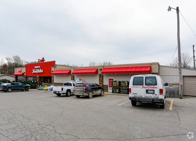
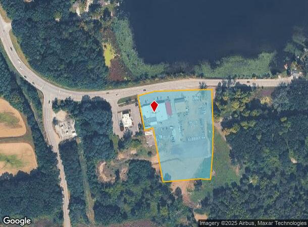
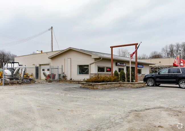
Property Record
6458 E Mi State Road 36, Whitmore Lake, MI 48189
NEARBY LISTINGS FOR SALE OR LEASE
-
-
View all Whitmore Lake listings for sale on LoopNet.com
Property Detail
6458 E Mi State Road 36
15-26-100-022
Part Of Sec 26 T1n R5e
Commercialnec
SEC 26 T1N R5E COM N 1/4 COR SAID SEC TH S 00*49*40' W 29.12 FT FOR POB TH S 86*25'59" E 5.34 FT TH S 03*42'07"W 208.68 FT TH
X
Livingston
26093C0454D
Michigan
2025
4.05 AC
2025
Livingston County
743700
Detroit
13,869 SF
Detroit-Warren-Dearborn, MI
DEMOGRAPHICS near 6458 E Mi State Road 36
1 Mile
3 Mile
5 Mile
2024 Total Population
1,434
14,635
46,350
2029 Population
1,453
15,011
47,389
Pop Growth 2024-2029
+ 1.32%
+ 2.57%
+ 2.24%
Average Age
44
44
44
2024 Total Households
581
5,680
18,060
HH Growth 2024-2029
+ 1.38%
+ 2.50%
+ 2.18%
Median Household Inc
$96,686
$101,414
$103,851
Avg Household Size
2.40
2.50
2.50
2024 Avg HH Vehicles
2.00
2.00
2.00
Median Home Value
$284,291
$334,708
$336,256
Median Year Built
1979
1986
1989
Nearby Places
Map Layers
Map Styles
 Street
 Aerial
- Restaurants
- Banks
- Shops
- Fitness
- Groceries
PUBLIC TRANSPORTATION
AIRPORT
Detroit Metro Wayne County
DRIVE
WALK
Distance
Detroit Metro Wayne County
53 min
41.8 mi
Freight Ports
Port of Toledo
DRIVE
WALK
Distance
Port of Toledo
95 min
74.8 mi
Nearby Properties
Address
Land Use
TOTAL SIZE
Lot Size
Zoning
Address
Land Use
TOTAL SIZE
Lot Size
Zoning
301,472 SF
72.80 AC
LI
Address
Land Use
TOTAL SIZE
Lot Size
Zoning
301,472 SF
62.80 AC
LI
Address
Land Use
TOTAL SIZE
Lot Size
Zoning
92,039 SF
5.34 AC
WFR
Address
Land Use
TOTAL SIZE
Lot Size
Zoning
55,885 SF
6.51 AC
VC
Address
Land Use
TOTAL SIZE
Lot Size
Zoning
1,970 SF
37.72 AC
MHP
Address
Land Use
TOTAL SIZE
Lot Size
Zoning
103,900 SF
26.88 AC
GI
Address
Land Use
TOTAL SIZE
Lot Size
Zoning
41,961 SF
4.88 AC
RA
Address
Land Use
TOTAL SIZE
Lot Size
Zoning
50 AC
MHP
Address
Land Use
TOTAL SIZE
Lot Size
Zoning
133.34 AC
PUD-VMU-2
Address
Land Use
TOTAL SIZE
Lot Size
Zoning
19,390 SF
2.44 AC
VC
Address
Land Use
TOTAL SIZE
Lot Size
Zoning
640 AC
PPRF
Address
Land Use
TOTAL SIZE
Lot Size
Zoning
73,711 SF
6.77 AC
LI
Address
Land Use
TOTAL SIZE
Lot Size
Zoning
195 AC
RAA
Address
Land Use
TOTAL SIZE
Lot Size
Zoning
27,000 SF
2 AC
WFR
Address
Land Use
TOTAL SIZE
Lot Size
Zoning
52,800 SF
8.10 AC
LB
Address
Land Use
TOTAL SIZE
Lot Size
Zoning
105,868 SF
37.75 AC
GI
Address
Land Use
TOTAL SIZE
Lot Size
Zoning
52,100 SF
10.36 AC
GI
Address
Land Use
TOTAL SIZE
Lot Size
Zoning
29,928 SF
7 AC
VC
Address
Land Use
TOTAL SIZE
Lot Size
Zoning
15,273 SF
3.72 AC
WFR
Address
Land Use
TOTAL SIZE
Lot Size
Zoning
37,508 SF
1.10 AC
RA
Address
Land Use
TOTAL SIZE
Lot Size
Zoning
45,800 SF
3.23 AC
LI
Address
Land Use
TOTAL SIZE
Lot Size
Zoning
8,045 SF
13.03 AC
CS
Address
Land Use
TOTAL SIZE
Lot Size
Zoning
26,392 SF
13.15 AC
GI
Address
Land Use
TOTAL SIZE
Lot Size
Zoning
402.30 AC
PPRF
Address
Land Use
TOTAL SIZE
Lot Size
Zoning
41,228 SF
3.90 AC
LI
Address
Land Use
TOTAL SIZE
Lot Size
Zoning
34,020 SF
4.78 AC
LI
Address
Land Use
TOTAL SIZE
Lot Size
Zoning
10,420 SF
3.56 AC
GI
Address
Land Use
TOTAL SIZE
Lot Size
Zoning
16,340 SF
4.10 AC
CS
Address
Land Use
TOTAL SIZE
Lot Size
Zoning
11,785 SF
6.78 AC
NS
Address
Land Use
TOTAL SIZE
Lot Size
Zoning
11,483 SF
1.66 AC
VC
The World's #1 Commercial Real Estate Marketplace
Connect with us
© 2026 CoStar Group
The information above has been obtained from sources believed reliable. While we do not doubt its accuracy we have not verified it and make no guarantee, warranty or representation about it. It is your responsibility to independently confirm its accuracy and completeness. Any projections, opinions, assumptions, or estimates used are for example only and do not represent the current or future performance of the property. The value of this transaction to you depends on tax and other factors which should be evaluated by your tax, financial, and legal advisors. You and your advisors should conduct a careful, independent investigation of the property to determine to your satisfaction the suitability of the property for your needs.