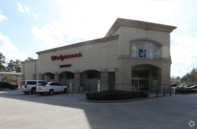
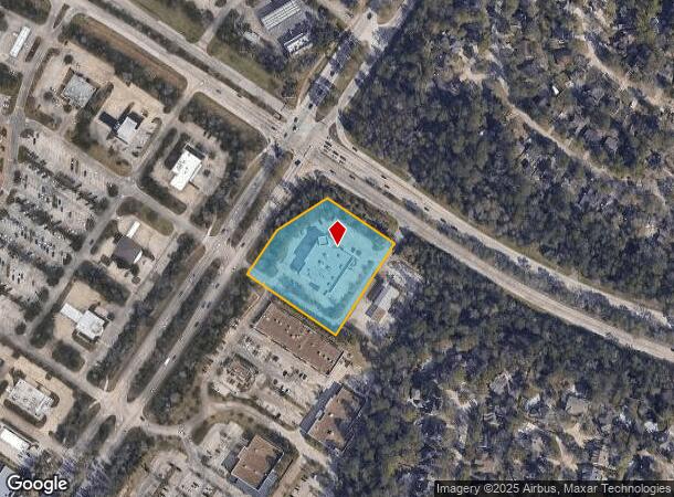
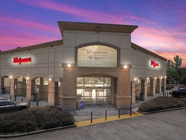
Property Record
6467 Woodlands Pkwy, Spring, TX 77381
NEARBY LISTINGS FOR SALE OR LEASE
Property Detail
6467 Woodlands Pkwy
9715-26-00101
Wdlnds Vil Indian Springs 26
Commercialnec
S971526 - WDLNDS VIL INDIAN SPRINGS 26, RES A-1, ACRES 2.36
X
Montgomery
48339C0520G
Texas
2024
2.36 AC
2025
Montgomery County
691301
Houston
14,735 SF
Houston-The Woodlands-Sugar Land, TX
DEMOGRAPHICS near 6467 Woodlands Pkwy
1 Mile
3 Mile
5 Mile
2024 Total Population
7,345
75,301
175,208
2029 Population
8,887
88,442
205,801
Pop Growth 2024-2029
+ 20.99%
+ 17.45%
+ 17.46%
Average Age
41
39
39
2024 Total Households
2,592
26,255
65,008
HH Growth 2024-2029
+ 21.14%
+ 17.97%
+ 18.22%
Median Household Inc
$209,831
$151,566
$121,435
Avg Household Size
2.80
2.80
2.70
2024 Avg HH Vehicles
2.00
2.00
2.00
Median Home Value
$459,900
$445,683
$395,840
Median Year Built
2000
1998
2004
Nearby Places
Map Layers
Map Styles
 Street
 Aerial
- Restaurants
- Banks
- Shops
- Fitness
- Groceries
PUBLIC TRANSPORTATION
AIRPORT
George Bush Intcntl/Houston
DRIVE
WALK
Distance
George Bush Intcntl/Houston
35 min
25.9 mi
Freight Ports
Port of Houston
DRIVE
WALK
Distance
Port of Houston
58 min
41.7 mi
SALE & LEASE HISTORY
LISTING DATE
SALE/LEASE

Jun 02, 2021
For Sale
Nearby Properties
Address
Land Use
TOTAL SIZE
Lot Size
Zoning
Address
Land Use
TOTAL SIZE
Lot Size
Zoning
370,296 SF
14.05 AC
Address
Land Use
TOTAL SIZE
Lot Size
Zoning
392,960 SF
20.01 AC
6
Address
Land Use
TOTAL SIZE
Lot Size
Zoning
289,737 SF
13.83 AC
Address
Land Use
TOTAL SIZE
Lot Size
Zoning
295,608 SF
10.07 AC
6
Address
Land Use
TOTAL SIZE
Lot Size
Zoning
289,611 SF
13.57 AC
Address
Land Use
TOTAL SIZE
Lot Size
Zoning
189,974 SF
29.76 AC
Address
Land Use
TOTAL SIZE
Lot Size
Zoning
299,416 SF
50 AC
6
Address
Land Use
TOTAL SIZE
Lot Size
Zoning
297,153 SF
17.13 AC
6
Address
Land Use
TOTAL SIZE
Lot Size
Zoning
87,445 SF
6.45 AC
Address
Land Use
TOTAL SIZE
Lot Size
Zoning
153,063 SF
17.50 AC
Address
Land Use
TOTAL SIZE
Lot Size
Zoning
385,000 SF
68.27 AC
6
Address
Land Use
TOTAL SIZE
Lot Size
Zoning
139,140 SF
18.22 AC
6
Address
Land Use
TOTAL SIZE
Lot Size
Zoning
138,468 SF
16.33 AC
6
Address
Land Use
TOTAL SIZE
Lot Size
Zoning
123,497 SF
18.77 AC
Address
Land Use
TOTAL SIZE
Lot Size
Zoning
76,841 SF
12.17 AC
Address
Land Use
TOTAL SIZE
Lot Size
Zoning
13.76 AC
Address
Land Use
TOTAL SIZE
Lot Size
Zoning
100,374 SF
11.24 AC
Address
Land Use
TOTAL SIZE
Lot Size
Zoning
61,218 SF
9.30 AC
Address
Land Use
TOTAL SIZE
Lot Size
Zoning
106,015 SF
11.86 AC
6
Address
Land Use
TOTAL SIZE
Lot Size
Zoning
278,939 SF
13.76 AC
Address
Land Use
TOTAL SIZE
Lot Size
Zoning
5,044 SF
42.52 AC
6
Address
Land Use
TOTAL SIZE
Lot Size
Zoning
117,326 SF
7.60 AC
Address
Land Use
TOTAL SIZE
Lot Size
Zoning
190,000 SF
24.21 AC
Address
Land Use
TOTAL SIZE
Lot Size
Zoning
108,824 SF
12.44 AC
Address
Land Use
TOTAL SIZE
Lot Size
Zoning
82,051 SF
10.14 AC
6
Address
Land Use
TOTAL SIZE
Lot Size
Zoning
94,128 SF
51.19 AC
2
Address
Land Use
TOTAL SIZE
Lot Size
Zoning
122,940 SF
17.10 AC
6
Address
Land Use
TOTAL SIZE
Lot Size
Zoning
84,320 SF
77.76 AC
Address
Land Use
TOTAL SIZE
Lot Size
Zoning
151,978 SF
21.94 AC
Address
Land Use
TOTAL SIZE
Lot Size
Zoning
48,525 SF
4.68 AC
The World's #1 Commercial Real Estate Marketplace
Connect with us
© 2025 CoStar Group
The information above has been obtained from sources believed reliable. While we do not doubt its accuracy we have not verified it and make no guarantee, warranty or representation about it. It is your responsibility to independently confirm its accuracy and completeness. Any projections, opinions, assumptions, or estimates used are for example only and do not represent the current or future performance of the property. The value of this transaction to you depends on tax and other factors which should be evaluated by your tax, financial, and legal advisors. You and your advisors should conduct a careful, independent investigation of the property to determine to your satisfaction the suitability of the property for your needs.