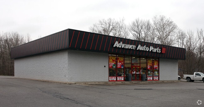
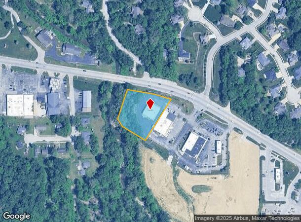
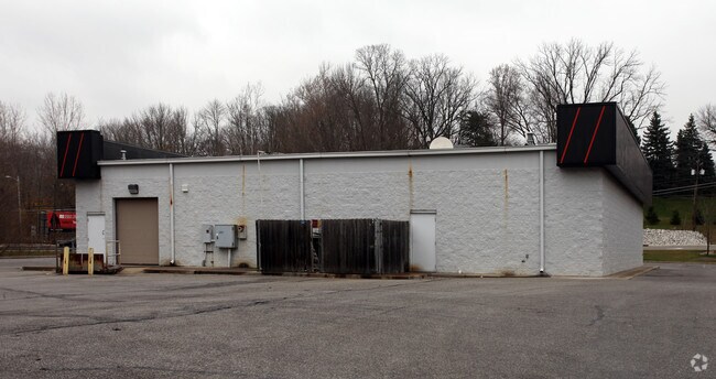
Property Record
647 E Main St, Danville, IN 46122
NEARBY LISTINGS FOR SALE OR LEASE
-
-
View all Danville listings for sale on LoopNet.com
Property Detail
647 E Main St
Indianapolis-Carmel-Anderson, IN
Whitelick Creek Commercial
32-11-10-227-001.000-003
WHITELICK CREEK COMMERCIAL SUB LOT 1 1.324AC
Storebuilding
Hendricks
AE
Indiana
18063C0144D
1
2024
1.32 AC
2024
Hendricks County
210502
Indianapolis
5,625 SF
DEMOGRAPHICS near 647 E Main St
1 Mile
3 Mile
5 Mile
2024 Total Population
4,517
13,729
23,283
2029 Population
5,065
15,402
26,043
Pop Growth 2024-2029
+ 12.13%
+ 12.19%
+ 11.85%
Average Age
40
40
42
2024 Total Households
1,715
5,193
8,883
HH Growth 2024-2029
+ 12.13%
+ 12.21%
+ 11.87%
Median Household Inc
$90,277
$95,472
$96,200
Avg Household Size
2.50
2.60
2.60
2024 Avg HH Vehicles
2.00
2.00
2.00
Median Home Value
$200,529
$225,482
$256,057
Median Year Built
1978
1990
1991
Nearby Places
Map Layers
Map Styles
 Street
 Aerial
- Restaurants
- Banks
- Shops
- Fitness
- Groceries
PUBLIC TRANSPORTATION
AIRPORT
Indianapolis International
DRIVE
WALK
Distance
Indianapolis International
31 min
16.9 mi
Nearby Properties
Address
Land Use
TOTAL SIZE
Lot Size
Zoning
Address
Land Use
TOTAL SIZE
Lot Size
Zoning
15,912 SF
29.86 AC
Address
Land Use
TOTAL SIZE
Lot Size
Zoning
100 SF
5.07 AC
Address
Land Use
TOTAL SIZE
Lot Size
Zoning
10,528 SF
12.54 AC
Address
Land Use
TOTAL SIZE
Lot Size
Zoning
156,080 SF
15.18 AC
Address
Land Use
TOTAL SIZE
Lot Size
Zoning
10,500 SF
10 AC
Address
Land Use
TOTAL SIZE
Lot Size
Zoning
64,062 SF
7.53 AC
Address
Land Use
TOTAL SIZE
Lot Size
Zoning
17,100 SF
5.99 AC
Address
Land Use
TOTAL SIZE
Lot Size
Zoning
2,244 SF
9.86 AC
Address
Land Use
TOTAL SIZE
Lot Size
Zoning
3,114 SF
3.04 AC
Address
Land Use
TOTAL SIZE
Lot Size
Zoning
18,970 SF
3.26 AC
Address
Land Use
TOTAL SIZE
Lot Size
Zoning
43,482 SF
10 AC
Address
Land Use
TOTAL SIZE
Lot Size
Zoning
19,932 SF
12.34 AC
Address
Land Use
TOTAL SIZE
Lot Size
Zoning
5,600 SF
12.29 AC
Address
Land Use
TOTAL SIZE
Lot Size
Zoning
29,586 SF
7.44 AC
Address
Land Use
TOTAL SIZE
Lot Size
Zoning
12,360 SF
6.86 AC
Address
Land Use
TOTAL SIZE
Lot Size
Zoning
6,023 SF
4.32 AC
Address
Land Use
TOTAL SIZE
Lot Size
Zoning
24,820 SF
9.59 AC
Address
Land Use
TOTAL SIZE
Lot Size
Zoning
17,904 SF
14.34 AC
Address
Land Use
TOTAL SIZE
Lot Size
Zoning
5,075 SF
2.13 AC
Address
Land Use
TOTAL SIZE
Lot Size
Zoning
12,480 SF
2.82 AC
Address
Land Use
TOTAL SIZE
Lot Size
Zoning
16,000 SF
1.42 AC
Address
Land Use
TOTAL SIZE
Lot Size
Zoning
10,920 SF
5.97 AC
Address
Land Use
TOTAL SIZE
Lot Size
Zoning
4,476 SF
3.20 AC
Address
Land Use
TOTAL SIZE
Lot Size
Zoning
9,547 SF
16.64 AC
Address
Land Use
TOTAL SIZE
Lot Size
Zoning
37,976 SF
3.03 AC
Address
Land Use
TOTAL SIZE
Lot Size
Zoning
3,000 SF
5.81 AC
Address
Land Use
TOTAL SIZE
Lot Size
Zoning
12,000 SF
4.66 AC
Address
Land Use
TOTAL SIZE
Lot Size
Zoning
2,688 SF
4.81 AC
Address
Land Use
TOTAL SIZE
Lot Size
Zoning
3,750 SF
2.67 AC
Address
Land Use
TOTAL SIZE
Lot Size
Zoning
8,680 SF
73.33 AC
The World's #1 Commercial Real Estate Marketplace
Connect with us
© 2025 CoStar Group
The information above has been obtained from sources believed reliable. While we do not doubt its accuracy we have not verified it and make no guarantee, warranty or representation about it. It is your responsibility to independently confirm its accuracy and completeness. Any projections, opinions, assumptions, or estimates used are for example only and do not represent the current or future performance of the property. The value of this transaction to you depends on tax and other factors which should be evaluated by your tax, financial, and legal advisors. You and your advisors should conduct a careful, independent investigation of the property to determine to your satisfaction the suitability of the property for your needs.