Property Record
647 Ne Santiam Blvd, Mill City, OR 97360
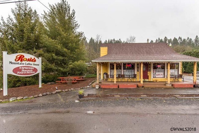

Property Detail
647 Ne Santiam Blvd
541798
ACRES .12
Officebuilding
Marion
CH
Oregon
B and X Area of moderate flood hazard, usually the area between the limits of the 100-year and 500-year floods.
0.12 AC
2024
Marion County
2025
Portland
010600
Salem, OR
1,034 SF
NEARBY LISTINGS FOR SALE OR LEASE
-
-
View all Mill City listings for sale on LoopNet.com
DEMOGRAPHICS near 647 Ne Santiam Blvd
1 mile
3 mile
5 mile
2025 Total Population
2,378
3,421
4,054
2030 Population
2,460
3,557
4,212
Pop Growth 2025-2030
+ 3.45%
+ 3.98%
+ 3.90%
Average Age
42
44
44
2025 Total Households
870
1,293
1,545
HH Growth 2025-2030
+ 3.45%
+ 4.10%
+ 4.14%
Median Household Inc
$69,819
$71,399
$72,904
Avg Household Size
2.70
2.60
2.60
2025 Avg HH Vehicles
2.00
2.00
2.00
Median Home Value
$371,130
$394,368
$410,858
Median Year Built
1975
1975
1975
Nearby Places
Map Layers
Map Styles
 Street
 Aerial
Transit
 Traffic
 Biking
Places
Listings with unknown addresses are not visible on the map
- Restaurants
- Banks
- Shops
- Fitness
- Groceries
SALE & LEASE HISTORY
LISTING DATE
SALE/LEASE

Oct 01, 2018
For Sale
Mar 20, 2018
For Sale
Nearby Properties
Address
Land Use
TOTAL SIZE
Lot Size
Zoning
Address
Land Use
TOTAL SIZE
Lot Size
Zoning
63.36 AC
UGA-HI
Address
Land Use
TOTAL SIZE
Lot Size
Zoning
55,000 SF
18.87 AC
PUB
Address
Land Use
TOTAL SIZE
Lot Size
Zoning
5.21 AC
PUB
Address
Land Use
TOTAL SIZE
Lot Size
Zoning
6.09 AC
PUB
Address
Land Use
TOTAL SIZE
Lot Size
Zoning
8,486 SF
0.94 AC
PUB
Address
Land Use
TOTAL SIZE
Lot Size
Zoning
55,346 SF
3.86 AC
R-2
Address
Land Use
TOTAL SIZE
Lot Size
Zoning
74.93 AC
UGA-HI
Address
Land Use
TOTAL SIZE
Lot Size
Zoning
3,012 SF
0.97 AC
CH
Address
Land Use
TOTAL SIZE
Lot Size
Zoning
3,694 SF
0.47 AC
CC
Address
Land Use
TOTAL SIZE
Lot Size
Zoning
5,440 SF
0.64 AC
CH
Address
Land Use
TOTAL SIZE
Lot Size
Zoning
4,048 SF
0.57 AC
R-2
Address
Land Use
TOTAL SIZE
Lot Size
Zoning
5,320 SF
0.42 AC
R-2
Address
Land Use
TOTAL SIZE
Lot Size
Zoning
0.42 AC
R-2
Address
Land Use
TOTAL SIZE
Lot Size
Zoning
5,400 SF
0.64 AC
CR
Address
Land Use
TOTAL SIZE
Lot Size
Zoning
3,797 SF
0.44 AC
CH
Address
Land Use
TOTAL SIZE
Lot Size
Zoning
7,022 SF
0.33 AC
CC
Address
Land Use
TOTAL SIZE
Lot Size
Zoning
3,566 SF
0.53 AC
CH
Address
Land Use
TOTAL SIZE
Lot Size
Zoning
5,712 SF
3.18 AC
UGA-HI
Address
Land Use
TOTAL SIZE
Lot Size
Zoning
3.16 AC
PUB
Address
Land Use
TOTAL SIZE
Lot Size
Zoning
4,600 SF
0.40 AC
CH
Address
Land Use
TOTAL SIZE
Lot Size
Zoning
1,700 SF
0.29 AC
CH
Address
Land Use
TOTAL SIZE
Lot Size
Zoning
2,072 SF
0.61 AC
CH
Address
Land Use
TOTAL SIZE
Lot Size
Zoning
5,758 SF
0.92 AC
CH; UT-5
Address
Land Use
TOTAL SIZE
Lot Size
Zoning
2,640 SF
0.58 AC
R-1
Address
Land Use
TOTAL SIZE
Lot Size
Zoning
0.47 AC
CC
Address
Land Use
TOTAL SIZE
Lot Size
Zoning
880 SF
0.40 AC
CH
Address
Land Use
TOTAL SIZE
Lot Size
Zoning
1,906 SF
0.48 AC
CH
Address
Land Use
TOTAL SIZE
Lot Size
Zoning
4,370 SF
0.13 AC
CH
Address
Land Use
TOTAL SIZE
Lot Size
Zoning
2,280 SF
0.23 AC
R-2
Address
Land Use
TOTAL SIZE
Lot Size
Zoning
2,623 SF
0.34 AC
CH
The World's #1 Commercial Real Estate Marketplace
Connect with us
© 2026 CoStar Group
The information above has been obtained from sources believed reliable. While we do not doubt its accuracy we have not verified it and make no guarantee, warranty or representation about it. It is your responsibility to independently confirm its accuracy and completeness. Any projections, opinions, assumptions, or estimates used are for example only and do not represent the current or future performance of the property. The value of this transaction to you depends on tax and other factors which should be evaluated by your tax, financial, and legal advisors. You and your advisors should conduct a careful, independent investigation of the property to determine to your satisfaction the suitability of the property for your needs.