Property Record
6471 E Main St, Reynoldsburg, OH 43068


Save to a Folder
{{folder.Name}}
{{folder.ListingIds.length}} Properties
{{folder.ListingIds.length}} Property
Create a New Folder
Property Detail
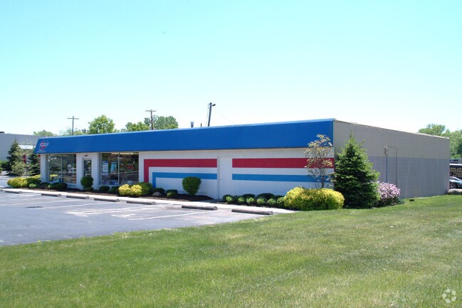
6471 E Main St
060-008939
E MAIN ST R21 T12 S13 1/4T20 0.919 ACRE
Storebuilding
Franklin
B and X Area of moderate flood hazard, usually the area between the limits of the 100-year and 500-year floods.
Ohio
2024
0.92 AC
2025
East
009383
Columbus
4,800 SF
Columbus, OH
NEARBY LISTINGS FOR SALE OR LEASE
DEMOGRAPHICS near 6471 E Main St
1 mile
3 mile
5 mile
2025 Total Population
14,397
107,582
242,579
2030 Population
14,758
110,466
249,974
Pop Growth 2025-2030
+ 2.51%
+ 2.68%
+ 3.05%
Average Age
40
38
38
2025 Total Households
5,918
42,911
94,613
HH Growth 2025-2030
+ 2.65%
+ 2.78%
+ 3.15%
Median Household Inc
$60,325
$62,374
$64,695
Avg Household Size
2.40
2.40
2.50
2025 Avg HH Vehicles
2.00
2.00
2.00
Median Home Value
$233,232
$242,472
$255,263
Median Year Built
1970
1982
1981
Nearby Places
Map Layers
Map Styles
 Street
 Aerial
Layers
 Traffic
 Biking
Places
Listings with unknown addresses are not visible on the map
- Restaurants
- Banks
- Shops
- Fitness
- Groceries
PUBLIC TRANSPORTATION
AIRPORT
John Glenn Columbus International
Drive
Walk
Distance
John Glenn Columbus International
14 min
7.9 mi
Rickenbacker International
Drive
Walk
Distance
Rickenbacker International
20 min
13.1 mi
Freight Ports
Port of Toledo
Drive
Walk
Distance
Port of Toledo
190 min
151.6 mi
Nearby Properties
Address
Land Use
TOTAL SIZE
Lot Size
Zoning
Address
Land Use
TOTAL SIZE
Lot Size
Zoning
761,542 SF
21.30 AC
Address
Land Use
TOTAL SIZE
Lot Size
Zoning
180,383 SF
15.54 AC
Address
Land Use
TOTAL SIZE
Lot Size
Zoning
208,472 SF
1.45 AC
Address
Land Use
TOTAL SIZE
Lot Size
Zoning
164,095 SF
33.71 AC
Address
Land Use
TOTAL SIZE
Lot Size
Zoning
147,649 SF
5.15 AC
Address
Land Use
TOTAL SIZE
Lot Size
Zoning
122,526 SF
27 AC
Address
Land Use
TOTAL SIZE
Lot Size
Zoning
514,341 SF
46.79 AC
Address
Land Use
TOTAL SIZE
Lot Size
Zoning
48,912 SF
45.91 AC
Address
Land Use
TOTAL SIZE
Lot Size
Zoning
60,056 SF
0.22 AC
Address
Land Use
TOTAL SIZE
Lot Size
Zoning
137,136 SF
69.71 AC
Address
Land Use
TOTAL SIZE
Lot Size
Zoning
281,803 SF
20 AC
Address
Land Use
TOTAL SIZE
Lot Size
Zoning
18,835 SF
31.53 AC
Address
Land Use
TOTAL SIZE
Lot Size
Zoning
1,200 SF
18.73 AC
Address
Land Use
TOTAL SIZE
Lot Size
Zoning
66,177 SF
11.17 AC
Address
Land Use
TOTAL SIZE
Lot Size
Zoning
464,796 SF
7.33 AC
Address
Land Use
TOTAL SIZE
Lot Size
Zoning
25,138 SF
23.64 AC
Address
Land Use
TOTAL SIZE
Lot Size
Zoning
13,591 SF
20.83 AC
Address
Land Use
TOTAL SIZE
Lot Size
Zoning
88,530 SF
4.73 AC
Address
Land Use
TOTAL SIZE
Lot Size
Zoning
201,687 SF
20.97 AC
Address
Land Use
TOTAL SIZE
Lot Size
Zoning
70,258 SF
23.32 AC
Address
Land Use
TOTAL SIZE
Lot Size
Zoning
2,117,753 SF
117.95 AC
Address
Land Use
TOTAL SIZE
Lot Size
Zoning
170,209 SF
15.03 AC
Address
Land Use
TOTAL SIZE
Lot Size
Zoning
125,575 SF
9.40 AC
Address
Land Use
TOTAL SIZE
Lot Size
Zoning
15,850 SF
21.65 AC
Address
Land Use
TOTAL SIZE
Lot Size
Zoning
188,305 SF
27.46 AC
Address
Land Use
TOTAL SIZE
Lot Size
Zoning
497,642 SF
29.98 AC
Address
Land Use
TOTAL SIZE
Lot Size
Zoning
158,325 SF
34.39 AC
Address
Land Use
TOTAL SIZE
Lot Size
Zoning
159,719 SF
36.24 AC
Address
Land Use
TOTAL SIZE
Lot Size
Zoning
58,272 SF
7.86 AC
Address
Land Use
TOTAL SIZE
Lot Size
Zoning
25,512 SF
18.89 AC
The World's #1 Commercial Real Estate Marketplace
Connect with us
© 2026 CoStar Group
The information above has been obtained from sources believed reliable. While we do not doubt its accuracy we have not verified it and make no guarantee, warranty or representation about it. It is your responsibility to independently confirm its accuracy and completeness. Any projections, opinions, assumptions, or estimates used are for example only and do not represent the current or future performance of the property. The value of this transaction to you depends on tax and other factors which should be evaluated by your tax, financial, and legal advisors. You and your advisors should conduct a careful, independent investigation of the property to determine to your satisfaction the suitability of the property for your needs.