Property Record
6471 Taylor Mill Rd, Independence, KY 41051


Current Lease Availabilities
NEARBY LISTINGS FOR SALE OR LEASE
Property Detail
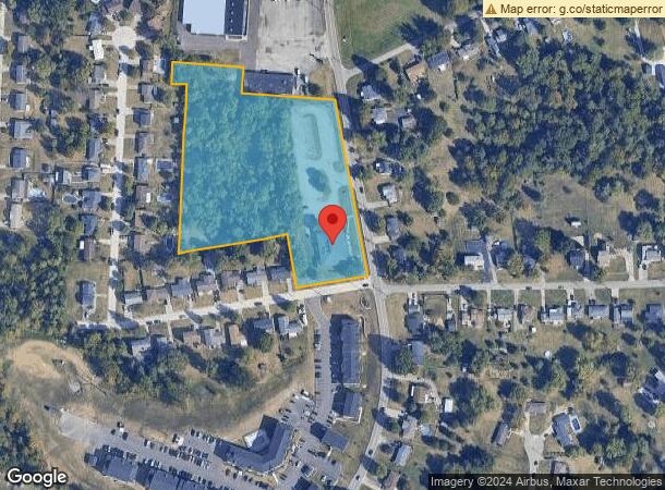
6471 Taylor Mill Rd
061-10-00-273.00
5.248 ACS WS TAYLOR MILL RD NORTH OF CHEROKEE DR
Restaurantbuilding
Kenton
X
Kentucky
21015C0250D
5.25 AC
2025
Outlying N Kentucky
2025
Cincinnati/Dayton
065800
Cincinnati, OH-KY-IN
7,740 SF
DEMOGRAPHICS near 6471 Taylor Mill Rd
1 Mile
3 Mile
5 Mile
2024 Total Population
4,588
25,784
53,230
2029 Population
4,706
26,378
54,436
Pop Growth 2024-2029
+ 2.57%
+ 2.30%
+ 2.27%
Average Age
37
38
38
2024 Total Households
1,560
8,775
18,639
HH Growth 2024-2029
+ 2.50%
+ 2.27%
+ 2.23%
Median Household Inc
$96,249
$96,552
$91,437
Avg Household Size
2.90
2.90
2.80
2024 Avg HH Vehicles
2.00
2.00
2.00
Median Home Value
$268,285
$233,439
$236,387
Median Year Built
2000
1996
1994
Nearby Places
Map Layers
Map Styles
 Street
 Aerial
- Restaurants
- Banks
- Shops
- Fitness
- Groceries
PUBLIC TRANSPORTATION
AIRPORT
Cincinnati/Northern Kentucky International
DRIVE
WALK
Distance
Cincinnati/Northern Kentucky International
24 min
15.4 mi
Nearby Properties
Address
Land Use
TOTAL SIZE
Lot Size
Zoning
Address
Land Use
TOTAL SIZE
Lot Size
Zoning
28.50 AC
Address
Land Use
TOTAL SIZE
Lot Size
Zoning
50.66 AC
Address
Land Use
TOTAL SIZE
Lot Size
Zoning
1,568 SF
40.46 AC
Address
Land Use
TOTAL SIZE
Lot Size
Zoning
123,480 SF
11.96 AC
Address
Land Use
TOTAL SIZE
Lot Size
Zoning
Address
Land Use
TOTAL SIZE
Lot Size
Zoning
13.27 AC
Address
Land Use
TOTAL SIZE
Lot Size
Zoning
65.43 AC
Address
Land Use
TOTAL SIZE
Lot Size
Zoning
25.04 AC
Address
Land Use
TOTAL SIZE
Lot Size
Zoning
Address
Land Use
TOTAL SIZE
Lot Size
Zoning
15.65 AC
Address
Land Use
TOTAL SIZE
Lot Size
Zoning
14.91 AC
Address
Land Use
TOTAL SIZE
Lot Size
Zoning
Address
Land Use
TOTAL SIZE
Lot Size
Zoning
105,205 SF
6.71 AC
Address
Land Use
TOTAL SIZE
Lot Size
Zoning
10.08 AC
Address
Land Use
TOTAL SIZE
Lot Size
Zoning
11.73 AC
Address
Land Use
TOTAL SIZE
Lot Size
Zoning
26,000 SF
6.86 AC
Address
Land Use
TOTAL SIZE
Lot Size
Zoning
Address
Land Use
TOTAL SIZE
Lot Size
Zoning
12,520 SF
3.06 AC
Address
Land Use
TOTAL SIZE
Lot Size
Zoning
1,200 SF
8.05 AC
Address
Land Use
TOTAL SIZE
Lot Size
Zoning
Address
Land Use
TOTAL SIZE
Lot Size
Zoning
14,820 SF
2.11 AC
Address
Land Use
TOTAL SIZE
Lot Size
Zoning
100.04 AC
Address
Land Use
TOTAL SIZE
Lot Size
Zoning
24.12 AC
Address
Land Use
TOTAL SIZE
Lot Size
Zoning
26,252 SF
2.98 AC
Address
Land Use
TOTAL SIZE
Lot Size
Zoning
Address
Land Use
TOTAL SIZE
Lot Size
Zoning
8,228 SF
2.46 AC
Address
Land Use
TOTAL SIZE
Lot Size
Zoning
5,270 SF
1.68 AC
Address
Land Use
TOTAL SIZE
Lot Size
Zoning
1,260 SF
4.03 AC
Address
Land Use
TOTAL SIZE
Lot Size
Zoning
2,201 SF
3.39 AC
Address
Land Use
TOTAL SIZE
Lot Size
Zoning
12,662 SF
2.48 AC
The World's #1 Commercial Real Estate Marketplace
Connect with us
© 2025 CoStar Group
The information above has been obtained from sources believed reliable. While we do not doubt its accuracy we have not verified it and make no guarantee, warranty or representation about it. It is your responsibility to independently confirm its accuracy and completeness. Any projections, opinions, assumptions, or estimates used are for example only and do not represent the current or future performance of the property. The value of this transaction to you depends on tax and other factors which should be evaluated by your tax, financial, and legal advisors. You and your advisors should conduct a careful, independent investigation of the property to determine to your satisfaction the suitability of the property for your needs.