Property Record
6475 21St St S, Fargo, ND 58104


NEARBY LISTINGS FOR SALE OR LEASE
-
-
View all Fargo listings for sale on LoopNet.com
Property Detail
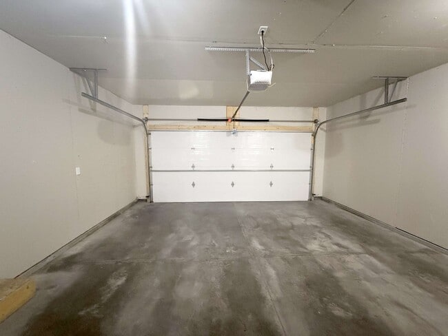
6475 21St St S
Fargo, ND-MN
First
01-8615-00300-000
LOT: 2 BLOCK: 2 ADDITION: SOUTH RIDGE FIRST ADDITION ADDITIONAL: SOUTH RIDGE 1ST ADDN LT 2 BLK 2 **8-2-16 PLATTED FRM
Apartment
Cass
AE
North Dakota
38017C0791G
2
2024
3.34 AC
2024
Fargo
040504
Other Market Areas
DEMOGRAPHICS near 6475 21St St S
1 Mile
3 Mile
5 Mile
2024 Total Population
8,361
30,529
105,578
2029 Population
9,243
33,041
112,419
Pop Growth 2024-2029
+ 10.55%
+ 8.23%
+ 6.48%
Average Age
34
37
36
2024 Total Households
2,977
12,244
44,703
HH Growth 2024-2029
+ 10.78%
+ 8.62%
+ 6.90%
Median Household Inc
$122,616
$80,982
$69,932
Avg Household Size
2.80
2.40
2.30
2024 Avg HH Vehicles
2.00
2.00
2.00
Median Home Value
$376,530
$326,090
$286,401
Median Year Built
2010
2005
2002
Nearby Places
Map Layers
Map Styles
 Street
 Aerial
- Restaurants
- Banks
- Shops
- Fitness
- Groceries
PUBLIC TRANSPORTATION
COMMUTER RAIL
Fargo Amtrak Station (Empire Builder - Amtrak)
DRIVE
WALK
Distance
Fargo Amtrak Station (Empire Builder - Amtrak)
15 min
7.4 mi
AIRPORT
Hector International
DRIVE
WALK
Distance
Hector International
22 min
10.6 mi
Freight Ports
Port Milwaukee
DRIVE
WALK
Distance
Port Milwaukee
633 min
575.7 mi
Nearby Properties
Address
Land Use
TOTAL SIZE
Lot Size
Zoning
Address
Land Use
TOTAL SIZE
Lot Size
Zoning
55.68 AC
Address
Land Use
TOTAL SIZE
Lot Size
Zoning
Address
Land Use
TOTAL SIZE
Lot Size
Zoning
7.66 AC
Address
Land Use
TOTAL SIZE
Lot Size
Zoning
64,653 SF
2.20 AC
MR3
Address
Land Use
TOTAL SIZE
Lot Size
Zoning
Address
Land Use
TOTAL SIZE
Lot Size
Zoning
217,776 SF
31.82 AC
GC
Address
Land Use
TOTAL SIZE
Lot Size
Zoning
122,201 SF
8.92 AC
GO
Address
Land Use
TOTAL SIZE
Lot Size
Zoning
191,151 SF
22.98 AC
LC
Address
Land Use
TOTAL SIZE
Lot Size
Zoning
88,956 SF
10.56 AC
GO
Address
Land Use
TOTAL SIZE
Lot Size
Zoning
160,913 SF
11.46 AC
GC
Address
Land Use
TOTAL SIZE
Lot Size
Zoning
Address
Land Use
TOTAL SIZE
Lot Size
Zoning
3.72 AC
Address
Land Use
TOTAL SIZE
Lot Size
Zoning
38,325 SF
465,408 AC
MR3
Address
Land Use
TOTAL SIZE
Lot Size
Zoning
54,870 SF
5.43 AC
MR3
Address
Land Use
TOTAL SIZE
Lot Size
Zoning
Address
Land Use
TOTAL SIZE
Lot Size
Zoning
75,600 SF
3.82 AC
LC
Address
Land Use
TOTAL SIZE
Lot Size
Zoning
Address
Land Use
TOTAL SIZE
Lot Size
Zoning
5.92 AC
Address
Land Use
TOTAL SIZE
Lot Size
Zoning
Address
Land Use
TOTAL SIZE
Lot Size
Zoning
41,698 SF
465,408 AC
MR3
Address
Land Use
TOTAL SIZE
Lot Size
Zoning
Address
Land Use
TOTAL SIZE
Lot Size
Zoning
Address
Land Use
TOTAL SIZE
Lot Size
Zoning
7.08 AC
Address
Land Use
TOTAL SIZE
Lot Size
Zoning
Address
Land Use
TOTAL SIZE
Lot Size
Zoning
13,824 SF
0.63 AC
MR2
Address
Land Use
TOTAL SIZE
Lot Size
Zoning
5.77 AC
LC
Address
Land Use
TOTAL SIZE
Lot Size
Zoning
3.95 AC
LC
Address
Land Use
TOTAL SIZE
Lot Size
Zoning
135,328 SF
3.44 AC
MR3
Address
Land Use
TOTAL SIZE
Lot Size
Zoning
24,816 SF
1.38 AC
MR3
Address
Land Use
TOTAL SIZE
Lot Size
Zoning
91,492 SF
2.85 AC
MR3
The World's #1 Commercial Real Estate Marketplace
Connect with us
© 2025 CoStar Group
The information above has been obtained from sources believed reliable. While we do not doubt its accuracy we have not verified it and make no guarantee, warranty or representation about it. It is your responsibility to independently confirm its accuracy and completeness. Any projections, opinions, assumptions, or estimates used are for example only and do not represent the current or future performance of the property. The value of this transaction to you depends on tax and other factors which should be evaluated by your tax, financial, and legal advisors. You and your advisors should conduct a careful, independent investigation of the property to determine to your satisfaction the suitability of the property for your needs.