Property Record
6475 Golf Course Blvd, Punta Gorda, FL 33982

Property Detail
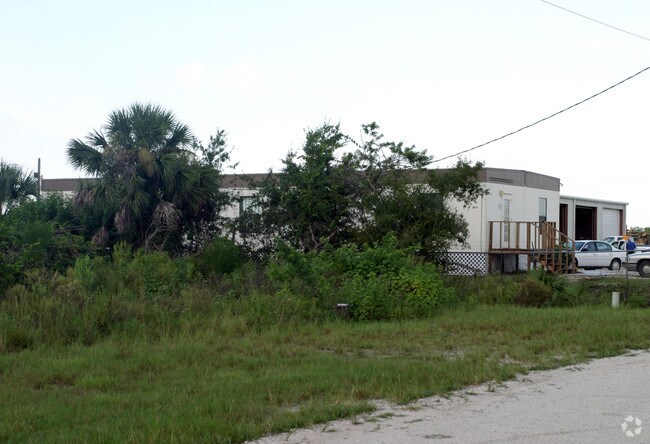
6475 Golf Course Blvd
412303351001
3-41-23 P-12 30AM/L NW1/4 OF SW1/4 OF SW1/4 & E1/2 OF SW1/4 OF SW1/4 346/56 E783/763 783/757 789/1780
Warehouse
Charlotte
ECAP
Florida
AE The base floodplain where base flood elevations are provided. AE Zones are now used on new format FIRMs instead of A1-A30 Zones.
30.03 AC
2024
Charlotte County
2025
Southwest Florida
010200
Punta Gorda, FL
5,472 SF
NEARBY LISTINGS FOR SALE OR LEASE
DEMOGRAPHICS near 6475 Golf Course Blvd
1 mile
3 mile
5 mile
2025 Total Population
551
12,588
49,846
2030 Population
600
13,851
55,065
Pop Growth 2025-2030
+ 8.89%
+ 10.03%
+ 10.47%
Average Age
52
48
56
2025 Total Households
243
5,582
24,060
HH Growth 2025-2030
+ 9.05%
+ 9.92%
+ 10.36%
Median Household Inc
$70,961
$57,097
$71,217
Avg Household Size
2.20
2.20
2.00
2025 Avg HH Vehicles
2.00
2.00
2.00
Median Home Value
$270,312
$308,418
$378,652
Median Year Built
1996
1995
1995
Nearby Places
Map Layers
Map Styles
 Street
 Aerial
Layers
 Traffic
 Biking
Places
Listings with unknown addresses are not visible on the map
- Restaurants
- Banks
- Shops
- Fitness
- Groceries
PUBLIC TRANSPORTATION
AIRPORT
Punta Gorda
Drive
Walk
Distance
Punta Gorda
5 min
1.7 mi
Freight Ports
Port Manatee
Drive
Walk
Distance
Port Manatee
85 min
72.3 mi
Nearby Properties
Address
Land Use
TOTAL SIZE
Lot Size
Zoning
Address
Land Use
TOTAL SIZE
Lot Size
Zoning
349,844 SF
78.47 AC
P
Address
Land Use
TOTAL SIZE
Lot Size
Zoning
164,121 SF
44.20 AC
ECAP
Address
Land Use
TOTAL SIZE
Lot Size
Zoning
77,154 SF
10.30 AC
CC
Address
Land Use
TOTAL SIZE
Lot Size
Zoning
161,439 SF
171 AC
RE1
Address
Land Use
TOTAL SIZE
Lot Size
Zoning
265,949 SF
22.80 AC
PD-CC
Address
Land Use
TOTAL SIZE
Lot Size
Zoning
253,440 SF
30.47 AC
ECAP
Address
Land Use
TOTAL SIZE
Lot Size
Zoning
378,000 SF
29.24 AC
ECAP
Address
Land Use
TOTAL SIZE
Lot Size
Zoning
345,043 SF
33.12 AC
ECAP
Address
Land Use
TOTAL SIZE
Lot Size
Zoning
62,415 SF
281.65 AC
ECAP
Address
Land Use
TOTAL SIZE
Lot Size
Zoning
15,253 SF
13.27 AC
P
Address
Land Use
TOTAL SIZE
Lot Size
Zoning
198,916 SF
25.79 AC
HC
Address
Land Use
TOTAL SIZE
Lot Size
Zoning
208,560 SF
36.69 AC
PD-GM
Address
Land Use
TOTAL SIZE
Lot Size
Zoning
385,350 SF
374.81 AC
ECAP
Address
Land Use
TOTAL SIZE
Lot Size
Zoning
134,308 SF
16 AC
RSF3.5
Address
Land Use
TOTAL SIZE
Lot Size
Zoning
44,185 SF
1.22 AC
CC
Address
Land Use
TOTAL SIZE
Lot Size
Zoning
8,406 SF
31.48 AC
ECAP
Address
Land Use
TOTAL SIZE
Lot Size
Zoning
24,880 SF
84.50 AC
PKR
Address
Land Use
TOTAL SIZE
Lot Size
Zoning
43,755 SF
8.19 AC
CC
Address
Land Use
TOTAL SIZE
Lot Size
Zoning
30,940 SF
0.42 AC
NC
Address
Land Use
TOTAL SIZE
Lot Size
Zoning
68,492 SF
6.38 AC
HC
Address
Land Use
TOTAL SIZE
Lot Size
Zoning
43,914 SF
4.06 AC
HC
Address
Land Use
TOTAL SIZE
Lot Size
Zoning
63,902 SF
5.87 AC
HC
Address
Land Use
TOTAL SIZE
Lot Size
Zoning
181,137 SF
12.34 AC
NR-15
Address
Land Use
TOTAL SIZE
Lot Size
Zoning
19,271 SF
3.51 AC
SP
Address
Land Use
TOTAL SIZE
Lot Size
Zoning
49,958 SF
6.81 AC
CC
Address
Land Use
TOTAL SIZE
Lot Size
Zoning
136.11 AC
ECAP
Address
Land Use
TOTAL SIZE
Lot Size
Zoning
13,260 SF
2.27 AC
CG
Address
Land Use
TOTAL SIZE
Lot Size
Zoning
60,000 SF
9.87 AC
ECAP
Address
Land Use
TOTAL SIZE
Lot Size
Zoning
66,461 SF
10.86 AC
CG
Address
Land Use
TOTAL SIZE
Lot Size
Zoning
54.25 AC
RMF10
The World's #1 Commercial Real Estate Marketplace
Connect with us
© 2026 CoStar Group
The information above has been obtained from sources believed reliable. While we do not doubt its accuracy we have not verified it and make no guarantee, warranty or representation about it. It is your responsibility to independently confirm its accuracy and completeness. Any projections, opinions, assumptions, or estimates used are for example only and do not represent the current or future performance of the property. The value of this transaction to you depends on tax and other factors which should be evaluated by your tax, financial, and legal advisors. You and your advisors should conduct a careful, independent investigation of the property to determine to your satisfaction the suitability of the property for your needs.